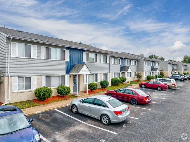
Property Record
1601 Pennwood Dr, Hampton, VA 23666

Save to a Folder
{{folder.Name}}
{{folder.ListingIds.length}} Properties
{{folder.ListingIds.length}} Property
Create a New Folder
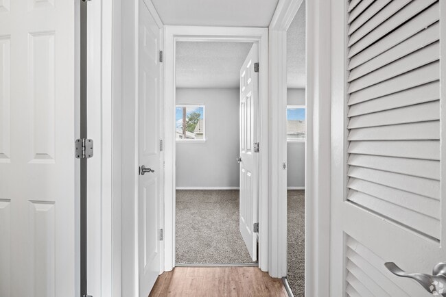
Property Detail
1601 Pennwood Dr
3001517
MERCURY WEST APTS PTPC2. L2A.
Highriseapartments
Hampton City
9 R-M MULT
Virginia
B and X Area of moderate flood hazard, usually the area between the limits of the 100-year and 500-year floods.
2a
2025
9.43 AC
2025
Farmington
010310
Hampton Roads
3,482 SF
Virginia Beach-Chesapeake-Norfolk, VA-NC
NEARBY LISTINGS FOR SALE OR LEASE
DEMOGRAPHICS near 1601 Pennwood Dr
1 mile
3 mile
5 mile
2025 Total Population
11,974
84,479
184,592
2030 Population
11,833
83,810
183,787
Pop Growth 2025-2030
(1.18%)
(0.79%)
(0.44%)
Average Age
42
40
38
2025 Total Households
5,130
37,026
76,500
HH Growth 2025-2030
(1.21%)
(0.85%)
(0.53%)
Median Household Inc
$67,377
$64,750
$64,694
Avg Household Size
2.30
2.20
2.30
2025 Avg HH Vehicles
2.00
2.00
2.00
Median Home Value
$226,043
$238,287
$246,115
Median Year Built
1965
1972
1974
Nearby Places
Map Layers
Map Styles
 Street
 Aerial
Layers
 Traffic
 Biking
Places
Listings with unknown addresses are not visible on the map
- Restaurants
- Banks
- Shops
- Fitness
- Groceries
PUBLIC TRANSPORTATION
AIRPORT
Newport News/Williamsburg International
Drive
Walk
Distance
Newport News/Williamsburg International
19 min
11.8 mi
Norfolk International
Drive
Walk
Distance
Norfolk International
28 min
19.9 mi
Freight Ports
Virginia Port Authority - Newport News
Drive
Walk
Distance
Virginia Port Authority - Newport News
1 min
3.8 mi
SALE & LEASE HISTORY
LISTING DATE
SALE/LEASE

Jun 26, 2019
For Sale
Nearby Properties
Address
Land Use
TOTAL SIZE
Lot Size
Zoning
Address
Land Use
TOTAL SIZE
Lot Size
Zoning
1 SF
444.26 AC
M2
Address
Land Use
TOTAL SIZE
Lot Size
Zoning
347,560 SF
31.84 AC
14 C-2 LIM
Address
Land Use
TOTAL SIZE
Lot Size
Zoning
249,628 SF
52.71 AC
14 C-2 LIM
Address
Land Use
TOTAL SIZE
Lot Size
Zoning
228,261 SF
48.49 AC
6 R-11 ONE
Address
Land Use
TOTAL SIZE
Lot Size
Zoning
35,550 SF
23.07 AC
14 C-2 LIM
Address
Land Use
TOTAL SIZE
Lot Size
Zoning
45,076 SF
9.53 AC
11 MD-4 MU
Address
Land Use
TOTAL SIZE
Lot Size
Zoning
13.01 AC
R7
Address
Land Use
TOTAL SIZE
Lot Size
Zoning
19,328 SF
15.14 AC
14 C-2 LIM
Address
Land Use
TOTAL SIZE
Lot Size
Zoning
540,444 SF
33.66 AC
32 M-2 LIG
Address
Land Use
TOTAL SIZE
Lot Size
Zoning
281,232 SF
17.16 AC
9 R-M MULT
Address
Land Use
TOTAL SIZE
Lot Size
Zoning
107,790 SF
5.66 AC
31 HRC-1 H
Address
Land Use
TOTAL SIZE
Lot Size
Zoning
248,956 SF
12.80 AC
14 C-2 LIM
Address
Land Use
TOTAL SIZE
Lot Size
Zoning
230,974 SF
42.68 AC
5 R-13 ONE
Address
Land Use
TOTAL SIZE
Lot Size
Zoning
88,941 SF
29.32 AC
11 MD-4 MU
Address
Land Use
TOTAL SIZE
Lot Size
Zoning
100 SF
35.50 AC
R7
Address
Land Use
TOTAL SIZE
Lot Size
Zoning
260,228 SF
37.04 AC
M1
Address
Land Use
TOTAL SIZE
Lot Size
Zoning
17,368 SF
7.08 AC
11 MD-4 MU
Address
Land Use
TOTAL SIZE
Lot Size
Zoning
7,362 SF
19.76 AC
9 R-M MULT
Address
Land Use
TOTAL SIZE
Lot Size
Zoning
7,053 SF
12.28 AC
14 C-2 LIM
Address
Land Use
TOTAL SIZE
Lot Size
Zoning
7,720 SF
9.91 AC
14 C-2 LIM
Address
Land Use
TOTAL SIZE
Lot Size
Zoning
100 SF
26.21 AC
R7
Address
Land Use
TOTAL SIZE
Lot Size
Zoning
286,173 SF
10 AC
14 C-2 LIM
Address
Land Use
TOTAL SIZE
Lot Size
Zoning
60,350 SF
27.53 AC
M1
Address
Land Use
TOTAL SIZE
Lot Size
Zoning
255,906 SF
36.57 AC
P1
Address
Land Use
TOTAL SIZE
Lot Size
Zoning
15,606 SF
12.07 AC
14 C-2 LIM
Address
Land Use
TOTAL SIZE
Lot Size
Zoning
34,222 SF
2.11 AC
14 C-2 LIM
Address
Land Use
TOTAL SIZE
Lot Size
Zoning
355,300 SF
19.03 AC
9 R-M MULT
Address
Land Use
TOTAL SIZE
Lot Size
Zoning
46.94 AC
39 LFA-4 L
Address
Land Use
TOTAL SIZE
Lot Size
Zoning
51,372 SF
5.99 AC
14 C-2 LIM
Address
Land Use
TOTAL SIZE
Lot Size
Zoning
458,744 SF
28.01 AC
17 M-3 HEA
The World's #1 Commercial Real Estate Marketplace
Connect with us
© 2026 CoStar Group
The information above has been obtained from sources believed reliable. While we do not doubt its accuracy we have not verified it and make no guarantee, warranty or representation about it. It is your responsibility to independently confirm its accuracy and completeness. Any projections, opinions, assumptions, or estimates used are for example only and do not represent the current or future performance of the property. The value of this transaction to you depends on tax and other factors which should be evaluated by your tax, financial, and legal advisors. You and your advisors should conduct a careful, independent investigation of the property to determine to your satisfaction the suitability of the property for your needs.