Property Record
1601 Plisko Ln, Port Orchard, WA 98366
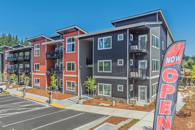
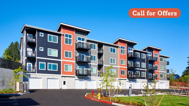
This Property Is For Sale
NEARBY LISTINGS FOR SALE OR LEASE
Property Detail
1601 Plisko Ln
Bremerton-Silverdale-Port Orchard, WA
PARCEL A THAT PORTION OF THE SOUTHEAST QUARTER OF THE SOUTHWEST QUARTER, SECTION 25, TOWNSHIP 24 NORTH, RANGE 1 EAST, IN KITSAP COUNTY, DESCRIBED AS FOLLOWS: BEGINNING AT THE SOUTHEAST CORNER OF THE WEST HALF OF SAID SOUTHEAST QUARTER OF THE SOUTHWES
252401-3-042-2002
Kitsap
Multifamilydwelling
Washington
X
42
53035C0390F
1.98 AC
2025
South Kitsap County
2026
Bremerton/Silverdale
092500
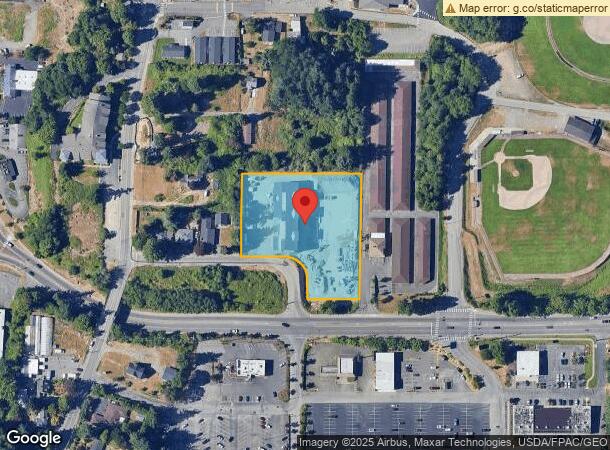
DEMOGRAPHICS near 1601 Plisko Ln
1 Mile
3 Mile
5 Mile
2024 Total Population
7,826
55,657
110,691
2029 Population
7,907
56,385
112,201
Pop Growth 2024-2029
+ 1.04%
+ 1.31%
+ 1.36%
Average Age
41
38
40
2024 Total Households
2,849
20,639
42,404
HH Growth 2024-2029
+ 0.74%
+ 1.48%
+ 1.50%
Median Household Inc
$73,146
$69,320
$71,046
Avg Household Size
2.40
2.40
2.40
2024 Avg HH Vehicles
2.00
2.00
2.00
Median Home Value
$347,377
$372,137
$413,241
Median Year Built
1973
1976
1979
Nearby Places
Map Layers
Map Styles
 Street
 Aerial
- Restaurants
- Banks
- Shops
- Fitness
- Groceries
PUBLIC TRANSPORTATION
AIRPORT
Seattle-Tacoma International
DRIVE
WALK
Distance
Seattle-Tacoma International
69 min
21.7 mi
Seattle Paine Field International
DRIVE
WALK
Distance
Seattle Paine Field International
97 min
44.5 mi
Freight Ports
Port of Seattle
DRIVE
WALK
Distance
Port of Seattle
61 min
16.9 mi
Nearby Properties
Address
Land Use
TOTAL SIZE
Lot Size
Zoning
Address
Land Use
TOTAL SIZE
Lot Size
Zoning
552 SF
17.39 AC
CITY
Address
Land Use
TOTAL SIZE
Lot Size
Zoning
143,022 SF
11.24 AC
R4
Address
Land Use
TOTAL SIZE
Lot Size
Zoning
127,853 SF
7.41 AC
R4
Address
Land Use
TOTAL SIZE
Lot Size
Zoning
135,371 SF
6.04 AC
R4
Address
Land Use
TOTAL SIZE
Lot Size
Zoning
112,847 SF
6.80 AC
UM
Address
Land Use
TOTAL SIZE
Lot Size
Zoning
17,592 SF
11.61 AC
UM
Address
Land Use
TOTAL SIZE
Lot Size
Zoning
25,973 SF
8.20 AC
CC
Address
Land Use
TOTAL SIZE
Lot Size
Zoning
110,994 SF
5.35 AC
R4
Address
Land Use
TOTAL SIZE
Lot Size
Zoning
1,092 SF
5.70 AC
CC
Address
Land Use
TOTAL SIZE
Lot Size
Zoning
125,582 SF
4.02 AC
NC
Address
Land Use
TOTAL SIZE
Lot Size
Zoning
0.54 AC
CITY
Address
Land Use
TOTAL SIZE
Lot Size
Zoning
110,778 SF
9.24 AC
CC
Address
Land Use
TOTAL SIZE
Lot Size
Zoning
Address
Land Use
TOTAL SIZE
Lot Size
Zoning
1,344 SF
5.47 AC
R-40
Address
Land Use
TOTAL SIZE
Lot Size
Zoning
79,615 SF
1.25 AC
DSAP
Address
Land Use
TOTAL SIZE
Lot Size
Zoning
158,870 SF
14.62 AC
CC
Address
Land Use
TOTAL SIZE
Lot Size
Zoning
185,893 SF
17.89 AC
CC
Address
Land Use
TOTAL SIZE
Lot Size
Zoning
77,580 SF
8.62 AC
UM
Address
Land Use
TOTAL SIZE
Lot Size
Zoning
63,213 SF
4.15 AC
R-10
Address
Land Use
TOTAL SIZE
Lot Size
Zoning
14,660 SF
6.14 AC
UM
Address
Land Use
TOTAL SIZE
Lot Size
Zoning
14,660 SF
6.07 AC
UM
Address
Land Use
TOTAL SIZE
Lot Size
Zoning
64,584 SF
4.92 AC
R-40
Address
Land Use
TOTAL SIZE
Lot Size
Zoning
49,604 SF
5.49 AC
UM
Address
Land Use
TOTAL SIZE
Lot Size
Zoning
62,642 SF
4.91 AC
UM
Address
Land Use
TOTAL SIZE
Lot Size
Zoning
56,006 SF
4.72 AC
UM
Address
Land Use
TOTAL SIZE
Lot Size
Zoning
73,931 SF
11.72 AC
FC
Address
Land Use
TOTAL SIZE
Lot Size
Zoning
45,379 SF
6.74 AC
UM
Address
Land Use
TOTAL SIZE
Lot Size
Zoning
69,192 SF
3.36 AC
UM
Address
Land Use
TOTAL SIZE
Lot Size
Zoning
2.33 AC
CITY
Address
Land Use
TOTAL SIZE
Lot Size
Zoning
55,866 SF
8.48 AC
FC
The World's #1 Commercial Real Estate Marketplace
Connect with us
© 2026 CoStar Group
The information above has been obtained from sources believed reliable. While we do not doubt its accuracy we have not verified it and make no guarantee, warranty or representation about it. It is your responsibility to independently confirm its accuracy and completeness. Any projections, opinions, assumptions, or estimates used are for example only and do not represent the current or future performance of the property. The value of this transaction to you depends on tax and other factors which should be evaluated by your tax, financial, and legal advisors. You and your advisors should conduct a careful, independent investigation of the property to determine to your satisfaction the suitability of the property for your needs.