Property Record
1601 W Old Route 66, Strafford, MO 65757


Save to a Folder
{{folder.Name}}
{{folder.ListingIds.length}} Properties
{{folder.ListingIds.length}} Property
Create a New Folder
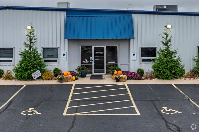
Property Detail
1601 W Old Route 66
11-05-200-057
31.65A M/L BEG S R/W I-44 & W LN 5/29/20 NELY 2029.74 FT SLY 418.36 FT SWLY 2312.25 FT N 454.57 FT W 971 FT S 44.74 FT W 160 FT NELY TO BEG BEING PT 5&6/29/20
Autorepair
Greene
INC
Missouri
A Areas with a 1% annual chance of flooding and a 26% chance of flooding over the life of a 30-year mortgage.
31.65 AC
2025
Outlying Greene County
2025
Springfield
004601
Springfield, MO
22,450 SF
NEARBY LISTINGS FOR SALE OR LEASE
DEMOGRAPHICS near 1601 W Old Route 66
1 mile
3 mile
5 mile
2025 Total Population
177
5,259
13,479
2030 Population
183
5,469
13,999
Pop Growth 2025-2030
+ 3.39%
+ 3.99%
+ 3.86%
Average Age
41
40
42
2025 Total Households
70
2,026
5,517
HH Growth 2025-2030
+ 4.29%
+ 4.20%
+ 4.04%
Median Household Inc
$68,333
$78,959
$85,749
Avg Household Size
2.50
2.50
2.40
2025 Avg HH Vehicles
2.00
2.00
2.00
Median Home Value
$209,091
$259,876
$321,340
Median Year Built
1986
1991
1994
Nearby Places
Map Layers
Map Styles
 Street
 Aerial
Layers
 Traffic
 Biking
Places
Listings with unknown addresses are not visible on the map
- Restaurants
- Banks
- Shops
- Fitness
- Groceries
PUBLIC TRANSPORTATION
AIRPORT
Springfield-Branson Ntl
Drive
Walk
Distance
Springfield-Branson Ntl
28 min
17.9 mi
Freight Ports
Tulsa Port of Inola
Drive
Walk
Distance
Tulsa Port of Inola
201 min
180.2 mi
Nearby Properties
Address
Land Use
TOTAL SIZE
Lot Size
Zoning
Address
Land Use
TOTAL SIZE
Lot Size
Zoning
68.92 AC
INC
Address
Land Use
TOTAL SIZE
Lot Size
Zoning
20.01 AC
Address
Land Use
TOTAL SIZE
Lot Size
Zoning
9.17 AC
INC.
Address
Land Use
TOTAL SIZE
Lot Size
Zoning
8.66 AC
INC
Address
Land Use
TOTAL SIZE
Lot Size
Zoning
31.56 AC
INC
Address
Land Use
TOTAL SIZE
Lot Size
Zoning
16.03 AC
INC
Address
Land Use
TOTAL SIZE
Lot Size
Zoning
10.11 AC
INC
Address
Land Use
TOTAL SIZE
Lot Size
Zoning
85.20 AC
Address
Land Use
TOTAL SIZE
Lot Size
Zoning
4.75 AC
INC
Address
Land Use
TOTAL SIZE
Lot Size
Zoning
129,666 SF
13.73 AC
INC
Address
Land Use
TOTAL SIZE
Lot Size
Zoning
67,502 SF
7.70 AC
INC
Address
Land Use
TOTAL SIZE
Lot Size
Zoning
102,824 SF
7.46 AC
M-1
Address
Land Use
TOTAL SIZE
Lot Size
Zoning
84,784 SF
9.02 AC
INC
Address
Land Use
TOTAL SIZE
Lot Size
Zoning
10.07 AC
INC.
Address
Land Use
TOTAL SIZE
Lot Size
Zoning
75,471 SF
22.31 AC
INC
Address
Land Use
TOTAL SIZE
Lot Size
Zoning
92,899 SF
33.70 AC
M-1
Address
Land Use
TOTAL SIZE
Lot Size
Zoning
17.48 AC
INC
Address
Land Use
TOTAL SIZE
Lot Size
Zoning
Address
Land Use
TOTAL SIZE
Lot Size
Zoning
10 AC
INC.
Address
Land Use
TOTAL SIZE
Lot Size
Zoning
12.03 AC
INC
Address
Land Use
TOTAL SIZE
Lot Size
Zoning
5.22 AC
INC
Address
Land Use
TOTAL SIZE
Lot Size
Zoning
14.70 AC
M-1
Address
Land Use
TOTAL SIZE
Lot Size
Zoning
61,640 SF
34.65 AC
INC
Address
Land Use
TOTAL SIZE
Lot Size
Zoning
Address
Land Use
TOTAL SIZE
Lot Size
Zoning
5.22 AC
INC
Address
Land Use
TOTAL SIZE
Lot Size
Zoning
46,440 SF
7.85 AC
INC
Address
Land Use
TOTAL SIZE
Lot Size
Zoning
15,626 SF
3.03 AC
INC
Address
Land Use
TOTAL SIZE
Lot Size
Zoning
40,920 SF
4.20 AC
M-1
Address
Land Use
TOTAL SIZE
Lot Size
Zoning
2.97 AC
INC
Address
Land Use
TOTAL SIZE
Lot Size
Zoning
23,806 SF
42.74 AC
INC
The World's #1 Commercial Real Estate Marketplace
Connect with us
© 2026 CoStar Group
The information above has been obtained from sources believed reliable. While we do not doubt its accuracy we have not verified it and make no guarantee, warranty or representation about it. It is your responsibility to independently confirm its accuracy and completeness. Any projections, opinions, assumptions, or estimates used are for example only and do not represent the current or future performance of the property. The value of this transaction to you depends on tax and other factors which should be evaluated by your tax, financial, and legal advisors. You and your advisors should conduct a careful, independent investigation of the property to determine to your satisfaction the suitability of the property for your needs.