Property Record
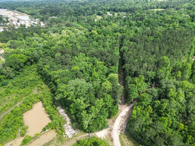
16010 Schank Rd, Conroe, TX 77306

NEARBY LISTINGS FOR SALE OR LEASE
Property Detail
16010 Schank Rd
Houston-Pasadena-The Woodlands, TX
Bridges Wm B
0073-00-01890
A0073 BRIDGES WM B, TRACT 76, ACRES 5.000
Residentialacreage
Montgomery
AE
Texas
48339C0425G
4 AC
2024
Outlying Montgomery Cnty
2025
Houston
693002
DEMOGRAPHICS near 16010 Schank Rd
1 Mile
3 Mile
5 Mile
2024 Total Population
4,225
19,958
33,427
2029 Population
5,361
25,173
41,903
Pop Growth 2024-2029
+ 26.89%
+ 26.13%
+ 25.36%
Average Age
31
34
35
2024 Total Households
1,200
5,974
10,437
HH Growth 2024-2029
+ 27.00%
+ 26.26%
+ 25.42%
Median Household Inc
$57,113
$53,654
$58,327
Avg Household Size
3.40
3.20
3.10
2024 Avg HH Vehicles
3.00
2.00
2.00
Median Home Value
$119,458
$136,431
$166,201
Median Year Built
2008
2004
2003
Nearby Places
Map Layers
Map Styles
 Street
 Aerial
- Restaurants
- Banks
- Shops
- Fitness
- Groceries
PUBLIC TRANSPORTATION
AIRPORT
George Bush Intcntl/Houston
DRIVE
WALK
Distance
George Bush Intcntl/Houston
55 min
40.1 mi
Freight Ports
Port of Houston
DRIVE
WALK
Distance
Port of Houston
77 min
51.4 mi
SALE & LEASE HISTORY
LISTING DATE
SALE/LEASE

Apr 27, 2023
For Sale
Nearby Properties
Address
Land Use
TOTAL SIZE
Lot Size
Zoning
Address
Land Use
TOTAL SIZE
Lot Size
Zoning
266,751 SF
12.95 AC
1
Address
Land Use
TOTAL SIZE
Lot Size
Zoning
124,209 SF
9.18 AC
1
Address
Land Use
TOTAL SIZE
Lot Size
Zoning
140,900 SF
83.24 AC
1
Address
Land Use
TOTAL SIZE
Lot Size
Zoning
84,192 SF
23.22 AC
1
Address
Land Use
TOTAL SIZE
Lot Size
Zoning
65,448 SF
10 AC
1
Address
Land Use
TOTAL SIZE
Lot Size
Zoning
9,120 SF
2.34 AC
Address
Land Use
TOTAL SIZE
Lot Size
Zoning
38,020 SF
28.47 AC
1
Address
Land Use
TOTAL SIZE
Lot Size
Zoning
11,929 SF
35.97 AC
1
Address
Land Use
TOTAL SIZE
Lot Size
Zoning
9,582 SF
10.46 AC
1
Address
Land Use
TOTAL SIZE
Lot Size
Zoning
8,450 SF
2.16 AC
Address
Land Use
TOTAL SIZE
Lot Size
Zoning
10,200 SF
1.06 AC
Address
Land Use
TOTAL SIZE
Lot Size
Zoning
28,920 SF
8.44 AC
1
Address
Land Use
TOTAL SIZE
Lot Size
Zoning
9,000 SF
1.10 AC
Address
Land Use
TOTAL SIZE
Lot Size
Zoning
43,371 SF
5.04 AC
Address
Land Use
TOTAL SIZE
Lot Size
Zoning
13,960 SF
5 AC
Address
Land Use
TOTAL SIZE
Lot Size
Zoning
7,740 SF
1.07 AC
Address
Land Use
TOTAL SIZE
Lot Size
Zoning
8,356 SF
1.75 AC
Address
Land Use
TOTAL SIZE
Lot Size
Zoning
19,400 SF
5 AC
Address
Land Use
TOTAL SIZE
Lot Size
Zoning
5,000 SF
2 AC
1
Address
Land Use
TOTAL SIZE
Lot Size
Zoning
20,060 SF
7.20 AC
1
Address
Land Use
TOTAL SIZE
Lot Size
Zoning
7,725 SF
5.90 AC
1
Address
Land Use
TOTAL SIZE
Lot Size
Zoning
10,070 SF
24.68 AC
1
Address
Land Use
TOTAL SIZE
Lot Size
Zoning
12,090 SF
1.04 AC
Address
Land Use
TOTAL SIZE
Lot Size
Zoning
22.80 AC
1
Address
Land Use
TOTAL SIZE
Lot Size
Zoning
15,900 SF
0.95 AC
1
Address
Land Use
TOTAL SIZE
Lot Size
Zoning
15,471 SF
4.28 AC
1
Address
Land Use
TOTAL SIZE
Lot Size
Zoning
11,890 SF
11.67 AC
1
Address
Land Use
TOTAL SIZE
Lot Size
Zoning
21,090 SF
3 AC
1
Address
Land Use
TOTAL SIZE
Lot Size
Zoning
14,525 SF
1.83 AC
1
Address
Land Use
TOTAL SIZE
Lot Size
Zoning
10,380 SF
1.08 AC
1
The World's #1 Commercial Real Estate Marketplace
Connect with us
© 2026 CoStar Group
The information above has been obtained from sources believed reliable. While we do not doubt its accuracy we have not verified it and make no guarantee, warranty or representation about it. It is your responsibility to independently confirm its accuracy and completeness. Any projections, opinions, assumptions, or estimates used are for example only and do not represent the current or future performance of the property. The value of this transaction to you depends on tax and other factors which should be evaluated by your tax, financial, and legal advisors. You and your advisors should conduct a careful, independent investigation of the property to determine to your satisfaction the suitability of the property for your needs.