Property Record
16015 Central Ave Ne, Andover, MN 55304
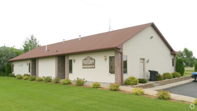

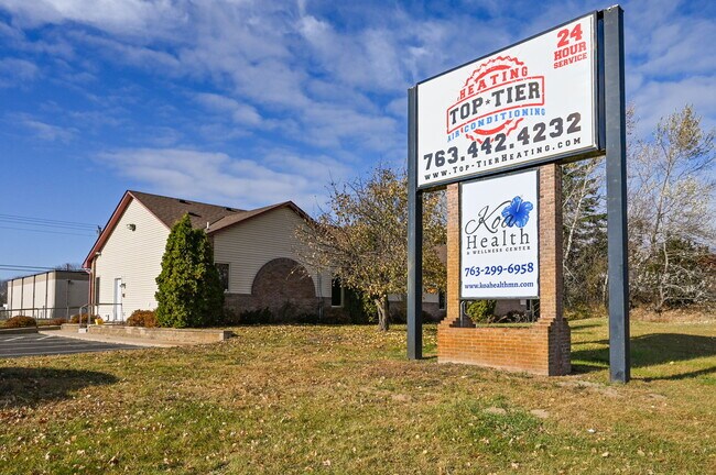
Property Detail
16015 Central Ave Ne
17-32-23-42-0004
THAT PRT OF NW1/4 OF SE1/4 OF SEC 17 TWP 32 RGE 23 DESC ASFOL: COM AT A PT ON W LINE OF SD 1/4 1/4 330 FT S OF NW CORTHEREOF, TH E PRLL/W N LINE OF SD 1/4 1/4 85 FT +OR- TO WLYR/W LINE OF T H NO 65, TH SELY ALG SD WLY R/W LINE TO PT OFINTER/W A LINE
Commercialnec
Anoka
B and X Area of moderate flood hazard, usually the area between the limits of the 100-year and 500-year floods.
Minnesota
2026
0.85 AC
2026
Anoka County Outlying
050235
Minneapolis/St Paul
3,144 SF
Minneapolis-St. Paul-Bloomington, MN-WI
NEARBY LISTINGS FOR SALE OR LEASE
-
-
View all Andover listings for sale on LoopNet.com
DEMOGRAPHICS near 16015 Central Ave Ne
1 mile
3 mile
5 mile
2025 Total Population
1,257
16,006
62,121
2030 Population
1,297
16,547
64,080
Pop Growth 2025-2030
+ 3.18%
+ 3.38%
+ 3.15%
Average Age
41
41
40
2025 Total Households
451
5,475
21,048
HH Growth 2025-2030
+ 3.10%
+ 3.38%
+ 3.14%
Median Household Inc
$128,302
$121,260
$125,621
Avg Household Size
2.80
2.90
2.90
2025 Avg HH Vehicles
3.00
3.00
2.00
Median Home Value
$425,769
$440,665
$419,126
Median Year Built
1990
1993
1995
Nearby Places
Map Layers
Map Styles
 Street
 Aerial
Layers
 Traffic
 Biking
Places
Listings with unknown addresses are not visible on the map
- Restaurants
- Banks
- Shops
- Fitness
- Groceries
PUBLIC TRANSPORTATION
COMMUTER RAIL
Coon Rapids-Riverdale Station (Northstar Corridor - Northstar Commuter Rail)
Drive
Walk
Distance
Coon Rapids-Riverdale Station (Northstar Corridor - Northstar Commuter Rail)
18 min
10.0 mi
AIRPORT
Minneapolis-St Paul International/Wold-Chamberlain
Drive
Walk
Distance
Minneapolis-St Paul International/Wold-Chamberlain
48 min
32.3 mi
SALE & LEASE HISTORY
LISTING DATE
SALE/LEASE

Nov 11, 2025
For Sale
Jun 21, 2023
For Sale
Jul 13, 2022
For Sale
Feb 16, 2023
For Lease
Nearby Properties
Address
Land Use
TOTAL SIZE
Lot Size
Zoning
Address
Land Use
TOTAL SIZE
Lot Size
Zoning
5.98 AC
Address
Land Use
TOTAL SIZE
Lot Size
Zoning
Address
Land Use
TOTAL SIZE
Lot Size
Zoning
30,528 SF
20.88 AC
Address
Land Use
TOTAL SIZE
Lot Size
Zoning
70,304 SF
Address
Land Use
TOTAL SIZE
Lot Size
Zoning
1 SF
2.82 AC
Address
Land Use
TOTAL SIZE
Lot Size
Zoning
58,977 SF
0.50 AC
Address
Land Use
TOTAL SIZE
Lot Size
Zoning
55,932 SF
0.50 AC
Address
Land Use
TOTAL SIZE
Lot Size
Zoning
53,180 SF
30.46 AC
Address
Land Use
TOTAL SIZE
Lot Size
Zoning
24,000 SF
Address
Land Use
TOTAL SIZE
Lot Size
Zoning
28,600 SF
4.37 AC
Address
Land Use
TOTAL SIZE
Lot Size
Zoning
19,557 SF
21.93 AC
Address
Land Use
TOTAL SIZE
Lot Size
Zoning
1,182 SF
20.50 AC
Address
Land Use
TOTAL SIZE
Lot Size
Zoning
34,970 SF
202.94 AC
Address
Land Use
TOTAL SIZE
Lot Size
Zoning
32,000 SF
5.25 AC
Address
Land Use
TOTAL SIZE
Lot Size
Zoning
33,992 SF
2.24 AC
Address
Land Use
TOTAL SIZE
Lot Size
Zoning
Address
Land Use
TOTAL SIZE
Lot Size
Zoning
62,624 SF
12 AC
Address
Land Use
TOTAL SIZE
Lot Size
Zoning
Address
Land Use
TOTAL SIZE
Lot Size
Zoning
1,120 SF
6.02 AC
Address
Land Use
TOTAL SIZE
Lot Size
Zoning
37,048 SF
0.20 AC
Address
Land Use
TOTAL SIZE
Lot Size
Zoning
Address
Land Use
TOTAL SIZE
Lot Size
Zoning
40,310 SF
1.05 AC
Address
Land Use
TOTAL SIZE
Lot Size
Zoning
36,159 SF
3.96 AC
Address
Land Use
TOTAL SIZE
Lot Size
Zoning
26,900 SF
0.30 AC
Address
Land Use
TOTAL SIZE
Lot Size
Zoning
Address
Land Use
TOTAL SIZE
Lot Size
Zoning
3,000 SF
12.75 AC
Address
Land Use
TOTAL SIZE
Lot Size
Zoning
29,618 SF
0.30 AC
Address
Land Use
TOTAL SIZE
Lot Size
Zoning
0.20 AC
Address
Land Use
TOTAL SIZE
Lot Size
Zoning
1 SF
2.20 AC
Address
Land Use
TOTAL SIZE
Lot Size
Zoning
17,894 SF
1.82 AC
The World's #1 Commercial Real Estate Marketplace
Connect with us
© 2026 CoStar Group
The information above has been obtained from sources believed reliable. While we do not doubt its accuracy we have not verified it and make no guarantee, warranty or representation about it. It is your responsibility to independently confirm its accuracy and completeness. Any projections, opinions, assumptions, or estimates used are for example only and do not represent the current or future performance of the property. The value of this transaction to you depends on tax and other factors which should be evaluated by your tax, financial, and legal advisors. You and your advisors should conduct a careful, independent investigation of the property to determine to your satisfaction the suitability of the property for your needs.