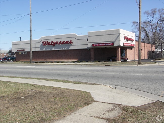
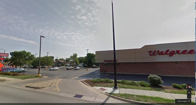
Property Record
1602 Kishwaukee St, Rockford, IL 61104
Current Lease Availabilities
NEARBY LISTINGS FOR SALE OR LEASE
Property Detail
1602 Kishwaukee St
Rockford, IL
L M Nolings 2Nd Sub
11-35-204-015
L M NOLINGS 2ND SUB PT NE 1/4 SEC 35-44-1 (EXC THAT PT TO STATE OF IL BY 94-25582) N 44.25 FT LOT 9 BLOCK 3
Commercialnec
Winnebago
X
Illinois
17201C0264E
9
2024
0.17 AC
2024
I-39 Corr/Winnebago Cnty
001800
Chicago
7,538 SF
DEMOGRAPHICS near 1602 Kishwaukee St
1 Mile
3 Mile
5 Mile
2024 Total Population
11,281
84,944
155,752
2029 Population
11,329
84,504
154,268
Pop Growth 2024-2029
+ 0.43%
(0.52%)
(0.95%)
Average Age
34
37
39
2024 Total Households
4,354
33,486
62,811
HH Growth 2024-2029
+ 0.57%
(0.60%)
(1.02%)
Median Household Inc
$25,645
$37,465
$44,600
Avg Household Size
2.40
2.40
2.40
2024 Avg HH Vehicles
1.00
1.00
2.00
Median Home Value
$63,383
$73,733
$101,667
Median Year Built
1948
1953
1959
Nearby Places
- Restaurants
- Banks
- Shops
- Fitness
- Groceries
PUBLIC TRANSPORTATION
AIRPORT
Chicago/Rockford International
DRIVE
WALK
Distance
Chicago/Rockford International
16 min
8.0 mi
Freight Ports
Port Milwaukee
DRIVE
WALK
Distance
Port Milwaukee
115 min
94.5 mi
Nearby Properties
Address
Land Use
TOTAL SIZE
Lot Size
Zoning
Address
Land Use
TOTAL SIZE
Lot Size
Zoning
1,456,216 SF
103.10 AC
I1
Address
Land Use
TOTAL SIZE
Lot Size
Zoning
201,507 SF
C4
Address
Land Use
TOTAL SIZE
Lot Size
Zoning
13,308 SF
19.30 AC
I2
Address
Land Use
TOTAL SIZE
Lot Size
Zoning
291,074 SF
10.97 AC
I3
Address
Land Use
TOTAL SIZE
Lot Size
Zoning
189,455 SF
10.99 AC
I3
Address
Land Use
TOTAL SIZE
Lot Size
Zoning
115,095 SF
0.25 AC
C4
Address
Land Use
TOTAL SIZE
Lot Size
Zoning
117,360 SF
1.52 AC
R4
Address
Land Use
TOTAL SIZE
Lot Size
Zoning
111,491 SF
0.32 AC
C4
Address
Land Use
TOTAL SIZE
Lot Size
Zoning
173,193 SF
5.97 AC
I3
Address
Land Use
TOTAL SIZE
Lot Size
Zoning
79,318 SF
1.55 AC
C4
Address
Land Use
TOTAL SIZE
Lot Size
Zoning
43.23 AC
I1
Address
Land Use
TOTAL SIZE
Lot Size
Zoning
192,575 SF
46.19 AC
I1
Address
Land Use
TOTAL SIZE
Lot Size
Zoning
79,700 SF
7.15 AC
C2
Address
Land Use
TOTAL SIZE
Lot Size
Zoning
623,379 SF
35.15 AC
I3
Address
Land Use
TOTAL SIZE
Lot Size
Zoning
189,568 SF
12.68 AC
I1
Address
Land Use
TOTAL SIZE
Lot Size
Zoning
113,175 SF
5 AC
R3
Address
Land Use
TOTAL SIZE
Lot Size
Zoning
58,750 SF
11.25 AC
I1
Address
Land Use
TOTAL SIZE
Lot Size
Zoning
174,318 SF
17.97 AC
Address
Land Use
TOTAL SIZE
Lot Size
Zoning
2,975 SF
5.42 AC
I2
Address
Land Use
TOTAL SIZE
Lot Size
Zoning
150,426 SF
9.25 AC
C3
Address
Land Use
TOTAL SIZE
Lot Size
Zoning
108,233 SF
0.34 AC
C4
Address
Land Use
TOTAL SIZE
Lot Size
Zoning
158,754 SF
0.91 AC
C4
Address
Land Use
TOTAL SIZE
Lot Size
Zoning
86,720 SF
3.91 AC
R4
Address
Land Use
TOTAL SIZE
Lot Size
Zoning
39,184 SF
3.10 AC
C2
Address
Land Use
TOTAL SIZE
Lot Size
Zoning
150,351 SF
22.95 AC
I3
Address
Land Use
TOTAL SIZE
Lot Size
Zoning
77,936 SF
1.71 AC
C4
Address
Land Use
TOTAL SIZE
Lot Size
Zoning
10,970 SF
26.80 AC
R2
Address
Land Use
TOTAL SIZE
Lot Size
Zoning
151,360 SF
8.13 AC
I1
Address
Land Use
TOTAL SIZE
Lot Size
Zoning
239,792 SF
0.25 AC
C4
Address
Land Use
TOTAL SIZE
Lot Size
Zoning
85,575 SF
10.29 AC
C2
The World's #1 Commercial Real Estate Marketplace
Connect with us
© 2025 CoStar Group
The information above has been obtained from sources believed reliable. While we do not doubt its accuracy we have not verified it and make no guarantee, warranty or representation about it. It is your responsibility to independently confirm its accuracy and completeness. Any projections, opinions, assumptions, or estimates used are for example only and do not represent the current or future performance of the property. The value of this transaction to you depends on tax and other factors which should be evaluated by your tax, financial, and legal advisors. You and your advisors should conduct a careful, independent investigation of the property to determine to your satisfaction the suitability of the property for your needs.