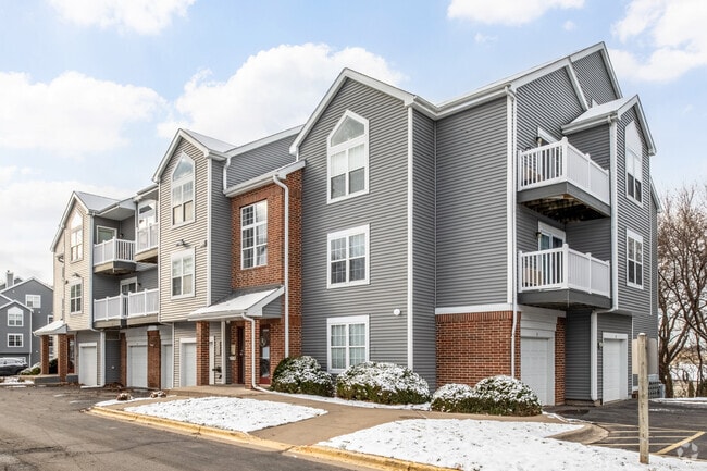
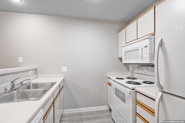
Property Record
1602 N Thompson Dr, Madison, WI 53704

NEARBY LISTINGS FOR SALE OR LEASE
Property Detail
1602 N Thompson Dr
Madison, WI
Certified Survey Map No 6972 Recorded In
0810-342-0237-5
CERTIFIED SURVEY MAP NO 6972 RECORDED IN DANE COUNTY REGISTER OF DEEDS IN VOL 35 PAGE 56 OF CERTIFIED SURVEYS, LOTS 1 & 2
Commercialnec
Dane
X
Wisconsin
55025C0431H
1
2024
5.63 AC
2024
East Madison
002603
Milwaukee/Madison
134,008 SF
DEMOGRAPHICS near 1602 N Thompson Dr
1 Mile
3 Mile
5 Mile
2024 Total Population
6,982
55,334
127,613
2029 Population
7,211
57,710
132,541
Pop Growth 2024-2029
+ 3.28%
+ 4.29%
+ 3.86%
Average Age
38
39
40
2024 Total Households
2,937
25,295
58,792
HH Growth 2024-2029
+ 3.37%
+ 4.40%
+ 3.94%
Median Household Inc
$64,060
$69,189
$72,583
Avg Household Size
2.30
2.10
2.10
2024 Avg HH Vehicles
2.00
2.00
2.00
Median Home Value
$259,689
$256,468
$280,956
Median Year Built
1991
1980
1977
Nearby Places
Map Layers
Map Styles
 Street
 Aerial
- Restaurants
- Banks
- Shops
- Fitness
- Groceries
PUBLIC TRANSPORTATION
AIRPORT
Dane County Regional/Truax Field
DRIVE
WALK
Distance
Dane County Regional/Truax Field
10 min
4.5 mi
Nearby Properties
Address
Land Use
TOTAL SIZE
Lot Size
Zoning
Address
Land Use
TOTAL SIZE
Lot Size
Zoning
27.70 AC
SEC
Address
Land Use
TOTAL SIZE
Lot Size
Zoning
509,946 SF
40.17 AC
IL
Address
Land Use
TOTAL SIZE
Lot Size
Zoning
81,771 SF
7.76 AC
CC-T
Address
Land Use
TOTAL SIZE
Lot Size
Zoning
344,415 SF
7.45 AC
SEC
Address
Land Use
TOTAL SIZE
Lot Size
Zoning
289,884 SF
19.36 AC
SR-V2
Address
Land Use
TOTAL SIZE
Lot Size
Zoning
921,697 SF
24.28 AC
SEC
Address
Land Use
TOTAL SIZE
Lot Size
Zoning
97,580 SF
6.86 AC
TR-U1
Address
Land Use
TOTAL SIZE
Lot Size
Zoning
357,427 SF
12.77 AC
PD
Address
Land Use
TOTAL SIZE
Lot Size
Zoning
13,440 SF
10.98 AC
IL
Address
Land Use
TOTAL SIZE
Lot Size
Zoning
216,017 SF
3.35 AC
TE
Address
Land Use
TOTAL SIZE
Lot Size
Zoning
372,177 SF
19.47 AC
SR-V2
Address
Land Use
TOTAL SIZE
Lot Size
Zoning
1,318,936 SF
25.96 AC
SEC
Address
Land Use
TOTAL SIZE
Lot Size
Zoning
294,106 SF
29.06 AC
CC
Address
Land Use
TOTAL SIZE
Lot Size
Zoning
1,322 SF
59.57 AC
SEC
Address
Land Use
TOTAL SIZE
Lot Size
Zoning
225,108 SF
2 AC
PD
Address
Land Use
TOTAL SIZE
Lot Size
Zoning
104,000 SF
11.21 AC
CC-T
Address
Land Use
TOTAL SIZE
Lot Size
Zoning
327,302 SF
8.24 AC
PD
Address
Land Use
TOTAL SIZE
Lot Size
Zoning
316,954 SF
24.96 AC
SEC
Address
Land Use
TOTAL SIZE
Lot Size
Zoning
101,348 SF
6.37 AC
SEC
Address
Land Use
TOTAL SIZE
Lot Size
Zoning
4,542 SF
10.01 AC
PD
Address
Land Use
TOTAL SIZE
Lot Size
Zoning
6.76 AC
SEC
Address
Land Use
TOTAL SIZE
Lot Size
Zoning
Address
Land Use
TOTAL SIZE
Lot Size
Zoning
92,130 SF
3.36 AC
PD
Address
Land Use
TOTAL SIZE
Lot Size
Zoning
167,519 SF
4.51 AC
PD
Address
Land Use
TOTAL SIZE
Lot Size
Zoning
105,743 SF
9.50 AC
IG
Address
Land Use
TOTAL SIZE
Lot Size
Zoning
64,900 SF
4.21 AC
PD
Address
Land Use
TOTAL SIZE
Lot Size
Zoning
11.48 AC
SEC
Address
Land Use
TOTAL SIZE
Lot Size
Zoning
37,133 SF
4.71 AC
CC-T
Address
Land Use
TOTAL SIZE
Lot Size
Zoning
191,145 SF
12.24 AC
SR-V2
Address
Land Use
TOTAL SIZE
Lot Size
Zoning
149,650 SF
21.35 AC
CC
The World's #1 Commercial Real Estate Marketplace
Connect with us
© 2025 CoStar Group
The information above has been obtained from sources believed reliable. While we do not doubt its accuracy we have not verified it and make no guarantee, warranty or representation about it. It is your responsibility to independently confirm its accuracy and completeness. Any projections, opinions, assumptions, or estimates used are for example only and do not represent the current or future performance of the property. The value of this transaction to you depends on tax and other factors which should be evaluated by your tax, financial, and legal advisors. You and your advisors should conduct a careful, independent investigation of the property to determine to your satisfaction the suitability of the property for your needs.