Property Record
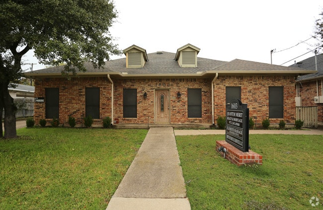
1603 E Belt Line Rd, Carrollton, TX 75006


NEARBY LISTINGS FOR SALE OR LEASE
Property Detail
1603 E Belt Line Rd
Dallas-Fort Worth-Arlington, TX
J H Maltpress 1
14057500080020000
J H MALTPRESS 1 BLK 8 PT LOT 2 ACS 0.239 71.8X145 VOL2004155/0699 DD08062004 CO-DC 0575000800200 1CC05750008
Officebuilding
Dallas
X
Texas
48113C0160K
2
2024
0.24 AC
2025
Lewisville
013717
Dallas/Ft Worth
2,834 SF
DEMOGRAPHICS near 1603 E Belt Line Rd
1 Mile
3 Mile
5 Mile
2024 Total Population
15,688
87,383
314,790
2029 Population
15,701
88,486
333,547
Pop Growth 2024-2029
+ 0.08%
+ 1.26%
+ 5.96%
Average Age
35
38
38
2024 Total Households
5,117
32,893
131,090
HH Growth 2024-2029
+ 0.25%
+ 1.14%
+ 6.20%
Median Household Inc
$65,760
$76,628
$81,926
Avg Household Size
2.90
2.60
2.30
2024 Avg HH Vehicles
2.00
2.00
2.00
Median Home Value
$232,532
$286,005
$342,215
Median Year Built
1972
1980
1988
Nearby Places
Map Layers
Map Styles
 Street
 Aerial
- Restaurants
- Banks
- Shops
- Fitness
- Groceries
PUBLIC TRANSPORTATION
TRANSIT/SUBWAY
Downtown Carrollton Station (Green Line - Dallas Area Rapid Transit (DART))
DRIVE
WALK
Distance
Downtown Carrollton Station (Green Line - Dallas Area Rapid Transit (DART))
1 min
11 min
0.6 mi
COMMUTER RAIL
Trinity Mills Station (Green Line - Dallas Area Rapid Transit (DART))
DRIVE
WALK
Distance
Trinity Mills Station (Green Line - Dallas Area Rapid Transit (DART))
6 min
3.0 mi
DRIVE
WALK
Distance
11 min
6.8 mi
AIRPORT
Dallas Love Field
DRIVE
WALK
Distance
Dallas Love Field
22 min
13.2 mi
Dallas-Fort Worth International
DRIVE
WALK
Distance
Dallas-Fort Worth International
22 min
15.8 mi
Nearby Properties
Address
Land Use
TOTAL SIZE
Lot Size
Zoning
Address
Land Use
TOTAL SIZE
Lot Size
Zoning
284,890 SF
40.44 AC
Z274
Address
Land Use
TOTAL SIZE
Lot Size
Zoning
605,278 SF
10.70 AC
Z236
Address
Land Use
TOTAL SIZE
Lot Size
Zoning
584,128 SF
3.51 AC
Z241
Address
Land Use
TOTAL SIZE
Lot Size
Zoning
513,871 SF
3.63 AC
Z235
Address
Land Use
TOTAL SIZE
Lot Size
Zoning
368,845 SF
20.96 AC
Z172
Address
Land Use
TOTAL SIZE
Lot Size
Zoning
321,732 SF
4.05 AC
Z235
Address
Land Use
TOTAL SIZE
Lot Size
Zoning
315,426 SF
3.52 AC
Z241
Address
Land Use
TOTAL SIZE
Lot Size
Zoning
345,320 SF
20.50 AC
Z172
Address
Land Use
TOTAL SIZE
Lot Size
Zoning
266,871 SF
87 SF
Address
Land Use
TOTAL SIZE
Lot Size
Zoning
725,972 SF
4 AC
Address
Land Use
TOTAL SIZE
Lot Size
Zoning
497,851 SF
3.34 AC
Z241
Address
Land Use
TOTAL SIZE
Lot Size
Zoning
283,285 SF
16.80 AC
Z172
Address
Land Use
TOTAL SIZE
Lot Size
Zoning
270,915 SF
3.91 AC
Z84
Address
Land Use
TOTAL SIZE
Lot Size
Zoning
396,899 SF
3.68 AC
Z236
Address
Land Use
TOTAL SIZE
Lot Size
Zoning
330,000 SF
3.05 AC
Z236
Address
Land Use
TOTAL SIZE
Lot Size
Zoning
374,093 SF
21.54 AC
Z268
Address
Land Use
TOTAL SIZE
Lot Size
Zoning
210,289 SF
10.16 AC
Z147
Address
Land Use
TOTAL SIZE
Lot Size
Zoning
300,956 SF
8.79 AC
Z236
Address
Land Use
TOTAL SIZE
Lot Size
Zoning
228,674 SF
11.81 AC
Z235
Address
Land Use
TOTAL SIZE
Lot Size
Zoning
227,032 SF
11 AC
Z243
Address
Land Use
TOTAL SIZE
Lot Size
Zoning
231,628 SF
12.21 AC
RMR2
Address
Land Use
TOTAL SIZE
Lot Size
Zoning
399,880 SF
25.21 AC
Z236
Address
Land Use
TOTAL SIZE
Lot Size
Zoning
213,216 SF
18.94 AC
Z235
Address
Land Use
TOTAL SIZE
Lot Size
Zoning
311,298 SF
2.66 AC
Z236
Address
Land Use
TOTAL SIZE
Lot Size
Zoning
360,360 SF
17.33 AC
Z236
Address
Land Use
TOTAL SIZE
Lot Size
Zoning
171,826 SF
12.49 AC
Z235
Address
Land Use
TOTAL SIZE
Lot Size
Zoning
404,200 SF
16.43 AC
Z123
Address
Land Use
TOTAL SIZE
Lot Size
Zoning
340,000 SF
15.61 AC
Z239
Address
Land Use
TOTAL SIZE
Lot Size
Zoning
197,024 SF
11.89 AC
Z235
Address
Land Use
TOTAL SIZE
Lot Size
Zoning
190,374 SF
10.88 AC
Z235
The World's #1 Commercial Real Estate Marketplace
Connect with us
© 2025 CoStar Group
The information above has been obtained from sources believed reliable. While we do not doubt its accuracy we have not verified it and make no guarantee, warranty or representation about it. It is your responsibility to independently confirm its accuracy and completeness. Any projections, opinions, assumptions, or estimates used are for example only and do not represent the current or future performance of the property. The value of this transaction to you depends on tax and other factors which should be evaluated by your tax, financial, and legal advisors. You and your advisors should conduct a careful, independent investigation of the property to determine to your satisfaction the suitability of the property for your needs.