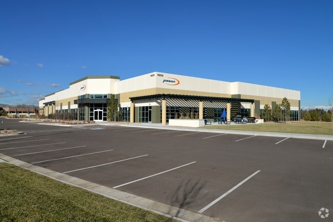
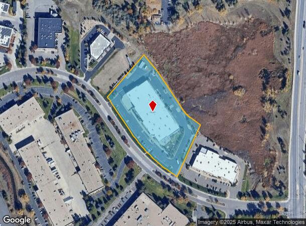
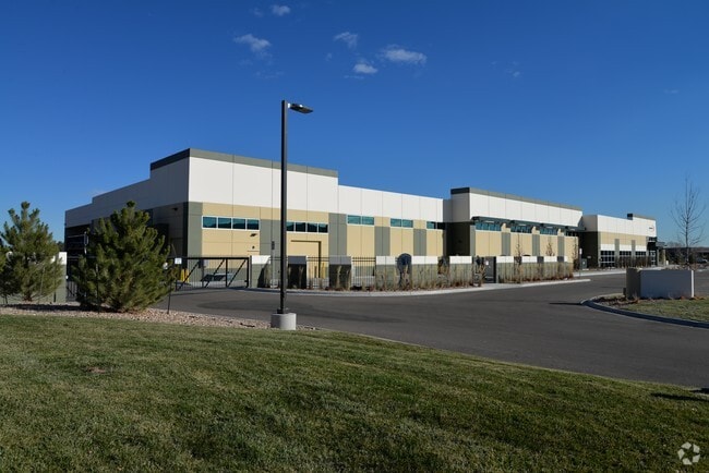
Property Record
16035 Table Mountain Pkwy, Golden, CO 80403

NEARBY LISTINGS FOR SALE OR LEASE
Property Detail
16035 Table Mountain Pkwy
Denver-Aurora-Lakewood, CO
Coors Technology Center Flg 17 Replat B
30-133-02-023
SECTION 13 TOWNSHIP 03 RANGE 70 QTR SW SUBDIVISIONCD 165611 SUBDIVISIONNAME COORS TECHNOLOGY CENTER FLG 17 REPLAT B BLOCK LOT 0001 SIZE: 197119 TRACT VALUE: 4.525
Industrialgeneral
Jefferson
X
Colorado
08059C0191F
1
2023
4.53 AC
2024
West Denver
009842
Denver
52,730 SF
DEMOGRAPHICS near 16035 Table Mountain Pkwy
1 Mile
3 Mile
5 Mile
2024 Total Population
2,756
43,797
156,596
2029 Population
2,699
43,414
155,504
Pop Growth 2024-2029
(2.07%)
(0.87%)
(0.70%)
Average Age
44
43
42
2024 Total Households
1,026
17,472
64,292
HH Growth 2024-2029
(2.14%)
(0.93%)
(0.70%)
Median Household Inc
$135,393
$119,602
$95,690
Avg Household Size
2.60
2.50
2.30
2024 Avg HH Vehicles
3.00
2.00
2.00
Median Home Value
$795,109
$705,826
$644,761
Median Year Built
1978
1990
1978
Nearby Places
Map Layers
Map Styles
 Street
 Aerial
- Restaurants
- Banks
- Shops
- Fitness
- Groceries
PUBLIC TRANSPORTATION
COMMUTER RAIL
DRIVE
WALK
Distance
9 min
3.3 mi
DRIVE
WALK
Distance
11 min
5.9 mi
AIRPORT
Denver International
DRIVE
WALK
Distance
Denver International
46 min
33.5 mi
SALE & LEASE HISTORY
LISTING DATE
SALE/LEASE

May 02, 2018
For Lease
Nearby Properties
Address
Land Use
TOTAL SIZE
Lot Size
Zoning
Address
Land Use
TOTAL SIZE
Lot Size
Zoning
830,160 SF
26.93 AC
Address
Land Use
TOTAL SIZE
Lot Size
Zoning
3,357,529 SF
32.87 AC
Address
Land Use
TOTAL SIZE
Lot Size
Zoning
187,745 SF
16.25 AC
Address
Land Use
TOTAL SIZE
Lot Size
Zoning
322,105 SF
136.23 AC
Address
Land Use
TOTAL SIZE
Lot Size
Zoning
353,286 SF
14.49 AC
Address
Land Use
TOTAL SIZE
Lot Size
Zoning
227,132 SF
11.95 AC
Address
Land Use
TOTAL SIZE
Lot Size
Zoning
365,230 SF
12.51 AC
Address
Land Use
TOTAL SIZE
Lot Size
Zoning
1,115,227 SF
84.74 AC
I2
Address
Land Use
TOTAL SIZE
Lot Size
Zoning
192,500 SF
10.97 AC
Address
Land Use
TOTAL SIZE
Lot Size
Zoning
260,325 SF
13.70 AC
Address
Land Use
TOTAL SIZE
Lot Size
Zoning
299,678 SF
20.79 AC
PD
Address
Land Use
TOTAL SIZE
Lot Size
Zoning
131,135 SF
2.83 AC
Address
Land Use
TOTAL SIZE
Lot Size
Zoning
454.79 AC
A2
Address
Land Use
TOTAL SIZE
Lot Size
Zoning
288,528 SF
12.78 AC
Address
Land Use
TOTAL SIZE
Lot Size
Zoning
126,539 SF
23.81 AC
Address
Land Use
TOTAL SIZE
Lot Size
Zoning
363,989 SF
30.10 AC
Address
Land Use
TOTAL SIZE
Lot Size
Zoning
101,761 SF
4.34 AC
Address
Land Use
TOTAL SIZE
Lot Size
Zoning
520,896 SF
24.42 AC
I1
Address
Land Use
TOTAL SIZE
Lot Size
Zoning
125,884 SF
8.88 AC
Address
Land Use
TOTAL SIZE
Lot Size
Zoning
109,401 SF
12.19 AC
Address
Land Use
TOTAL SIZE
Lot Size
Zoning
132,114 SF
11.05 AC
PD
Address
Land Use
TOTAL SIZE
Lot Size
Zoning
130,662 SF
9.67 AC
Address
Land Use
TOTAL SIZE
Lot Size
Zoning
223,338 SF
9.42 AC
I1
Address
Land Use
TOTAL SIZE
Lot Size
Zoning
149,760 SF
8.64 AC
Address
Land Use
TOTAL SIZE
Lot Size
Zoning
64,883 SF
4.74 AC
Address
Land Use
TOTAL SIZE
Lot Size
Zoning
82,432 SF
1.62 AC
Address
Land Use
TOTAL SIZE
Lot Size
Zoning
82,055 SF
19.39 AC
Address
Land Use
TOTAL SIZE
Lot Size
Zoning
67,520 SF
6.46 AC
Address
Land Use
TOTAL SIZE
Lot Size
Zoning
51,987 SF
15.23 AC
PD
Address
Land Use
TOTAL SIZE
Lot Size
Zoning
83,684 SF
8.15 AC
The World's #1 Commercial Real Estate Marketplace
Connect with us
© 2026 CoStar Group
The information above has been obtained from sources believed reliable. While we do not doubt its accuracy we have not verified it and make no guarantee, warranty or representation about it. It is your responsibility to independently confirm its accuracy and completeness. Any projections, opinions, assumptions, or estimates used are for example only and do not represent the current or future performance of the property. The value of this transaction to you depends on tax and other factors which should be evaluated by your tax, financial, and legal advisors. You and your advisors should conduct a careful, independent investigation of the property to determine to your satisfaction the suitability of the property for your needs.