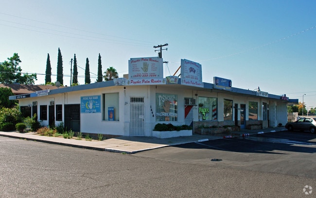
Property Record
1626 N Cedar Ave, Fresno, CA 93703

Current Lease Availabilities
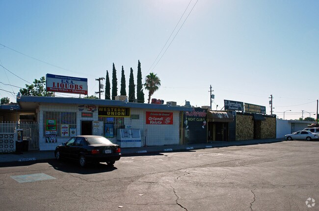
NEARBY LISTINGS FOR SALE OR LEASE
Property Detail
1626 N Cedar Ave
Fresno, CA
1345 Marfair #7
447-291-03
LOT 2 TRACT NO 1345 MAYFAIR NO 7
Storebuilding
Fresno
X
California
06019C1570H
2,5
2025
0.11 AC
2025
Midtown East
003202
Fresno
3,249 SF
DEMOGRAPHICS near 1626 N Cedar Ave
1 Mile
3 Mile
5 Mile
2024 Total Population
23,189
185,572
412,809
2029 Population
23,591
189,079
421,311
Pop Growth 2024-2029
+ 1.73%
+ 1.89%
+ 2.06%
Average Age
33
34
35
2024 Total Households
6,507
57,431
132,313
HH Growth 2024-2029
+ 1.71%
+ 1.92%
+ 2.08%
Median Household Inc
$38,711
$41,747
$49,791
Avg Household Size
3.40
3.10
3.00
2024 Avg HH Vehicles
2.00
2.00
2.00
Median Home Value
$215,907
$231,629
$270,359
Median Year Built
1957
1962
1969
Nearby Places
Map Layers
Map Styles
 Street
 Aerial
- Restaurants
- Banks
- Shops
- Fitness
- Groceries
PUBLIC TRANSPORTATION
COMMUTER RAIL
Fresno (San Joaquins - Amtrak)
DRIVE
WALK
Distance
Fresno (San Joaquins - Amtrak)
6 min
3.9 mi
AIRPORT
Fresno Yosemite International
DRIVE
WALK
Distance
Fresno Yosemite International
5 min
2.4 mi
Freight Ports
Port of Stockton
DRIVE
WALK
Distance
Port of Stockton
154 min
128.5 mi
Nearby Properties
Address
Land Use
TOTAL SIZE
Lot Size
Zoning
Address
Land Use
TOTAL SIZE
Lot Size
Zoning
1,081,456 SF
113.56 AC
M1
Address
Land Use
TOTAL SIZE
Lot Size
Zoning
794,471 SF
73.71 AC
Address
Land Use
TOTAL SIZE
Lot Size
Zoning
534,993 SF
5.23 AC
CP
Address
Land Use
TOTAL SIZE
Lot Size
Zoning
0.01 AC
P
Address
Land Use
TOTAL SIZE
Lot Size
Zoning
288,597 SF
1.18 AC
C4
Address
Land Use
TOTAL SIZE
Lot Size
Zoning
147,101 SF
6.31 AC
SPLIT
Address
Land Use
TOTAL SIZE
Lot Size
Zoning
184,130 SF
1.87 AC
PI
Address
Land Use
TOTAL SIZE
Lot Size
Zoning
385,529 SF
29.36 AC
R2
Address
Land Use
TOTAL SIZE
Lot Size
Zoning
471,760 SF
1.98 AC
CP
Address
Land Use
TOTAL SIZE
Lot Size
Zoning
116,349 SF
16.56 AC
CP
Address
Land Use
TOTAL SIZE
Lot Size
Zoning
194,109 SF
19.42 AC
C3
Address
Land Use
TOTAL SIZE
Lot Size
Zoning
213,874 SF
4.17 AC
SPLIT
Address
Land Use
TOTAL SIZE
Lot Size
Zoning
175,310 SF
19.22 AC
CMX
Address
Land Use
TOTAL SIZE
Lot Size
Zoning
94,584 SF
10.93 AC
M1
Address
Land Use
TOTAL SIZE
Lot Size
Zoning
157,702 SF
4.61 AC
R2A
Address
Land Use
TOTAL SIZE
Lot Size
Zoning
79,518 SF
2.03 AC
R4
Address
Land Use
TOTAL SIZE
Lot Size
Zoning
480,570 SF
2.98 AC
P
Address
Land Use
TOTAL SIZE
Lot Size
Zoning
90,500 SF
1.29 AC
CM
Address
Land Use
TOTAL SIZE
Lot Size
Zoning
110,456 SF
6.56 AC
RMX
Address
Land Use
TOTAL SIZE
Lot Size
Zoning
669,447 SF
0.01 AC
C3
Address
Land Use
TOTAL SIZE
Lot Size
Zoning
249,126 SF
17.33 AC
SPLIT
Address
Land Use
TOTAL SIZE
Lot Size
Zoning
250,412 SF
16.09 AC
RM3
Address
Land Use
TOTAL SIZE
Lot Size
Zoning
82,096 SF
0.26 AC
C4
Address
Land Use
TOTAL SIZE
Lot Size
Zoning
190,006 SF
19.35 AC
RM1
Address
Land Use
TOTAL SIZE
Lot Size
Zoning
151,980 SF
4.94 AC
CM
Address
Land Use
TOTAL SIZE
Lot Size
Zoning
212,113 SF
13.21 AC
R3
Address
Land Use
TOTAL SIZE
Lot Size
Zoning
203,687 SF
10.63 AC
R3
Address
Land Use
TOTAL SIZE
Lot Size
Zoning
138,502 SF
3.46 AC
C2
Address
Land Use
TOTAL SIZE
Lot Size
Zoning
121,250 SF
9.51 AC
R3
Address
Land Use
TOTAL SIZE
Lot Size
Zoning
119,914 SF
4.50 AC
CMX
The World's #1 Commercial Real Estate Marketplace
Connect with us
© 2025 CoStar Group
The information above has been obtained from sources believed reliable. While we do not doubt its accuracy we have not verified it and make no guarantee, warranty or representation about it. It is your responsibility to independently confirm its accuracy and completeness. Any projections, opinions, assumptions, or estimates used are for example only and do not represent the current or future performance of the property. The value of this transaction to you depends on tax and other factors which should be evaluated by your tax, financial, and legal advisors. You and your advisors should conduct a careful, independent investigation of the property to determine to your satisfaction the suitability of the property for your needs.