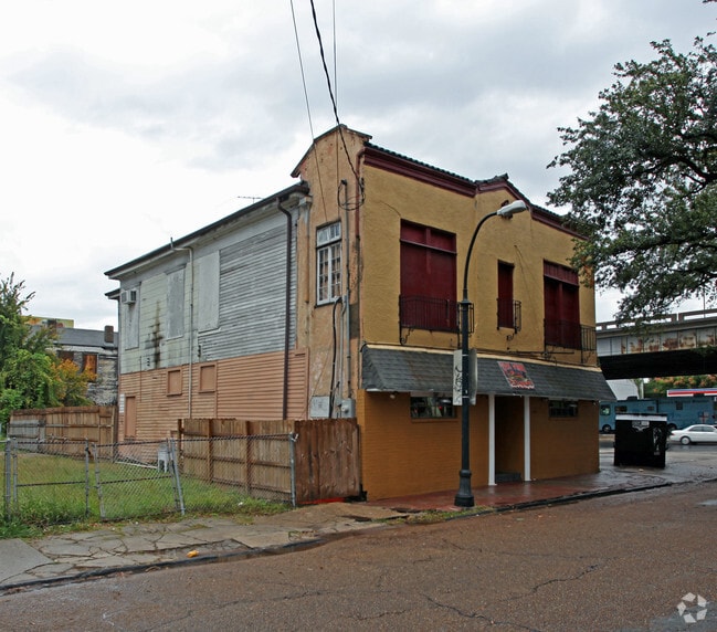
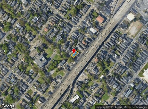
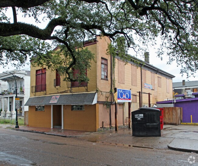
Property Record
1605 Esplanade Ave, New Orleans, LA 70116
NEARBY LISTINGS FOR SALE OR LEASE
Property Detail
1605 Esplanade Ave
New Orleans-Metairie, LA
Historic 7Th Ward
3-7W-1-087-02
SQ 760 LOT B PT 1 ESPLANADE 40 X 90 2/ST BR & STUCCO DBLE 5/RMS EACH REST & BAR SEE SEQ E002
Miscresidentialimprovement
Orleans
X
Louisiana
22051C0225F
b
2025
0.08 AC
2025
Gentilly/St Claude
003400
New Orleans/Metairie/Kenner
4,814 SF
DEMOGRAPHICS near 1605 Esplanade Ave
1 Mile
3 Mile
5 Mile
2024 Total Population
29,439
158,388
345,286
2029 Population
28,905
153,753
333,628
Pop Growth 2024-2029
(1.81%)
(2.93%)
(3.38%)
Average Age
43
41
41
2024 Total Households
15,931
76,607
154,360
HH Growth 2024-2029
(1.71%)
(2.83%)
(3.41%)
Median Household Inc
$37,392
$42,625
$50,972
Avg Household Size
1.80
2.00
2.10
2024 Avg HH Vehicles
1.00
1.00
1.00
Median Home Value
$355,754
$305,883
$322,115
Median Year Built
1946
1948
1954
Nearby Places
Map Layers
Map Styles
 Street
 Aerial
- Restaurants
- Banks
- Shops
- Fitness
- Groceries
PUBLIC TRANSPORTATION
TRANSIT/SUBWAY
N. Rampart St. At Esplanade Ave. (Rampart-Loyola Streetcar - NORTA)
DRIVE
WALK
Distance
N. Rampart St. At Esplanade Ave. (Rampart-Loyola Streetcar - NORTA)
2 min
8 min
0.4 mi
N. Rampart St. At Ursulines Ave. (Rampart-Loyola Streetcar - NORTA)
DRIVE
WALK
Distance
N. Rampart St. At Ursulines Ave. (Rampart-Loyola Streetcar - NORTA)
2 min
11 min
0.6 mi
St. Claude Ave. At Pauger St. (Rampart-Loyola Streetcar - NORTA)
DRIVE
WALK
Distance
St. Claude Ave. At Pauger St. (Rampart-Loyola Streetcar - NORTA)
2 min
12 min
0.6 mi
N. Rampart St. At St. Ann St. (Rampart-Loyola Streetcar - NORTA)
DRIVE
WALK
Distance
N. Rampart St. At St. Ann St. (Rampart-Loyola Streetcar - NORTA)
2 min
15 min
0.8 mi
St. Claude Ave. At Elysian Fields (Rampart-Loyola Streetcar - NORTA)
DRIVE
WALK
Distance
St. Claude Ave. At Elysian Fields (Rampart-Loyola Streetcar - NORTA)
2 min
15 min
0.8 mi
COMMUTER RAIL
New Orleans Union Passenger Terminal (City of New Orleans - Amtrak, Crescent - Amtrak, Sunset Limited - Amtrak)
DRIVE
WALK
Distance
New Orleans Union Passenger Terminal (City of New Orleans - Amtrak, Crescent - Amtrak, Sunset Limited - Amtrak)
5 min
2.4 mi
AIRPORT
Louis Armstrong New Orleans International
DRIVE
WALK
Distance
Louis Armstrong New Orleans International
22 min
14.7 mi
Freight Ports
Port of New Orleans
DRIVE
WALK
Distance
Port of New Orleans
12 min
5.3 mi
SALE & LEASE HISTORY
LISTING DATE
SALE/LEASE

Jun 27, 2024
For Sale
Nearby Properties
Address
Land Use
TOTAL SIZE
Lot Size
Zoning
Address
Land Use
TOTAL SIZE
Lot Size
Zoning
Address
Land Use
TOTAL SIZE
Lot Size
Zoning
300 SF
2.19 AC
LS
Address
Land Use
TOTAL SIZE
Lot Size
Zoning
85,052 SF
2.19 AC
LS
Address
Land Use
TOTAL SIZE
Lot Size
Zoning
44.43 AC
CBD-4
Address
Land Use
TOTAL SIZE
Lot Size
Zoning
66.23 AC
CBD-4
Address
Land Use
TOTAL SIZE
Lot Size
Zoning
834,043 SF
1.40 AC
CBD-2
Address
Land Use
TOTAL SIZE
Lot Size
Zoning
18.31 AC
CBD-4
Address
Land Use
TOTAL SIZE
Lot Size
Zoning
1.87 AC
CBD-2
Address
Land Use
TOTAL SIZE
Lot Size
Zoning
6.64 AC
Address
Land Use
TOTAL SIZE
Lot Size
Zoning
844,362 SF
5.85 AC
CBD-4
Address
Land Use
TOTAL SIZE
Lot Size
Zoning
30.63 AC
Address
Land Use
TOTAL SIZE
Lot Size
Zoning
444,121 SF
1.46 AC
CBD-1
Address
Land Use
TOTAL SIZE
Lot Size
Zoning
0.88 AC
CBD-2
Address
Land Use
TOTAL SIZE
Lot Size
Zoning
22.17 AC
Address
Land Use
TOTAL SIZE
Lot Size
Zoning
725,677 SF
54.19 AC
EC
Address
Land Use
TOTAL SIZE
Lot Size
Zoning
1.91 AC
CBD-1
Address
Land Use
TOTAL SIZE
Lot Size
Zoning
576,962 SF
3.31 AC
CBD-4
Address
Land Use
TOTAL SIZE
Lot Size
Zoning
1.79 AC
Address
Land Use
TOTAL SIZE
Lot Size
Zoning
512,729 SF
6.60 AC
Address
Land Use
TOTAL SIZE
Lot Size
Zoning
1.24 AC
CBD-1
Address
Land Use
TOTAL SIZE
Lot Size
Zoning
190,708 SF
1.09 AC
CBD-2
Address
Land Use
TOTAL SIZE
Lot Size
Zoning
225,284 SF
16.83 AC
S-RD
Address
Land Use
TOTAL SIZE
Lot Size
Zoning
499,287 SF
1.44 AC
VCE
Address
Land Use
TOTAL SIZE
Lot Size
Zoning
0.67 AC
CBD-3
Address
Land Use
TOTAL SIZE
Lot Size
Zoning
202,291 SF
4.04 AC
HU-RD2
Address
Land Use
TOTAL SIZE
Lot Size
Zoning
162,382 SF
1.25 AC
CBD-2
Address
Land Use
TOTAL SIZE
Lot Size
Zoning
258,024 SF
0.63 AC
CBD-2
Address
Land Use
TOTAL SIZE
Lot Size
Zoning
2.94 AC
CBD-1
Address
Land Use
TOTAL SIZE
Lot Size
Zoning
462,672 SF
1.11 AC
CBD-1
Address
Land Use
TOTAL SIZE
Lot Size
Zoning
1.84 AC
CBD-7
The World's #1 Commercial Real Estate Marketplace
Connect with us
© 2025 CoStar Group
The information above has been obtained from sources believed reliable. While we do not doubt its accuracy we have not verified it and make no guarantee, warranty or representation about it. It is your responsibility to independently confirm its accuracy and completeness. Any projections, opinions, assumptions, or estimates used are for example only and do not represent the current or future performance of the property. The value of this transaction to you depends on tax and other factors which should be evaluated by your tax, financial, and legal advisors. You and your advisors should conduct a careful, independent investigation of the property to determine to your satisfaction the suitability of the property for your needs.