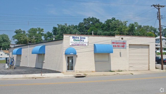
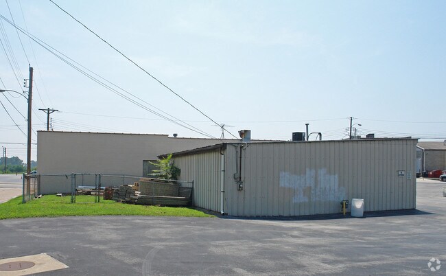
Property Record
1606 Bozza St, Alton, IL 62002

Property Detail
1606 Bozza St
St. Louis, MO-IL
SEGARS C H SUBD LT PT 33 76.8X48IRR
23-2-07-13-11-201-002
MADISON
Commercialnec
Illinois
2024
33
2025
0.11 AC
402000
Illinois
4,059 SF
St. Louis
NEARBY LISTINGS FOR SALE OR LEASE
DEMOGRAPHICS near 1606 Bozza St
1 mile
3 mile
5 mile
2025 Total Population
6,534
27,539
58,015
2030 Population
6,676
27,574
57,845
Pop Growth 2025-2030
+ 2.17%
+ 0.13%
(0.29%)
Average Age
40
42
42
2025 Total Households
2,883
12,210
25,145
HH Growth 2025-2030
+ 2.15%
+ 0.07%
(0.35%)
Median Household Inc
$49,342
$52,408
$59,866
Avg Household Size
2.20
2.20
2.20
2025 Avg HH Vehicles
1.00
2.00
2.00
Median Home Value
$75,250
$99,245
$129,146
Median Year Built
1948
1952
1957
Nearby Places
Map Layers
Map Styles
 Street
 Aerial
Layers
 Traffic
 Biking
Places
Listings with unknown addresses are not visible on the map
- Restaurants
- Banks
- Shops
- Fitness
- Groceries
PUBLIC TRANSPORTATION
COMMUTER RAIL
Alton Amtrak Station (Lincoln Service - Amtrak, Lincoln Service Missouri River Runner - Amtrak, Texas Eagle - Amtrak)
Drive
Walk
Distance
Alton Amtrak Station (Lincoln Service - Amtrak, Lincoln Service Missouri River Runner - Amtrak, Texas Eagle - Amtrak)
7 min
3.3 mi
AIRPORT
St Louis Lambert International
Drive
Walk
Distance
St Louis Lambert International
27 min
18.8 mi
Scott AFB/Midamerica St Louis
Drive
Walk
Distance
Scott AFB/Midamerica St Louis
61 min
42.8 mi
Freight Ports
Port Milwaukee
Drive
Walk
Distance
Port Milwaukee
412 min
358.0 mi
Nearby Properties
Address
Land Use
TOTAL SIZE
Lot Size
Zoning
Address
Land Use
TOTAL SIZE
Lot Size
Zoning
16.14 AC
Address
Land Use
TOTAL SIZE
Lot Size
Zoning
16.61 AC
Address
Land Use
TOTAL SIZE
Lot Size
Zoning
117,520 SF
2.29 AC
Address
Land Use
TOTAL SIZE
Lot Size
Zoning
Address
Land Use
TOTAL SIZE
Lot Size
Zoning
625.98 AC
AA9
Address
Land Use
TOTAL SIZE
Lot Size
Zoning
45,834 SF
7.10 AC
Address
Land Use
TOTAL SIZE
Lot Size
Zoning
114,461 SF
9.13 AC
Address
Land Use
TOTAL SIZE
Lot Size
Zoning
87,624 SF
4.28 AC
Address
Land Use
TOTAL SIZE
Lot Size
Zoning
57,492 SF
6.54 AC
Address
Land Use
TOTAL SIZE
Lot Size
Zoning
6,146 SF
9 AC
Address
Land Use
TOTAL SIZE
Lot Size
Zoning
1.90 AC
Address
Land Use
TOTAL SIZE
Lot Size
Zoning
Address
Land Use
TOTAL SIZE
Lot Size
Zoning
132,494 SF
18.48 AC
Address
Land Use
TOTAL SIZE
Lot Size
Zoning
26.24 AC
Address
Land Use
TOTAL SIZE
Lot Size
Zoning
576 SF
16.80 AC
Address
Land Use
TOTAL SIZE
Lot Size
Zoning
64,260 SF
3.90 AC
Address
Land Use
TOTAL SIZE
Lot Size
Zoning
56,684 SF
2.19 AC
Address
Land Use
TOTAL SIZE
Lot Size
Zoning
1.90 AC
Address
Land Use
TOTAL SIZE
Lot Size
Zoning
28,193 SF
4.23 AC
Address
Land Use
TOTAL SIZE
Lot Size
Zoning
Address
Land Use
TOTAL SIZE
Lot Size
Zoning
155,147 SF
14.37 AC
Address
Land Use
TOTAL SIZE
Lot Size
Zoning
334.25 AC
AA9
Address
Land Use
TOTAL SIZE
Lot Size
Zoning
320.80 AC
AA1
Address
Land Use
TOTAL SIZE
Lot Size
Zoning
105,137 SF
13.61 AC
Address
Land Use
TOTAL SIZE
Lot Size
Zoning
76,022 SF
4.69 AC
Address
Land Use
TOTAL SIZE
Lot Size
Zoning
100,645 SF
8.32 AC
Address
Land Use
TOTAL SIZE
Lot Size
Zoning
38,748 SF
1.77 AC
Address
Land Use
TOTAL SIZE
Lot Size
Zoning
39.31 AC
Address
Land Use
TOTAL SIZE
Lot Size
Zoning
235.26 AC
AA9
Address
Land Use
TOTAL SIZE
Lot Size
Zoning
The World's #1 Commercial Real Estate Marketplace
Connect with us
© 2026 CoStar Group
The information above has been obtained from sources believed reliable. While we do not doubt its accuracy we have not verified it and make no guarantee, warranty or representation about it. It is your responsibility to independently confirm its accuracy and completeness. Any projections, opinions, assumptions, or estimates used are for example only and do not represent the current or future performance of the property. The value of this transaction to you depends on tax and other factors which should be evaluated by your tax, financial, and legal advisors. You and your advisors should conduct a careful, independent investigation of the property to determine to your satisfaction the suitability of the property for your needs.