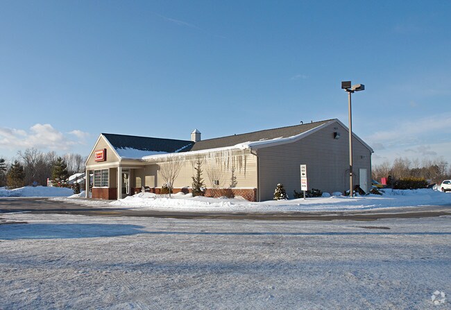
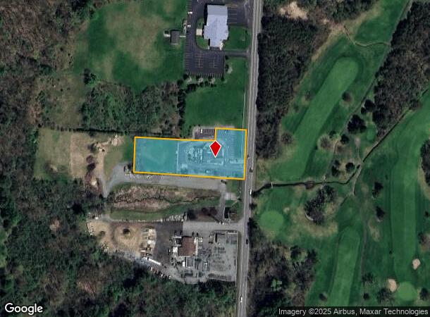
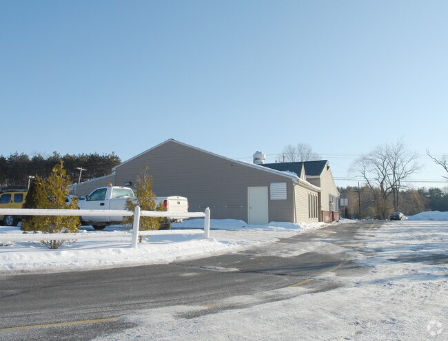
Property Record
1607 Route 146, Rexford, NY 12148
NEARBY LISTINGS FOR SALE OR LEASE
Property Detail
1607 Route 146
Albany-Schenectady-Troy, NY
DUNKIN DONUTS
412400-269-000-0003-024-002-0000
Saratoga
Restaurantdrivein
New York
2025
24.002
2024
1.69 AC
062602
Saratoga County
3,594 SF
Albany/Schenectady/Troy
DEMOGRAPHICS near 1607 Route 146
1 Mile
3 Mile
5 Mile
2024 Total Population
2,279
26,931
106,542
2029 Population
2,391
28,435
111,825
Pop Growth 2024-2029
+ 4.91%
+ 5.58%
+ 4.96%
Average Age
42
41
41
2024 Total Households
855
10,958
43,100
HH Growth 2024-2029
+ 5.03%
+ 6.01%
+ 5.21%
Median Household Inc
$136,730
$93,929
$84,513
Avg Household Size
2.60
2.40
2.30
2024 Avg HH Vehicles
2.00
2.00
2.00
Median Home Value
$338,265
$256,258
$241,175
Median Year Built
1982
1969
1959
Nearby Places
- Restaurants
- Banks
- Shops
- Fitness
- Groceries
PUBLIC TRANSPORTATION
COMMUTER RAIL
Schenectady (Adirondack - VIA Rail, Empire Service - VIA Rail, Ethan Allen Express - VIA Rail, Lake Shore Limited - VIA Rail, Maple Leaf - VIA Rail, Toronto - New York - VIA Rail)
DRIVE
WALK
Distance
Schenectady (Adirondack - VIA Rail, Empire Service - VIA Rail, Ethan Allen Express - VIA Rail, Lake Shore Limited - VIA Rail, Maple Leaf - VIA Rail, Toronto - New York - VIA Rail)
10 min
4.8 mi
AIRPORT
Albany International
DRIVE
WALK
Distance
Albany International
21 min
10.9 mi
Freight Ports
Albany, NY Port
DRIVE
WALK
Distance
Albany, NY Port
37 min
23.4 mi
Nearby Properties
Address
Land Use
TOTAL SIZE
Lot Size
Zoning
Address
Land Use
TOTAL SIZE
Lot Size
Zoning
174.70 AC
Address
Land Use
TOTAL SIZE
Lot Size
Zoning
338.40 AC
Address
Land Use
TOTAL SIZE
Lot Size
Zoning
600 SF
28.40 AC
06 - INDUS
Address
Land Use
TOTAL SIZE
Lot Size
Zoning
194,403 SF
315.80 AC
06 - INDUS
Address
Land Use
TOTAL SIZE
Lot Size
Zoning
249,801 SF
54.35 AC
R1
Address
Land Use
TOTAL SIZE
Lot Size
Zoning
19,080 SF
602.20 AC
CON
Address
Land Use
TOTAL SIZE
Lot Size
Zoning
12,528 SF
20.66 AC
R2
Address
Land Use
TOTAL SIZE
Lot Size
Zoning
60,274 SF
12.95 AC
OT
Address
Land Use
TOTAL SIZE
Lot Size
Zoning
23,923 SF
109.83 AC
CON
Address
Land Use
TOTAL SIZE
Lot Size
Zoning
11,424 SF
42.41 AC
CON
Address
Land Use
TOTAL SIZE
Lot Size
Zoning
194.77 AC
Address
Land Use
TOTAL SIZE
Lot Size
Zoning
32,626 SF
81.39 AC
IR
Address
Land Use
TOTAL SIZE
Lot Size
Zoning
34,807 SF
15.91 AC
R2
Address
Land Use
TOTAL SIZE
Lot Size
Zoning
135,000 SF
10.29 AC
CON
Address
Land Use
TOTAL SIZE
Lot Size
Zoning
16,392 SF
14.64 AC
CON
Address
Land Use
TOTAL SIZE
Lot Size
Zoning
60,000 SF
3.48 AC
CON
Address
Land Use
TOTAL SIZE
Lot Size
Zoning
85,953 SF
2.24 AC
CON
Address
Land Use
TOTAL SIZE
Lot Size
Zoning
4.21 AC
02 - SINGL
Address
Land Use
TOTAL SIZE
Lot Size
Zoning
123,226 SF
31.66 AC
CON
Address
Land Use
TOTAL SIZE
Lot Size
Zoning
62,131 SF
14.96 AC
RP
Address
Land Use
TOTAL SIZE
Lot Size
Zoning
81,125 SF
8.60 AC
CON
Address
Land Use
TOTAL SIZE
Lot Size
Zoning
14,160 SF
14.43 AC
R2
Address
Land Use
TOTAL SIZE
Lot Size
Zoning
8,736 SF
10.40 AC
R3
Address
Land Use
TOTAL SIZE
Lot Size
Zoning
94,868 SF
2.40 AC
03
Address
Land Use
TOTAL SIZE
Lot Size
Zoning
47,600 SF
6.71 AC
CON
Address
Land Use
TOTAL SIZE
Lot Size
Zoning
83,859 SF
8.40 AC
CON
Address
Land Use
TOTAL SIZE
Lot Size
Zoning
56,000 SF
21.89 AC
CON
Address
Land Use
TOTAL SIZE
Lot Size
Zoning
46,000 SF
8.53 AC
CON
Address
Land Use
TOTAL SIZE
Lot Size
Zoning
123,120 SF
9.58 AC
RP
Address
Land Use
TOTAL SIZE
Lot Size
Zoning
80,849 SF
37.83 AC
OT
The World's #1 Commercial Real Estate Marketplace
Connect with us
© 2025 CoStar Group
The information above has been obtained from sources believed reliable. While we do not doubt its accuracy we have not verified it and make no guarantee, warranty or representation about it. It is your responsibility to independently confirm its accuracy and completeness. Any projections, opinions, assumptions, or estimates used are for example only and do not represent the current or future performance of the property. The value of this transaction to you depends on tax and other factors which should be evaluated by your tax, financial, and legal advisors. You and your advisors should conduct a careful, independent investigation of the property to determine to your satisfaction the suitability of the property for your needs.