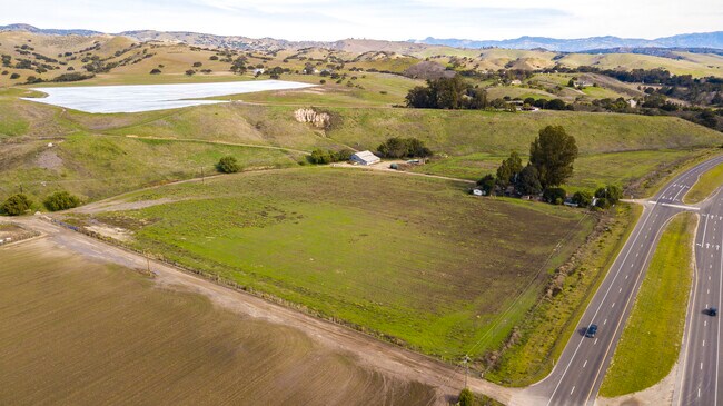
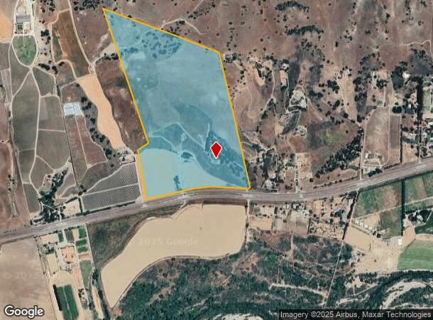
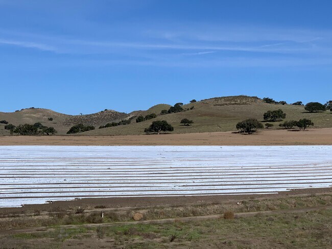
Property Record
1607 W Highway 246, Buellton, CA 93427
NEARBY LISTINGS FOR SALE OR LEASE
Property Detail
1607 W Highway 246
099-190-074
San Carlos De Jonata Rho 18
Agriculturalland
Santa Barbara
X
California
06083C1055G
126.27 AC
2024
Central SB County
2025
Santa Barbara/Sta Maria/Goleta
001911
Santa Maria-Santa Barbara, CA
3,032 SF
DEMOGRAPHICS near 1607 W Highway 246
1 Mile
3 Mile
5 Mile
2024 Total Population
67
4,340
5,464
2029 Population
62
4,252
5,308
Pop Growth 2024-2029
(7.46%)
(2.03%)
(2.86%)
Average Age
44
42
41
2024 Total Households
25
1,629
2,050
HH Growth 2024-2029
(8.00%)
(2.09%)
(2.98%)
Median Household Inc
$124,999
$106,834
$107,676
Avg Household Size
2.60
2.70
2.70
2024 Avg HH Vehicles
2.00
2.00
2.00
Median Home Value
$1,060,000
$708,142
$712,725
Median Year Built
1986
1993
1994
Nearby Places
Map Layers
Map Styles
 Street
 Aerial
- Restaurants
- Banks
- Shops
- Fitness
- Groceries
PUBLIC TRANSPORTATION
AIRPORT
Santa Barbara Municipal
DRIVE
WALK
Distance
Santa Barbara Municipal
60 min
39.0 mi
Freight Ports
The Port of Hueneme
DRIVE
WALK
Distance
The Port of Hueneme
108 min
85.6 mi
SALE & LEASE HISTORY
LISTING DATE
SALE/LEASE

Jun 13, 2018
For Sale
Feb 05, 2020
For Sale
Nearby Properties
Address
Land Use
TOTAL SIZE
Lot Size
Zoning
Address
Land Use
TOTAL SIZE
Lot Size
Zoning
3.63 AC
Address
Land Use
TOTAL SIZE
Lot Size
Zoning
3.19 AC
AGI40
Address
Land Use
TOTAL SIZE
Lot Size
Zoning
1,346 SF
101.66 AC
AGII100
Address
Land Use
TOTAL SIZE
Lot Size
Zoning
3,086 SF
68.19 AC
AGII40
Address
Land Use
TOTAL SIZE
Lot Size
Zoning
2,578 SF
132.30 AC
AGII100
Address
Land Use
TOTAL SIZE
Lot Size
Zoning
50,439 SF
3.30 AC
Address
Land Use
TOTAL SIZE
Lot Size
Zoning
137,419 SF
5.12 AC
Address
Land Use
TOTAL SIZE
Lot Size
Zoning
1,002.93 AC
AGII100
Address
Land Use
TOTAL SIZE
Lot Size
Zoning
2,110 SF
3.01 AC
Address
Land Use
TOTAL SIZE
Lot Size
Zoning
2.07 AC
Address
Land Use
TOTAL SIZE
Lot Size
Zoning
1.57 AC
Address
Land Use
TOTAL SIZE
Lot Size
Zoning
3,282 SF
62.61 AC
AGII40
Address
Land Use
TOTAL SIZE
Lot Size
Zoning
35.61 AC
AGI40
Address
Land Use
TOTAL SIZE
Lot Size
Zoning
2,137 SF
108.06 AC
AGII100
Address
Land Use
TOTAL SIZE
Lot Size
Zoning
2.45 AC
Address
Land Use
TOTAL SIZE
Lot Size
Zoning
1,124 SF
348.52 AC
AGII100
Address
Land Use
TOTAL SIZE
Lot Size
Zoning
14,227 SF
2.32 AC
Address
Land Use
TOTAL SIZE
Lot Size
Zoning
21,903 SF
1 AC
Address
Land Use
TOTAL SIZE
Lot Size
Zoning
157.22 AC
AGII100
Address
Land Use
TOTAL SIZE
Lot Size
Zoning
2.70 AC
Address
Land Use
TOTAL SIZE
Lot Size
Zoning
81.50 AC
AGII100
Address
Land Use
TOTAL SIZE
Lot Size
Zoning
136.35 AC
AGII100
Address
Land Use
TOTAL SIZE
Lot Size
Zoning
1.37 AC
Address
Land Use
TOTAL SIZE
Lot Size
Zoning
24,044 SF
3.14 AC
Address
Land Use
TOTAL SIZE
Lot Size
Zoning
2,963 SF
126.23 AC
AGII100
Address
Land Use
TOTAL SIZE
Lot Size
Zoning
39.23 AC
AGII100
Address
Land Use
TOTAL SIZE
Lot Size
Zoning
2.20 AC
Address
Land Use
TOTAL SIZE
Lot Size
Zoning
1,400 SF
38.45 AC
AGII40
Address
Land Use
TOTAL SIZE
Lot Size
Zoning
16,034 SF
2.68 AC
The World's #1 Commercial Real Estate Marketplace
Connect with us
© 2026 CoStar Group
The information above has been obtained from sources believed reliable. While we do not doubt its accuracy we have not verified it and make no guarantee, warranty or representation about it. It is your responsibility to independently confirm its accuracy and completeness. Any projections, opinions, assumptions, or estimates used are for example only and do not represent the current or future performance of the property. The value of this transaction to you depends on tax and other factors which should be evaluated by your tax, financial, and legal advisors. You and your advisors should conduct a careful, independent investigation of the property to determine to your satisfaction the suitability of the property for your needs.