Property Record
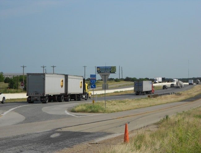
16074 N Interstate 35, West, TX 76691


Property Detail
16074 N Interstate 35
50-046900-001300-5
HAMPTON W R ACRES 3.579, LAND ACCT; MH ONLY PID ON 418239
Commercialnec
MCLENNAN
C
Texas
B and X Area of moderate flood hazard, usually the area between the limits of the 100-year and 500-year floods.
3.58 AC
2024
Waco
2025
Other Market Areas
004201
Waco, TX
9,600 SF
NEARBY LISTINGS FOR SALE OR LEASE
-
-
View all West listings for sale on LoopNet.com
DEMOGRAPHICS near 16074 N Interstate 35
1 mile
3 mile
5 mile
2025 Total Population
285
2,328
8,227
2030 Population
290
2,380
8,441
Pop Growth 2025-2030
+ 1.75%
+ 2.23%
+ 2.60%
Average Age
41
42
41
2025 Total Households
107
880
3,088
HH Growth 2025-2030
+ 1.87%
+ 2.27%
+ 2.56%
Median Household Inc
$71,999
$74,999
$74,194
Avg Household Size
2.60
2.60
2.60
2025 Avg HH Vehicles
2.00
2.00
2.00
Median Home Value
$315,789
$344,403
$308,435
Median Year Built
1983
1984
1984
Nearby Places
Map Layers
Map Styles
 Street
 Aerial
Layers
 Traffic
 Biking
Places
Listings with unknown addresses are not visible on the map
- Restaurants
- Banks
- Shops
- Fitness
- Groceries
PUBLIC TRANSPORTATION
AIRPORT
Waco Regional
Drive
Walk
Distance
Waco Regional
34 min
18.6 mi
Freight Ports
Port of Houston
Drive
Walk
Distance
Port of Houston
229 min
196.4 mi
SALE & LEASE HISTORY
LISTING DATE
SALE/LEASE

Sep 24, 2016
For Sale
Nov 29, 2016
For Sale
Jan 16, 2018
For Lease
Apr 16, 2020
For Sale
Nearby Properties
Address
Land Use
TOTAL SIZE
Lot Size
Zoning
Address
Land Use
TOTAL SIZE
Lot Size
Zoning
9,694 SF
34.11 AC
R
Address
Land Use
TOTAL SIZE
Lot Size
Zoning
79,000 SF
6.09 AC
R
Address
Land Use
TOTAL SIZE
Lot Size
Zoning
40,270 SF
51.91 AC
R
Address
Land Use
TOTAL SIZE
Lot Size
Zoning
13,379 SF
8.99 AC
C
Address
Land Use
TOTAL SIZE
Lot Size
Zoning
70,675 SF
19.48 AC
C
Address
Land Use
TOTAL SIZE
Lot Size
Zoning
45,000 SF
8.01 AC
R
Address
Land Use
TOTAL SIZE
Lot Size
Zoning
82,965 SF
10.77 AC
R
Address
Land Use
TOTAL SIZE
Lot Size
Zoning
1,800 SF
24.77 AC
C
Address
Land Use
TOTAL SIZE
Lot Size
Zoning
23,274 SF
5 AC
R
Address
Land Use
TOTAL SIZE
Lot Size
Zoning
18,850 SF
21.94 AC
R
Address
Land Use
TOTAL SIZE
Lot Size
Zoning
48,790 SF
4.01 AC
C
Address
Land Use
TOTAL SIZE
Lot Size
Zoning
33,720 SF
10 AC
R
Address
Land Use
TOTAL SIZE
Lot Size
Zoning
15,140 SF
21.74 AC
Address
Land Use
TOTAL SIZE
Lot Size
Zoning
12,952 SF
4.08 AC
R
Address
Land Use
TOTAL SIZE
Lot Size
Zoning
26,102 SF
5.66 AC
Address
Land Use
TOTAL SIZE
Lot Size
Zoning
17,500 SF
5.18 AC
C
Address
Land Use
TOTAL SIZE
Lot Size
Zoning
36,001 SF
8.82 AC
R
Address
Land Use
TOTAL SIZE
Lot Size
Zoning
7,123 SF
14.62 AC
C
Address
Land Use
TOTAL SIZE
Lot Size
Zoning
20,550 SF
5.58 AC
R
Address
Land Use
TOTAL SIZE
Lot Size
Zoning
20,290 SF
6.77 AC
R
Address
Land Use
TOTAL SIZE
Lot Size
Zoning
21,871 SF
7.92 AC
R
Address
Land Use
TOTAL SIZE
Lot Size
Zoning
4,890 SF
8 AC
Address
Land Use
TOTAL SIZE
Lot Size
Zoning
8,300 SF
18.55 AC
R
Address
Land Use
TOTAL SIZE
Lot Size
Zoning
8,135 SF
8.33 AC
C
Address
Land Use
TOTAL SIZE
Lot Size
Zoning
3,793 SF
9.99 AC
Address
Land Use
TOTAL SIZE
Lot Size
Zoning
25,600 SF
1.75 AC
Address
Land Use
TOTAL SIZE
Lot Size
Zoning
24.02 AC
R
Address
Land Use
TOTAL SIZE
Lot Size
Zoning
12,500 SF
3.12 AC
Address
Land Use
TOTAL SIZE
Lot Size
Zoning
24,300 SF
2.86 AC
Address
Land Use
TOTAL SIZE
Lot Size
Zoning
3,041 SF
3.54 AC
The World's #1 Commercial Real Estate Marketplace
Connect with us
© 2026 CoStar Group
The information above has been obtained from sources believed reliable. While we do not doubt its accuracy we have not verified it and make no guarantee, warranty or representation about it. It is your responsibility to independently confirm its accuracy and completeness. Any projections, opinions, assumptions, or estimates used are for example only and do not represent the current or future performance of the property. The value of this transaction to you depends on tax and other factors which should be evaluated by your tax, financial, and legal advisors. You and your advisors should conduct a careful, independent investigation of the property to determine to your satisfaction the suitability of the property for your needs.