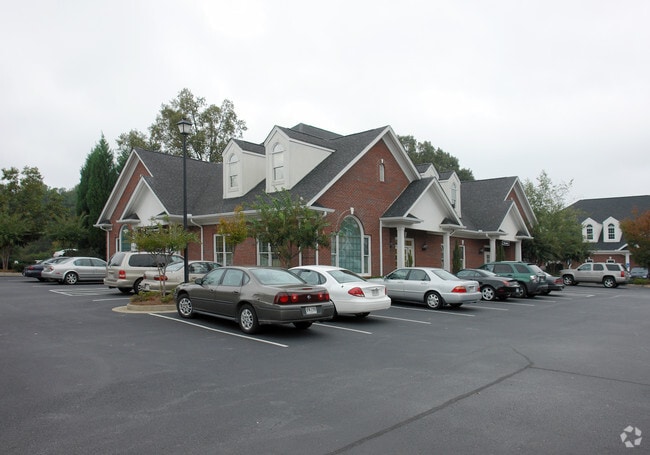
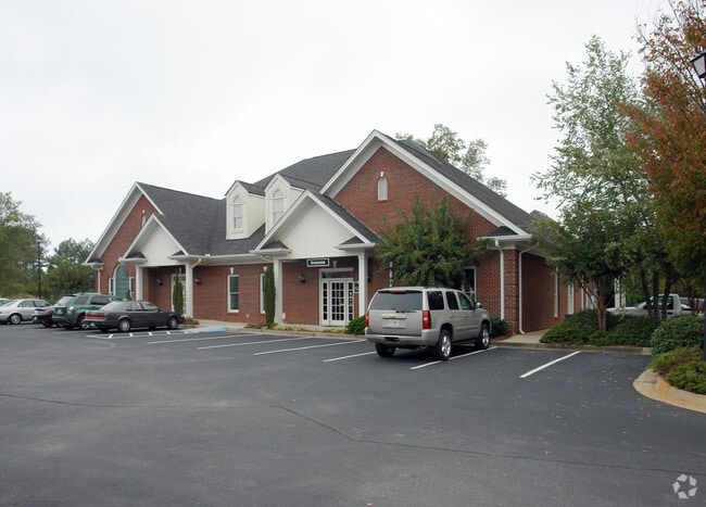
Property Record
1608 Tree Ln, Snellville, GA 30078


Property Detail
1608 Tree Ln
5-041-001D
TREE LANE & L3 & L4 SURREY FARMS
Medicalbuilding
GWINNETT
OP
Georgia
B and X Area of moderate flood hazard, usually the area between the limits of the 100-year and 500-year floods.
3,4
2025
2.77 AC
2025
Lawrenceville/Lilburn
050762
Atlanta
23,943 SF
Atlanta-Sandy Springs-Roswell, GA
NEARBY LISTINGS FOR SALE OR LEASE
DEMOGRAPHICS near 1608 Tree Ln
1 mile
3 mile
5 mile
2024 Total Population
6,559
70,018
206,705
2029 Population
6,891
73,272
216,066
Pop Growth 2024-2029
+ 5.06%
+ 4.65%
+ 4.53%
Average Age
41
39
39
2024 Total Households
2,108
22,517
65,951
HH Growth 2024-2029
+ 4.93%
+ 4.75%
+ 4.63%
Median Household Inc
$117,428
$99,965
$93,849
Avg Household Size
3.00
3.00
3.10
2024 Avg HH Vehicles
2.00
2.00
2.00
Median Home Value
$547,817
$396,179
$378,402
Median Year Built
1987
1989
1992
Nearby Places
Map Layers
Map Styles
 Street
 Aerial
Transit
 Traffic
 Biking
Places
Listings with unknown addresses are not visible on the map
- Restaurants
- Banks
- Shops
- Fitness
- Groceries
PUBLIC TRANSPORTATION
AIRPORT
Hartsfield - Jackson Atlanta International
Drive
Walk
Distance
Hartsfield - Jackson Atlanta International
54 min
35.0 mi
SALE & LEASE HISTORY
LISTING DATE
SALE/LEASE

Nov 03, 2016
For Lease
Jun 02, 2022
For Lease
Nearby Properties
Address
Land Use
TOTAL SIZE
Lot Size
Zoning
Address
Land Use
TOTAL SIZE
Lot Size
Zoning
362,674 SF
43.59 AC
CI
Address
Land Use
TOTAL SIZE
Lot Size
Zoning
469,566 SF
24.30 AC
RS180
Address
Land Use
TOTAL SIZE
Lot Size
Zoning
319,290 SF
2.05 AC
TC-MU
Address
Land Use
TOTAL SIZE
Lot Size
Zoning
245,208 SF
15.37 AC
RO
Address
Land Use
TOTAL SIZE
Lot Size
Zoning
274,964 SF
27.82 AC
BG
Address
Land Use
TOTAL SIZE
Lot Size
Zoning
214,399 SF
29.91 AC
C2
Address
Land Use
TOTAL SIZE
Lot Size
Zoning
230,417 SF
24.09 AC
BG
Address
Land Use
TOTAL SIZE
Lot Size
Zoning
214,082 SF
18.56 AC
BG
Address
Land Use
TOTAL SIZE
Lot Size
Zoning
283,953 SF
20.56 AC
RS30
Address
Land Use
TOTAL SIZE
Lot Size
Zoning
160,939 SF
25.46 AC
R75
Address
Land Use
TOTAL SIZE
Lot Size
Zoning
148,880 SF
23.15 AC
R100
Address
Land Use
TOTAL SIZE
Lot Size
Zoning
125,097 SF
1.01 AC
CI
Address
Land Use
TOTAL SIZE
Lot Size
Zoning
357,243 SF
59.63 AC
R100
Address
Land Use
TOTAL SIZE
Lot Size
Zoning
118,804 SF
17.66 AC
C2
Address
Land Use
TOTAL SIZE
Lot Size
Zoning
128,054 SF
15.62 AC
BG2
Address
Land Use
TOTAL SIZE
Lot Size
Zoning
123,713 SF
5.97 AC
C2
Address
Land Use
TOTAL SIZE
Lot Size
Zoning
202,864 SF
1.35 AC
TC-MU
Address
Land Use
TOTAL SIZE
Lot Size
Zoning
131,121 SF
12.99 AC
BG
Address
Land Use
TOTAL SIZE
Lot Size
Zoning
218,973 SF
21.04 AC
BG
Address
Land Use
TOTAL SIZE
Lot Size
Zoning
79,339 SF
38.25 AC
RS180
Address
Land Use
TOTAL SIZE
Lot Size
Zoning
120,113 SF
13 AC
BG
Address
Land Use
TOTAL SIZE
Lot Size
Zoning
108,123 SF
13.96 AC
R100
Address
Land Use
TOTAL SIZE
Lot Size
Zoning
122,201 SF
10.23 AC
BG
Address
Land Use
TOTAL SIZE
Lot Size
Zoning
100,913 SF
8.30 AC
HSB
Address
Land Use
TOTAL SIZE
Lot Size
Zoning
97,411 SF
8.47 AC
BG
Address
Land Use
TOTAL SIZE
Lot Size
Zoning
111,732 SF
9.71 AC
CI
Address
Land Use
TOTAL SIZE
Lot Size
Zoning
55,810 SF
8.28 AC
R100
Address
Land Use
TOTAL SIZE
Lot Size
Zoning
61,200 SF
0.59 AC
CI
Address
Land Use
TOTAL SIZE
Lot Size
Zoning
66,544 SF
6.70 AC
BG
Address
Land Use
TOTAL SIZE
Lot Size
Zoning
103,660 SF
9.58 AC
BG
The World's #1 Commercial Real Estate Marketplace
Connect with us
© 2026 CoStar Group
The information above has been obtained from sources believed reliable. While we do not doubt its accuracy we have not verified it and make no guarantee, warranty or representation about it. It is your responsibility to independently confirm its accuracy and completeness. Any projections, opinions, assumptions, or estimates used are for example only and do not represent the current or future performance of the property. The value of this transaction to you depends on tax and other factors which should be evaluated by your tax, financial, and legal advisors. You and your advisors should conduct a careful, independent investigation of the property to determine to your satisfaction the suitability of the property for your needs.