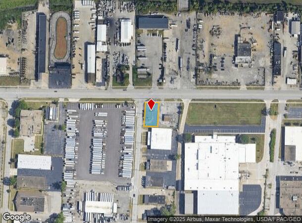
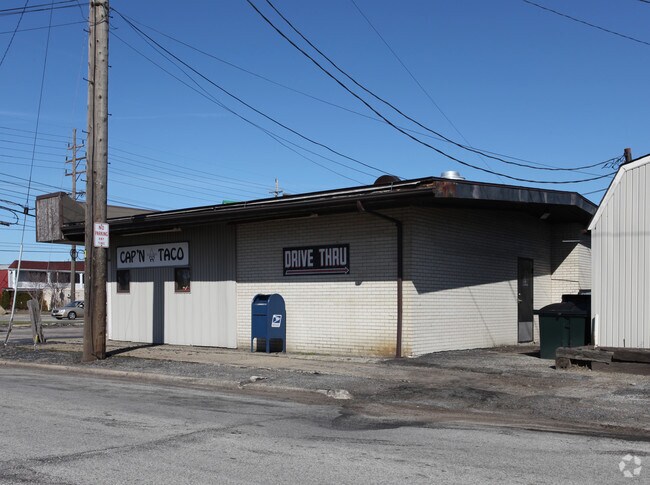
Property Record
16099 Brookpark Rd, Brookpark, OH 44142

NEARBY LISTINGS FOR SALE OR LEASE
Property Detail
16099 Brookpark Rd
Cleveland-Elyria, OH
Kay Dev
343-10-020
10-1-2 KAY DEV COS W 161 0001 NWP
Restaurantbuilding
Cuyahoga
X
Ohio
39035C0166E
1
2024
0.26 AC
2024
Southwest
138107
Cleveland
1,242 SF
DEMOGRAPHICS near 16099 Brookpark Rd
1 Mile
3 Mile
5 Mile
2024 Total Population
4,870
79,555
284,067
2029 Population
4,731
77,312
275,048
Pop Growth 2024-2029
(2.85%)
(2.82%)
(3.17%)
Average Age
41
42
41
2024 Total Households
2,018
35,127
125,855
HH Growth 2024-2029
(3.07%)
(3.02%)
(3.37%)
Median Household Inc
$49,027
$56,021
$59,337
Avg Household Size
2.30
2.20
2.20
2024 Avg HH Vehicles
2.00
2.00
2.00
Median Home Value
$126,122
$145,239
$159,080
Median Year Built
1955
1957
1954
Nearby Places
Map Layers
Map Styles
 Street
 Aerial
- Restaurants
- Banks
- Shops
- Fitness
- Groceries
PUBLIC TRANSPORTATION
AIRPORT
Cleveland-Hopkins International
DRIVE
WALK
Distance
Cleveland-Hopkins International
8 min
2.8 mi
SALE & LEASE HISTORY
LISTING DATE
SALE/LEASE

Sep 23, 2016
For Sale
Apr 23, 2024
For Sale
Nearby Properties
Address
Land Use
TOTAL SIZE
Lot Size
Zoning
Address
Land Use
TOTAL SIZE
Lot Size
Zoning
748.88 AC
GI
Address
Land Use
TOTAL SIZE
Lot Size
Zoning
1,669,041 SF
169.42 AC
U6
Address
Land Use
TOTAL SIZE
Lot Size
Zoning
754.68 AC
GI
Address
Land Use
TOTAL SIZE
Lot Size
Zoning
526.33 AC
GI
Address
Land Use
TOTAL SIZE
Lot Size
Zoning
237,144 SF
2.12 AC
PG
Address
Land Use
TOTAL SIZE
Lot Size
Zoning
668,882 SF
41.27 AC
SC
Address
Land Use
TOTAL SIZE
Lot Size
Zoning
780,869 SF
14.77 AC
LR
Address
Land Use
TOTAL SIZE
Lot Size
Zoning
208.22 AC
U5-A
Address
Land Use
TOTAL SIZE
Lot Size
Zoning
657,013 SF
48.88 AC
SI
Address
Land Use
TOTAL SIZE
Lot Size
Zoning
70.02 AC
GI
Address
Land Use
TOTAL SIZE
Lot Size
Zoning
Address
Land Use
TOTAL SIZE
Lot Size
Zoning
208,209 SF
12.10 AC
1F
Address
Land Use
TOTAL SIZE
Lot Size
Zoning
Address
Land Use
TOTAL SIZE
Lot Size
Zoning
768,485 SF
14.53 AC
R1-A
Address
Land Use
TOTAL SIZE
Lot Size
Zoning
88.28 AC
U5-A
Address
Land Use
TOTAL SIZE
Lot Size
Zoning
505,418 SF
33.99 AC
SC
Address
Land Use
TOTAL SIZE
Lot Size
Zoning
809,240 SF
36.27 AC
L-I
Address
Land Use
TOTAL SIZE
Lot Size
Zoning
340,593 SF
10.10 AC
G-1
Address
Land Use
TOTAL SIZE
Lot Size
Zoning
126,000 SF
3.02 AC
PG
Address
Land Use
TOTAL SIZE
Lot Size
Zoning
1,391,445 SF
136.05 AC
GI
Address
Land Use
TOTAL SIZE
Lot Size
Zoning
3.53 AC
SI
Address
Land Use
TOTAL SIZE
Lot Size
Zoning
49.67 AC
SI
Address
Land Use
TOTAL SIZE
Lot Size
Zoning
123,130 SF
21.88 AC
GI
Address
Land Use
TOTAL SIZE
Lot Size
Zoning
33.27 AC
IA
Address
Land Use
TOTAL SIZE
Lot Size
Zoning
364,000 SF
33.27 AC
U5-A
Address
Land Use
TOTAL SIZE
Lot Size
Zoning
355,701 SF
16.35 AC
OB
Address
Land Use
TOTAL SIZE
Lot Size
Zoning
519,592 SF
69.70 AC
L-I
Address
Land Use
TOTAL SIZE
Lot Size
Zoning
174.94 AC
U5-A
Address
Land Use
TOTAL SIZE
Lot Size
Zoning
355,242 SF
13.28 AC
RMF-HR
Address
Land Use
TOTAL SIZE
Lot Size
Zoning
300,120 SF
20.18 AC
GI
The World's #1 Commercial Real Estate Marketplace
Connect with us
© 2026 CoStar Group
The information above has been obtained from sources believed reliable. While we do not doubt its accuracy we have not verified it and make no guarantee, warranty or representation about it. It is your responsibility to independently confirm its accuracy and completeness. Any projections, opinions, assumptions, or estimates used are for example only and do not represent the current or future performance of the property. The value of this transaction to you depends on tax and other factors which should be evaluated by your tax, financial, and legal advisors. You and your advisors should conduct a careful, independent investigation of the property to determine to your satisfaction the suitability of the property for your needs.