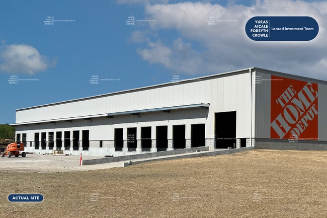
Property Record
161 Drive In Rd, Frankfort, NY 13340

NEARBY LISTINGS FOR SALE OR LEASE
Property Detail
161 Drive In Rd
Utica-Rome, NY
Herkimer
214800-105-003-0002-001-200-0000
New York
Warehouse
1.200
2025
3.80 AC
2024
Herkimer County
011302
Utica/Rome
DEMOGRAPHICS near 161 Drive In Rd
1 Mile
3 Mile
5 Mile
2024 Total Population
201
2,906
21,696
2029 Population
199
2,872
21,202
Pop Growth 2024-2029
(1.00%)
(1.17%)
(2.28%)
Average Age
45
45
42
2024 Total Households
85
1,262
8,691
HH Growth 2024-2029
0.00%
(1.27%)
(2.34%)
Median Household Inc
$43,749
$58,593
$52,961
Avg Household Size
2.30
2.20
2.30
2024 Avg HH Vehicles
2.00
2.00
2.00
Median Home Value
$150,000
$142,455
$135,985
Median Year Built
1989
1982
1958
Nearby Places
Map Layers
Map Styles
 Street
 Aerial
- Restaurants
- Banks
- Shops
- Fitness
- Groceries
PUBLIC TRANSPORTATION
COMMUTER RAIL
Utica Amtrak Station (Empire Service - Amtrak, Lake Shore Limited - Amtrak, Maple Leaf - Amtrak)
DRIVE
WALK
Distance
Utica Amtrak Station (Empire Service - Amtrak, Lake Shore Limited - Amtrak, Maple Leaf - Amtrak)
10 min
6.3 mi
Utica (Toronto - New York - VIA Rail)
DRIVE
WALK
Distance
Utica (Toronto - New York - VIA Rail)
11 min
6.3 mi
Freight Ports
Albany, NY Port
DRIVE
WALK
Distance
Albany, NY Port
111 min
89.8 mi
SALE & LEASE HISTORY
LISTING DATE
SALE/LEASE

Jul 11, 2023
For Sale
Nearby Properties
Address
Land Use
TOTAL SIZE
Lot Size
Zoning
Address
Land Use
TOTAL SIZE
Lot Size
Zoning
1 AC
RA
Address
Land Use
TOTAL SIZE
Lot Size
Zoning
195,000 SF
49.40 AC
CH
Address
Land Use
TOTAL SIZE
Lot Size
Zoning
61,000 SF
9.90 AC
CH
Address
Land Use
TOTAL SIZE
Lot Size
Zoning
52,500 SF
11 AC
CH
Address
Land Use
TOTAL SIZE
Lot Size
Zoning
50,000 SF
11.50 AC
CH
Address
Land Use
TOTAL SIZE
Lot Size
Zoning
141,072 SF
18.70 AC
Address
Land Use
TOTAL SIZE
Lot Size
Zoning
14.30 AC
RA
Address
Land Use
TOTAL SIZE
Lot Size
Zoning
16,502 SF
4.76 AC
CH
Address
Land Use
TOTAL SIZE
Lot Size
Zoning
1,080 SF
43.30 AC
CH
Address
Land Use
TOTAL SIZE
Lot Size
Zoning
1,152 SF
40.70 AC
RA
Address
Land Use
TOTAL SIZE
Lot Size
Zoning
1,456 SF
30 AC
PD
Address
Land Use
TOTAL SIZE
Lot Size
Zoning
131.40 AC
Address
Land Use
TOTAL SIZE
Lot Size
Zoning
16.93 AC
R
Address
Land Use
TOTAL SIZE
Lot Size
Zoning
117,260 SF
11.50 AC
CH
Address
Land Use
TOTAL SIZE
Lot Size
Zoning
768 SF
10 AC
CH
Address
Land Use
TOTAL SIZE
Lot Size
Zoning
1,568 SF
11 AC
CH
Address
Land Use
TOTAL SIZE
Lot Size
Zoning
26,251 SF
8 AC
Address
Land Use
TOTAL SIZE
Lot Size
Zoning
50,138 SF
25 AC
R
Address
Land Use
TOTAL SIZE
Lot Size
Zoning
780 SF
9.60 AC
CH
Address
Land Use
TOTAL SIZE
Lot Size
Zoning
131.40 AC
Address
Land Use
TOTAL SIZE
Lot Size
Zoning
7.70 AC
CH
Address
Land Use
TOTAL SIZE
Lot Size
Zoning
1,764 SF
7 AC
CH
Address
Land Use
TOTAL SIZE
Lot Size
Zoning
11,991 SF
2.51 AC
CH
Address
Land Use
TOTAL SIZE
Lot Size
Zoning
0.30 AC
CH
Address
Land Use
TOTAL SIZE
Lot Size
Zoning
22,788 SF
9 AC
CH
Address
Land Use
TOTAL SIZE
Lot Size
Zoning
938 SF
5.90 AC
CH
Address
Land Use
TOTAL SIZE
Lot Size
Zoning
33,480 SF
9.24 AC
PD
Address
Land Use
TOTAL SIZE
Lot Size
Zoning
0.50 AC
CH
The World's #1 Commercial Real Estate Marketplace
Connect with us
© 2026 CoStar Group
The information above has been obtained from sources believed reliable. While we do not doubt its accuracy we have not verified it and make no guarantee, warranty or representation about it. It is your responsibility to independently confirm its accuracy and completeness. Any projections, opinions, assumptions, or estimates used are for example only and do not represent the current or future performance of the property. The value of this transaction to you depends on tax and other factors which should be evaluated by your tax, financial, and legal advisors. You and your advisors should conduct a careful, independent investigation of the property to determine to your satisfaction the suitability of the property for your needs.