Property Record
150 W Phillips Rd, Greer, SC 29650
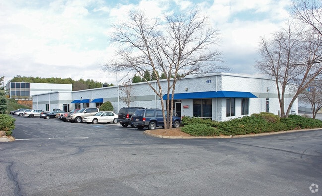


Property Detail
150 W Phillips Rd
Greenville-Anderson-Greer, SC
MAP 0530.05
0530.05-01-014.01
Greenville
Publicstorage
South Carolina
I1
014.01
B and X Area of moderate flood hazard, usually the area between the limits of the 100-year and 500-year floods.
8.48 AC
2025
Rt 14 Corridor
2025
Greenville/Spartanburg
002503
NEARBY LISTINGS FOR SALE OR LEASE
DEMOGRAPHICS near 150 W Phillips Rd
1 mile
3 mile
5 mile
2025 Total Population
975
32,915
110,385
2030 Population
1,093
35,532
119,022
Pop Growth 2025-2030
+ 12.10%
+ 7.95%
+ 7.82%
Average Age
40
41
40
2025 Total Households
367
12,591
43,066
HH Growth 2025-2030
+ 12.26%
+ 8.11%
+ 7.99%
Median Household Inc
$100,176
$112,402
$94,178
Avg Household Size
2.60
2.60
2.50
2025 Avg HH Vehicles
2.00
2.00
2.00
Median Home Value
$338,947
$436,960
$381,748
Median Year Built
2007
1998
1995
Nearby Places
Map Layers
Map Styles
 Street
 Aerial
Transit
 Traffic
 Biking
Places
Listings with unknown addresses are not visible on the map
- Restaurants
- Banks
- Shops
- Fitness
- Groceries
PUBLIC TRANSPORTATION
AIRPORT
Greenville Spartanburg International
Drive
Walk
Distance
Greenville Spartanburg International
8 min
2.0 mi
Freight Ports
North Charleston Terminal
Drive
Walk
Distance
North Charleston Terminal
231 min
203.8 mi
SALE & LEASE HISTORY
LISTING DATE
SALE/LEASE

Sep 25, 2016
For Lease
Nearby Properties
Address
Land Use
TOTAL SIZE
Lot Size
Zoning
Address
Land Use
TOTAL SIZE
Lot Size
Zoning
136.04 AC
I1
Address
Land Use
TOTAL SIZE
Lot Size
Zoning
18.55 AC
RS
Address
Land Use
TOTAL SIZE
Lot Size
Zoning
88.98 AC
RS
Address
Land Use
TOTAL SIZE
Lot Size
Zoning
20.40 AC
RS
Address
Land Use
TOTAL SIZE
Lot Size
Zoning
18.50 AC
PD
Address
Land Use
TOTAL SIZE
Lot Size
Zoning
17.53 AC
I1
Address
Land Use
TOTAL SIZE
Lot Size
Zoning
1,202 SF
14.38 AC
RS
Address
Land Use
TOTAL SIZE
Lot Size
Zoning
12.20 AC
PDC
Address
Land Use
TOTAL SIZE
Lot Size
Zoning
9.50 AC
I1
Address
Land Use
TOTAL SIZE
Lot Size
Zoning
143.57 AC
I1
Address
Land Use
TOTAL SIZE
Lot Size
Zoning
91.80 AC
PD
Address
Land Use
TOTAL SIZE
Lot Size
Zoning
86,884 SF
5.31 AC
Address
Land Use
TOTAL SIZE
Lot Size
Zoning
5.20 AC
TI1
Address
Land Use
TOTAL SIZE
Lot Size
Zoning
5.70 AC
I1
Address
Land Use
TOTAL SIZE
Lot Size
Zoning
92.74 AC
R15
Address
Land Use
TOTAL SIZE
Lot Size
Zoning
9.40 AC
RM1
Address
Land Use
TOTAL SIZE
Lot Size
Zoning
9.27 AC
I1
Address
Land Use
TOTAL SIZE
Lot Size
Zoning
4.80 AC
I1
Address
Land Use
TOTAL SIZE
Lot Size
Zoning
9.90 AC
I1
Address
Land Use
TOTAL SIZE
Lot Size
Zoning
16.50 AC
TS1
Address
Land Use
TOTAL SIZE
Lot Size
Zoning
15.90 AC
TS1
Address
Land Use
TOTAL SIZE
Lot Size
Zoning
5.80 AC
RS
Address
Land Use
TOTAL SIZE
Lot Size
Zoning
2,417 SF
115.88 AC
Address
Land Use
TOTAL SIZE
Lot Size
Zoning
29 AC
I1
Address
Land Use
TOTAL SIZE
Lot Size
Zoning
22.48 AC
I1
Address
Land Use
TOTAL SIZE
Lot Size
Zoning
2.30 AC
I1
Address
Land Use
TOTAL SIZE
Lot Size
Zoning
23.20 AC
PD
Address
Land Use
TOTAL SIZE
Lot Size
Zoning
2 AC
PD
Address
Land Use
TOTAL SIZE
Lot Size
Zoning
44.37 AC
R15
Address
Land Use
TOTAL SIZE
Lot Size
Zoning
1.70 AC
I1
The World's #1 Commercial Real Estate Marketplace
Connect with us
© 2026 CoStar Group
The information above has been obtained from sources believed reliable. While we do not doubt its accuracy we have not verified it and make no guarantee, warranty or representation about it. It is your responsibility to independently confirm its accuracy and completeness. Any projections, opinions, assumptions, or estimates used are for example only and do not represent the current or future performance of the property. The value of this transaction to you depends on tax and other factors which should be evaluated by your tax, financial, and legal advisors. You and your advisors should conduct a careful, independent investigation of the property to determine to your satisfaction the suitability of the property for your needs.