Property Record
161 Maple Ave S, Slinger, WI 53086
Property Detail
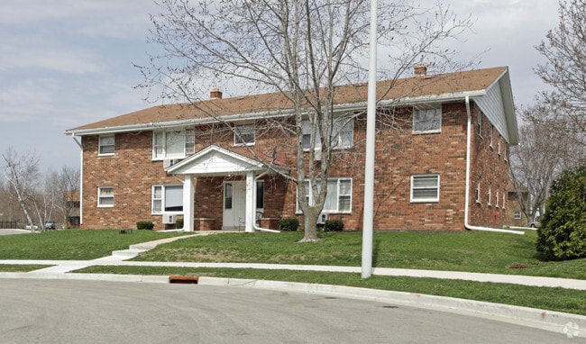
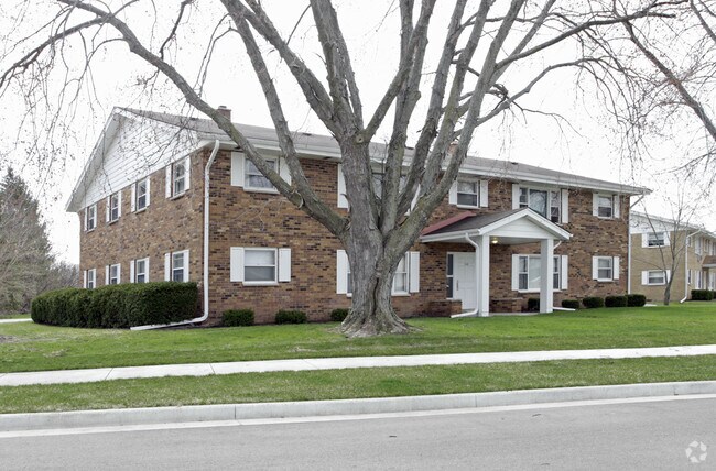
161 Maple Ave S
Milwaukee-Waukesha, WI
V SLINGER FAIRVIEW TERRACE LOT 10 EXC PT SOLD DOC 1370973 (ESMNT V824 P459)
V5-0205010
Washington
Commercialnec
Wisconsin
B and X Area of moderate flood hazard, usually the area between the limits of the 100-year and 500-year floods.
10
2025
0.62 AC
2025
Washington County
450106
Milwaukee/Madison
6,720 SF
NEARBY LISTINGS FOR SALE OR LEASE
DEMOGRAPHICS near 161 Maple Ave S
1 mile
3 mile
5 mile
2025 Total Population
3,293
11,584
30,503
2030 Population
3,313
11,840
31,195
Pop Growth 2025-2030
+ 0.61%
+ 2.21%
+ 2.27%
Average Age
41
42
43
2025 Total Households
1,382
4,531
12,487
HH Growth 2025-2030
+ 0.58%
+ 2.10%
+ 2.19%
Median Household Inc
$101,273
$106,053
$91,938
Avg Household Size
2.30
2.50
2.40
2025 Avg HH Vehicles
2.00
2.00
2.00
Median Home Value
$354,517
$405,965
$370,574
Median Year Built
1991
1993
1990
Nearby Places
Map Layers
Map Styles
 Street
 Aerial
Layers
 Traffic
 Biking
Places
Listings with unknown addresses are not visible on the map
- Restaurants
- Banks
- Shops
- Fitness
- Groceries
Nearby Properties
Address
Land Use
TOTAL SIZE
Lot Size
Zoning
Address
Land Use
TOTAL SIZE
Lot Size
Zoning
Address
Land Use
TOTAL SIZE
Lot Size
Zoning
Address
Land Use
TOTAL SIZE
Lot Size
Zoning
16.35 AC
Address
Land Use
TOTAL SIZE
Lot Size
Zoning
10,500 SF
4.83 AC
Address
Land Use
TOTAL SIZE
Lot Size
Zoning
4.74 AC
Address
Land Use
TOTAL SIZE
Lot Size
Zoning
Address
Land Use
TOTAL SIZE
Lot Size
Zoning
11,143 SF
9.23 AC
Address
Land Use
TOTAL SIZE
Lot Size
Zoning
5,335 SF
6.69 AC
Address
Land Use
TOTAL SIZE
Lot Size
Zoning
39.78 AC
Address
Land Use
TOTAL SIZE
Lot Size
Zoning
11,143 SF
6 AC
Address
Land Use
TOTAL SIZE
Lot Size
Zoning
Address
Land Use
TOTAL SIZE
Lot Size
Zoning
2.42 AC
Address
Land Use
TOTAL SIZE
Lot Size
Zoning
Address
Land Use
TOTAL SIZE
Lot Size
Zoning
Address
Land Use
TOTAL SIZE
Lot Size
Zoning
Address
Land Use
TOTAL SIZE
Lot Size
Zoning
13,506 SF
1.38 AC
Address
Land Use
TOTAL SIZE
Lot Size
Zoning
8.28 AC
Address
Land Use
TOTAL SIZE
Lot Size
Zoning
11,143 SF
1.85 AC
Address
Land Use
TOTAL SIZE
Lot Size
Zoning
6,334 SF
2.86 AC
Address
Land Use
TOTAL SIZE
Lot Size
Zoning
12,781 SF
1.68 AC
Address
Land Use
TOTAL SIZE
Lot Size
Zoning
8.20 AC
Address
Land Use
TOTAL SIZE
Lot Size
Zoning
10,870 SF
2.99 AC
Address
Land Use
TOTAL SIZE
Lot Size
Zoning
7.49 AC
Address
Land Use
TOTAL SIZE
Lot Size
Zoning
1,404 SF
8 AC
Address
Land Use
TOTAL SIZE
Lot Size
Zoning
Address
Land Use
TOTAL SIZE
Lot Size
Zoning
6,654 SF
2.91 AC
Address
Land Use
TOTAL SIZE
Lot Size
Zoning
5,335 SF
2.05 AC
Address
Land Use
TOTAL SIZE
Lot Size
Zoning
46.13 AC
Address
Land Use
TOTAL SIZE
Lot Size
Zoning
5,335 SF
4.02 AC
Address
Land Use
TOTAL SIZE
Lot Size
Zoning
The World's #1 Commercial Real Estate Marketplace
Connect with us
© 2026 CoStar Group
The information above has been obtained from sources believed reliable. While we do not doubt its accuracy we have not verified it and make no guarantee, warranty or representation about it. It is your responsibility to independently confirm its accuracy and completeness. Any projections, opinions, assumptions, or estimates used are for example only and do not represent the current or future performance of the property. The value of this transaction to you depends on tax and other factors which should be evaluated by your tax, financial, and legal advisors. You and your advisors should conduct a careful, independent investigation of the property to determine to your satisfaction the suitability of the property for your needs.