Property Record
161 Nw 97Th Ave, Miami, FL 33172


NEARBY LISTINGS FOR SALE OR LEASE
-
-
View all Miami listings for sale on LoopNet.com
Property Detail
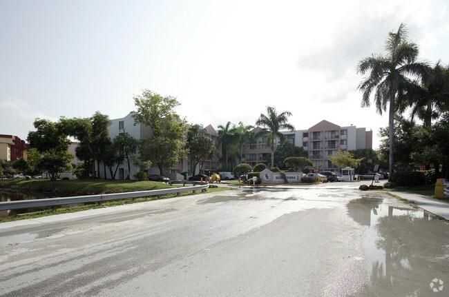
161 Nw 97Th Ave
Miami-Miami Beach-Kendall, FL
Fontainebleau Park Sub
30-4004-009-0020
FONTAINEBLEAU PARK SUB SEC 9 PB 94-35 TR 24 LESS THE FOLWG BEG MOST SWLY COR TR 24 TH NW137.83FT NWLY AD 352.48FT N 67 DEG W 45.95FT NE181.78FT SE65.81FT S 60 DEG E 604.26FT E50FT SE247.91FT SWLY AD 64.92FT S 86 DEG W 200FT SWLY AD 64.92FT W265.58FT
Multifamilydwelling
Miami/Dade
AH
Florida
12086C0288L
2
2024
5.54 AC
2025
Fontainebleau East
009028
South Florida
378,455 SF
DEMOGRAPHICS near 161 Nw 97Th Ave
1 mile
3 mile
5 mile
2024 Total Population
37,855
168,019
375,145
2029 Population
36,773
163,294
365,464
Pop Growth 2024-2029
(2.86%)
(2.81%)
(2.58%)
Average Age
43
43
43
2024 Total Households
14,069
56,363
126,530
HH Growth 2024-2029
(3.18%)
(3.22%)
(2.94%)
Median Household Inc
$55,393
$57,478
$65,001
Avg Household Size
2.60
2.80
2.80
2024 Avg HH Vehicles
2.00
2.00
2.00
Median Home Value
$261,137
$338,549
$395,612
Median Year Built
1980
1979
1979
Nearby Places
Map Layers
Map Styles
 Street
 Aerial
Transit
 Traffic
 Biking
Places
Listings with unknown addresses are not visible on the map
- Restaurants
- Banks
- Shops
- Fitness
- Groceries
PUBLIC TRANSPORTATION
COMMUTER RAIL
Palmetto (Metrorail Green Line - Miami-Dade Transit (Metrorail/Metromover))
Drive
Walk
Distance
Palmetto (Metrorail Green Line - Miami-Dade Transit (Metrorail/Metromover))
16 min
7.1 mi
Okeechobee (Metrorail Green Line - Miami-Dade Transit (Metrorail/Metromover))
Drive
Walk
Distance
Okeechobee (Metrorail Green Line - Miami-Dade Transit (Metrorail/Metromover))
18 min
9.5 mi
AIRPORT
Miami International
Drive
Walk
Distance
Miami International
16 min
6.3 mi
Fort Lauderdale/Hollywood International
Drive
Walk
Distance
Fort Lauderdale/Hollywood International
48 min
34.5 mi
Freight Ports
Port of Miami
Drive
Walk
Distance
Port of Miami
26 min
14.2 mi
Nearby Properties
Address
Land Use
TOTAL SIZE
Lot Size
Zoning
Address
Land Use
TOTAL SIZE
Lot Size
Zoning
2,512,642 SF
100.78 AC
6400
Address
Land Use
TOTAL SIZE
Lot Size
Zoning
4,384,261 SF
343.66 AC
6400
Address
Land Use
TOTAL SIZE
Lot Size
Zoning
851,502 SF
11.73 AC
6119
Address
Land Use
TOTAL SIZE
Lot Size
Zoning
784,416 SF
1.72 AC
6480
Address
Land Use
TOTAL SIZE
Lot Size
Zoning
1,680,493 SF
23.71 AC
4100
Address
Land Use
TOTAL SIZE
Lot Size
Zoning
481,242 SF
13.61 AC
6400
Address
Land Use
TOTAL SIZE
Lot Size
Zoning
465,663 SF
11.29 AC
4100
Address
Land Use
TOTAL SIZE
Lot Size
Zoning
671,088 SF
19.84 AC
6400
Address
Land Use
TOTAL SIZE
Lot Size
Zoning
448,531 SF
37 AC
6400
Address
Land Use
TOTAL SIZE
Lot Size
Zoning
608,139 SF
5.80 AC
6119
Address
Land Use
TOTAL SIZE
Lot Size
Zoning
868,154 SF
1.71 AC
6480
Address
Land Use
TOTAL SIZE
Lot Size
Zoning
612,289 SF
3.38 AC
6119
Address
Land Use
TOTAL SIZE
Lot Size
Zoning
762,624 SF
1.70 AC
6480
Address
Land Use
TOTAL SIZE
Lot Size
Zoning
145.77 AC
7700
Address
Land Use
TOTAL SIZE
Lot Size
Zoning
755,156 SF
29.44 AC
7100
Address
Land Use
TOTAL SIZE
Lot Size
Zoning
429,568 SF
7.44 AC
6400
Address
Land Use
TOTAL SIZE
Lot Size
Zoning
438,387 SF
16.20 AC
3900
Address
Land Use
TOTAL SIZE
Lot Size
Zoning
428,212 SF
17.56 AC
3900
Address
Land Use
TOTAL SIZE
Lot Size
Zoning
468,218 SF
17.06 AC
7100
Address
Land Use
TOTAL SIZE
Lot Size
Zoning
468,411 SF
21.36 AC
7100
Address
Land Use
TOTAL SIZE
Lot Size
Zoning
366,237 SF
9.24 AC
4100
Address
Land Use
TOTAL SIZE
Lot Size
Zoning
687,304 SF
3.03 AC
6119
Address
Land Use
TOTAL SIZE
Lot Size
Zoning
538,739 SF
5.05 AC
7100
Address
Land Use
TOTAL SIZE
Lot Size
Zoning
206,535 SF
7100
Address
Land Use
TOTAL SIZE
Lot Size
Zoning
476,094 SF
1.09 AC
6480
Address
Land Use
TOTAL SIZE
Lot Size
Zoning
353,267 SF
30.40 AC
6400
Address
Land Use
TOTAL SIZE
Lot Size
Zoning
667,273 SF
38.34 AC
6400
Address
Land Use
TOTAL SIZE
Lot Size
Zoning
229,154 SF
9.02 AC
3900
Address
Land Use
TOTAL SIZE
Lot Size
Zoning
540,199 SF
24.93 AC
6400
The World's #1 Commercial Real Estate Marketplace
Connect with us
© 2026 CoStar Group
The information above has been obtained from sources believed reliable. While we do not doubt its accuracy we have not verified it and make no guarantee, warranty or representation about it. It is your responsibility to independently confirm its accuracy and completeness. Any projections, opinions, assumptions, or estimates used are for example only and do not represent the current or future performance of the property. The value of this transaction to you depends on tax and other factors which should be evaluated by your tax, financial, and legal advisors. You and your advisors should conduct a careful, independent investigation of the property to determine to your satisfaction the suitability of the property for your needs.