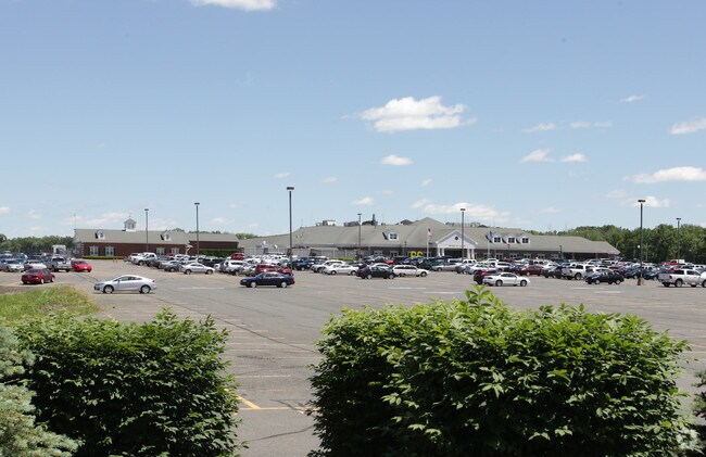
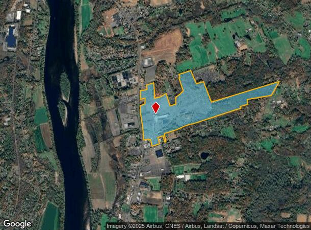
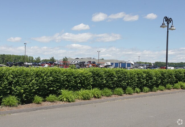
Property Record
161 S Main St, East Windsor, CT 06088
NEARBY LISTINGS FOR SALE OR LEASE
Property Detail
161 S Main St
EWIN-000032-000021-000066
Hartford
Multipleuses
Connecticut
X
66
09003C0238F
181.32 AC
2025
East Windsor
2025
Hartford
484100
Hartford-West Hartford-East Hartford, CT
34,045 SF
DEMOGRAPHICS near 161 S Main St
1 Mile
3 Mile
5 Mile
2024 Total Population
1,054
15,263
59,683
2029 Population
1,047
15,260
59,269
Pop Growth 2024-2029
(0.66%)
(0.02%)
(0.69%)
Average Age
46
44
43
2024 Total Households
484
6,526
24,380
HH Growth 2024-2029
(0.83%)
(0.09%)
(0.80%)
Median Household Inc
$68,835
$86,933
$98,561
Avg Household Size
2.10
2.30
2.40
2024 Avg HH Vehicles
2.00
2.00
2.00
Median Home Value
$203,977
$251,028
$257,393
Median Year Built
1978
1973
1970
Nearby Places
Map Layers
Map Styles
 Street
 Aerial
- Restaurants
- Banks
- Shops
- Fitness
- Groceries
PUBLIC TRANSPORTATION
COMMUTER RAIL
Windsor Locks (Hartford Line - CT Rail (CTRail))
DRIVE
WALK
Distance
Windsor Locks (Hartford Line - CT Rail (CTRail))
7 min
4.5 mi
AIRPORT
Bradley International
DRIVE
WALK
Distance
Bradley International
24 min
10.0 mi
Freight Ports
Port of New Haven
DRIVE
WALK
Distance
Port of New Haven
63 min
48.3 mi
Nearby Properties
Address
Land Use
TOTAL SIZE
Lot Size
Zoning
Address
Land Use
TOTAL SIZE
Lot Size
Zoning
492,240 SF
40.80 AC
Address
Land Use
TOTAL SIZE
Lot Size
Zoning
164,765 SF
17.40 AC
Address
Land Use
TOTAL SIZE
Lot Size
Zoning
659,693 SF
102.30 AC
I
Address
Land Use
TOTAL SIZE
Lot Size
Zoning
126,079 SF
38.72 AC
TZ5
Address
Land Use
TOTAL SIZE
Lot Size
Zoning
301,011 SF
60.83 AC
I
Address
Land Use
TOTAL SIZE
Lot Size
Zoning
177,366 SF
61.60 AC
RESA
Address
Land Use
TOTAL SIZE
Lot Size
Zoning
190,997 SF
18.47 AC
M-1
Address
Land Use
TOTAL SIZE
Lot Size
Zoning
277,552 SF
40.24 AC
M-1
Address
Land Use
TOTAL SIZE
Lot Size
Zoning
302,370 SF
16.43 AC
I
Address
Land Use
TOTAL SIZE
Lot Size
Zoning
117,699 SF
6.83 AC
MFDD
Address
Land Use
TOTAL SIZE
Lot Size
Zoning
2,867 SF
17.27 AC
R-2
Address
Land Use
TOTAL SIZE
Lot Size
Zoning
11,952 SF
25 AC
MFDD
Address
Land Use
TOTAL SIZE
Lot Size
Zoning
11.65 AC
Address
Land Use
TOTAL SIZE
Lot Size
Zoning
25.92 AC
Address
Land Use
TOTAL SIZE
Lot Size
Zoning
44,054 SF
16.87 AC
A-1
Address
Land Use
TOTAL SIZE
Lot Size
Zoning
14,295 SF
24.45 AC
R-1
Address
Land Use
TOTAL SIZE
Lot Size
Zoning
150,000 SF
22.20 AC
M-1
Address
Land Use
TOTAL SIZE
Lot Size
Zoning
52.53 AC
Address
Land Use
TOTAL SIZE
Lot Size
Zoning
168,000 SF
13.86 AC
I
Address
Land Use
TOTAL SIZE
Lot Size
Zoning
50,160 SF
4.31 AC
Address
Land Use
TOTAL SIZE
Lot Size
Zoning
112,820 SF
8.98 AC
BUS1
Address
Land Use
TOTAL SIZE
Lot Size
Zoning
129,480 SF
21.87 AC
Address
Land Use
TOTAL SIZE
Lot Size
Zoning
7,271 SF
14.43 AC
IND2
Address
Land Use
TOTAL SIZE
Lot Size
Zoning
273,865 SF
39.41 AC
M-1
Address
Land Use
TOTAL SIZE
Lot Size
Zoning
10.24 AC
Address
Land Use
TOTAL SIZE
Lot Size
Zoning
83,541 SF
16.30 AC
M-1
Address
Land Use
TOTAL SIZE
Lot Size
Zoning
130,577 SF
15.09 AC
B-1
Address
Land Use
TOTAL SIZE
Lot Size
Zoning
65,329 SF
24.13 AC
RESA
Address
Land Use
TOTAL SIZE
Lot Size
Zoning
12.96 AC
The World's #1 Commercial Real Estate Marketplace
Connect with us
© 2025 CoStar Group
The information above has been obtained from sources believed reliable. While we do not doubt its accuracy we have not verified it and make no guarantee, warranty or representation about it. It is your responsibility to independently confirm its accuracy and completeness. Any projections, opinions, assumptions, or estimates used are for example only and do not represent the current or future performance of the property. The value of this transaction to you depends on tax and other factors which should be evaluated by your tax, financial, and legal advisors. You and your advisors should conduct a careful, independent investigation of the property to determine to your satisfaction the suitability of the property for your needs.