Property Record
161 2Nd Ave, Rochelle, IL 61068


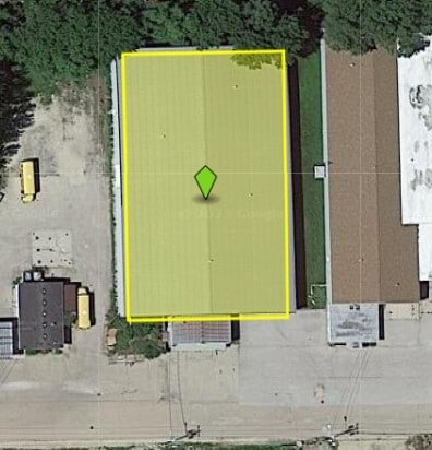
Property Detail
161 2Nd Ave
Rochelle, IL
RNG/BLK:1 TWP:40 SECT/LOT:24 BEG S LN RR 685.74FT E W LN SW4 SE4 S 271.11FT E 153.34FT N286.44FT SWLY ALG S LN RR TO BK 00-3099
24-24-458-005
OGLE
Industrialgeneral
Illinois
B and X Area of moderate flood hazard, usually the area between the limits of the 100-year and 500-year floods.
24
2024
0.98 AC
2024
I-39 Corr/Ogle Cnty
961200
Chicago
22,800 SF
NEARBY LISTINGS FOR SALE OR LEASE
DEMOGRAPHICS near 161 2Nd Ave
1 mile
3 mile
5 mile
2025 Total Population
6,718
11,153
13,585
2030 Population
6,704
11,108
13,484
Pop Growth 2025-2030
(0.21%)
(0.40%)
(0.74%)
Average Age
39
39
39
2025 Total Households
2,728
4,414
5,314
HH Growth 2025-2030
(0.29%)
(0.41%)
(0.75%)
Median Household Inc
$61,682
$69,466
$71,413
Avg Household Size
2.40
2.50
2.50
2025 Avg HH Vehicles
2.00
2.00
2.00
Median Home Value
$158,092
$171,231
$175,971
Median Year Built
1966
1970
1970
Nearby Places
Map Layers
Map Styles
 Street
 Aerial
Transit
 Traffic
 Biking
Places
Listings with unknown addresses are not visible on the map
- Restaurants
- Banks
- Shops
- Fitness
- Groceries
PUBLIC TRANSPORTATION
AIRPORT
Chicago/Rockford International
Drive
Walk
Distance
Chicago/Rockford International
34 min
20.5 mi
SALE & LEASE HISTORY
LISTING DATE
SALE/LEASE

Mar 12, 2024
For Lease
Jan 12, 2023
For Lease
Nearby Properties
Address
Land Use
TOTAL SIZE
Lot Size
Zoning
Address
Land Use
TOTAL SIZE
Lot Size
Zoning
24.14 AC
Address
Land Use
TOTAL SIZE
Lot Size
Zoning
39.59 AC
Address
Land Use
TOTAL SIZE
Lot Size
Zoning
45.20 AC
Address
Land Use
TOTAL SIZE
Lot Size
Zoning
47.91 AC
Address
Land Use
TOTAL SIZE
Lot Size
Zoning
26.63 AC
Address
Land Use
TOTAL SIZE
Lot Size
Zoning
20.21 AC
Address
Land Use
TOTAL SIZE
Lot Size
Zoning
28.48 AC
Address
Land Use
TOTAL SIZE
Lot Size
Zoning
22.16 AC
Address
Land Use
TOTAL SIZE
Lot Size
Zoning
18.14 AC
Address
Land Use
TOTAL SIZE
Lot Size
Zoning
14.66 AC
Address
Land Use
TOTAL SIZE
Lot Size
Zoning
14.33 AC
Address
Land Use
TOTAL SIZE
Lot Size
Zoning
Address
Land Use
TOTAL SIZE
Lot Size
Zoning
39,403 SF
13.64 AC
Address
Land Use
TOTAL SIZE
Lot Size
Zoning
34.90 AC
Address
Land Use
TOTAL SIZE
Lot Size
Zoning
Address
Land Use
TOTAL SIZE
Lot Size
Zoning
20,000 SF
12 AC
Address
Land Use
TOTAL SIZE
Lot Size
Zoning
14.13 AC
Address
Land Use
TOTAL SIZE
Lot Size
Zoning
25.19 AC
Address
Land Use
TOTAL SIZE
Lot Size
Zoning
55.67 AC
Address
Land Use
TOTAL SIZE
Lot Size
Zoning
20,200 SF
5.10 AC
Address
Land Use
TOTAL SIZE
Lot Size
Zoning
23.94 AC
Address
Land Use
TOTAL SIZE
Lot Size
Zoning
41.28 AC
Address
Land Use
TOTAL SIZE
Lot Size
Zoning
10,260 SF
17.06 AC
Address
Land Use
TOTAL SIZE
Lot Size
Zoning
9.55 AC
Address
Land Use
TOTAL SIZE
Lot Size
Zoning
176,200 SF
15.72 AC
Address
Land Use
TOTAL SIZE
Lot Size
Zoning
14.90 AC
Address
Land Use
TOTAL SIZE
Lot Size
Zoning
2.64 AC
Address
Land Use
TOTAL SIZE
Lot Size
Zoning
21,000 SF
4.81 AC
Address
Land Use
TOTAL SIZE
Lot Size
Zoning
55,200 SF
1.74 AC
The World's #1 Commercial Real Estate Marketplace
Connect with us
© 2026 CoStar Group
The information above has been obtained from sources believed reliable. While we do not doubt its accuracy we have not verified it and make no guarantee, warranty or representation about it. It is your responsibility to independently confirm its accuracy and completeness. Any projections, opinions, assumptions, or estimates used are for example only and do not represent the current or future performance of the property. The value of this transaction to you depends on tax and other factors which should be evaluated by your tax, financial, and legal advisors. You and your advisors should conduct a careful, independent investigation of the property to determine to your satisfaction the suitability of the property for your needs.