Property Record
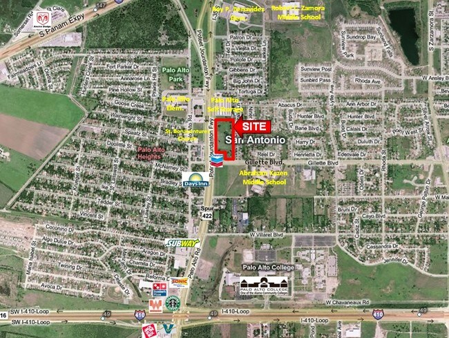
1610 Gillette Blvd, San Antonio, TX 78224

NEARBY LISTINGS FOR SALE OR LEASE
Property Detail
1610 Gillette Blvd
San Antonio-New Braunfels, TX
Conv A/S Code
11074-103-0191
NCB 11073 BLK 103 LOT 19 (IGLESIA BETHEL) 2024-MERGED PIDS 1137850/1248638 PER OWNER REQUEST CR # 59733. (KEPT PID 1248638) JF/GIS/8-24-2023
Religious
Bexar
X
Texas
48029C0560F
19
2024
13.48 AC
2025
South
151200
San Antonio
80,936 SF
DEMOGRAPHICS near 1610 Gillette Blvd
1 Mile
3 Mile
5 Mile
2024 Total Population
13,724
60,068
172,325
2029 Population
14,509
63,891
183,199
Pop Growth 2024-2029
+ 5.72%
+ 6.36%
+ 6.31%
Average Age
36
36
36
2024 Total Households
4,026
18,454
52,848
HH Growth 2024-2029
+ 5.89%
+ 6.49%
+ 6.60%
Median Household Inc
$54,771
$45,845
$44,502
Avg Household Size
3.30
3.10
3.00
2024 Avg HH Vehicles
2.00
2.00
2.00
Median Home Value
$136,794
$119,103
$120,427
Median Year Built
1990
1975
1969
Nearby Places
Map Layers
Map Styles
 Street
 Aerial
- Restaurants
- Banks
- Shops
- Fitness
- Groceries
PUBLIC TRANSPORTATION
COMMUTER RAIL
San Antonio Amtrak Station (Sunset Limited - Amtrak, Texas Eagle - Amtrak)
DRIVE
WALK
Distance
San Antonio Amtrak Station (Sunset Limited - Amtrak, Texas Eagle - Amtrak)
15 min
9.6 mi
AIRPORT
San Antonio International
DRIVE
WALK
Distance
San Antonio International
23 min
15.9 mi
Freight Ports
Port of Corpus Christi
DRIVE
WALK
Distance
Port of Corpus Christi
148 min
143.9 mi
Nearby Properties
Address
Land Use
TOTAL SIZE
Lot Size
Zoning
Address
Land Use
TOTAL SIZE
Lot Size
Zoning
548,048 SF
27.53 AC
Address
Land Use
TOTAL SIZE
Lot Size
Zoning
324,153 SF
17.31 AC
Address
Land Use
TOTAL SIZE
Lot Size
Zoning
504,337 SF
45.55 AC
Address
Land Use
TOTAL SIZE
Lot Size
Zoning
447,169 SF
46.74 AC
Address
Land Use
TOTAL SIZE
Lot Size
Zoning
71,607 SF
10.46 AC
Address
Land Use
TOTAL SIZE
Lot Size
Zoning
218,003 SF
12.33 AC
Address
Land Use
TOTAL SIZE
Lot Size
Zoning
11,553 SF
67.15 AC
Address
Land Use
TOTAL SIZE
Lot Size
Zoning
1,269.46 AC
Address
Land Use
TOTAL SIZE
Lot Size
Zoning
45,363 SF
4.29 AC
Address
Land Use
TOTAL SIZE
Lot Size
Zoning
143,067 SF
11.69 AC
Address
Land Use
TOTAL SIZE
Lot Size
Zoning
56,875 SF
10.04 AC
Address
Land Use
TOTAL SIZE
Lot Size
Zoning
526.61 AC
Address
Land Use
TOTAL SIZE
Lot Size
Zoning
188,948 SF
20.59 AC
Address
Land Use
TOTAL SIZE
Lot Size
Zoning
166,270 SF
13.95 AC
Address
Land Use
TOTAL SIZE
Lot Size
Zoning
141,606 SF
13.74 AC
Address
Land Use
TOTAL SIZE
Lot Size
Zoning
67,184 SF
60.16 AC
Address
Land Use
TOTAL SIZE
Lot Size
Zoning
47.74 AC
Address
Land Use
TOTAL SIZE
Lot Size
Zoning
73,178 SF
23.11 AC
Address
Land Use
TOTAL SIZE
Lot Size
Zoning
34,344 SF
9.79 AC
Address
Land Use
TOTAL SIZE
Lot Size
Zoning
72,868 SF
14.79 AC
Address
Land Use
TOTAL SIZE
Lot Size
Zoning
51,960 SF
8 AC
Address
Land Use
TOTAL SIZE
Lot Size
Zoning
86,352 SF
5.05 AC
Address
Land Use
TOTAL SIZE
Lot Size
Zoning
137,586 SF
13.50 AC
Address
Land Use
TOTAL SIZE
Lot Size
Zoning
262,013 SF
13.41 AC
Address
Land Use
TOTAL SIZE
Lot Size
Zoning
153,762 SF
8.34 AC
Address
Land Use
TOTAL SIZE
Lot Size
Zoning
101,660 SF
4.57 AC
Address
Land Use
TOTAL SIZE
Lot Size
Zoning
36,720 SF
7.85 AC
Address
Land Use
TOTAL SIZE
Lot Size
Zoning
39,851 SF
8.22 AC
Address
Land Use
TOTAL SIZE
Lot Size
Zoning
60,000 SF
3.99 AC
The World's #1 Commercial Real Estate Marketplace
Connect with us
© 2025 CoStar Group
The information above has been obtained from sources believed reliable. While we do not doubt its accuracy we have not verified it and make no guarantee, warranty or representation about it. It is your responsibility to independently confirm its accuracy and completeness. Any projections, opinions, assumptions, or estimates used are for example only and do not represent the current or future performance of the property. The value of this transaction to you depends on tax and other factors which should be evaluated by your tax, financial, and legal advisors. You and your advisors should conduct a careful, independent investigation of the property to determine to your satisfaction the suitability of the property for your needs.