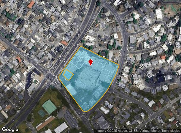
Property Record
1610 N School St, Honolulu, HI 96817


NEARBY LISTINGS FOR SALE OR LEASE
Property Detail
1610 N School St
Urban Honolulu, HI
Payless Shoe Source
1-1-6-028-056-0000
LOT 663 337,707 SF LCAPP 750, MAP 232
Commercialnec
Honolulu
X
Hawaii
15003C0354G
663
2024
7.75 AC
2025
Honolulu
004801
Hawaii
166,873 SF
DEMOGRAPHICS near 1610 N School St
1 Mile
3 Mile
5 Mile
2024 Total Population
47,966
176,017
336,349
2029 Population
45,622
171,540
330,915
Pop Growth 2024-2029
(4.89%)
(2.54%)
(1.62%)
Average Age
40
43
43
2024 Total Households
11,772
64,018
130,436
HH Growth 2024-2029
(5.66%)
(2.64%)
(1.53%)
Median Household Inc
$79,181
$76,008
$74,667
Avg Household Size
3.50
2.50
2.40
2024 Avg HH Vehicles
2.00
1.00
1.00
Median Home Value
$784,309
$724,207
$741,931
Median Year Built
1965
1974
1974
Nearby Places
Map Layers
Map Styles
 Street
 Aerial
- Restaurants
- Banks
- Shops
- Fitness
- Groceries
PUBLIC TRANSPORTATION
AIRPORT
Daniel K Inouye International
DRIVE
WALK
Distance
Daniel K Inouye International
9 min
4.3 mi
Freight Ports
Honolulu Harbor, Oahu
DRIVE
WALK
Distance
Honolulu Harbor, Oahu
11 min
4.6 mi
SALE & LEASE HISTORY
LISTING DATE
SALE/LEASE

Jun 28, 2022
For Lease
Jun 13, 2022
For Sale
Aug 16, 2017
For Lease
Nearby Properties
Address
Land Use
TOTAL SIZE
Lot Size
Zoning
Address
Land Use
TOTAL SIZE
Lot Size
Zoning
1,675.63 AC
C/61/60
Address
Land Use
TOTAL SIZE
Lot Size
Zoning
355.21 AC
U/63/80 -
Address
Land Use
TOTAL SIZE
Lot Size
Zoning
55.93 AC
WI
Address
Land Use
TOTAL SIZE
Lot Size
Zoning
1,153,381 SF
425.42 AC
R-5
Address
Land Use
TOTAL SIZE
Lot Size
Zoning
45.65 AC
Kak
Address
Land Use
TOTAL SIZE
Lot Size
Zoning
254,832 SF
2.92 AC
BMX-4
Address
Land Use
TOTAL SIZE
Lot Size
Zoning
12,430 SF
86.69 AC
P-1
Address
Land Use
TOTAL SIZE
Lot Size
Zoning
9,272 SF
141.38 AC
P-2
Address
Land Use
TOTAL SIZE
Lot Size
Zoning
163,285 SF
15.08 AC
R-7.5
Address
Land Use
TOTAL SIZE
Lot Size
Zoning
446,464 SF
9.90 AC
Kak
Address
Land Use
TOTAL SIZE
Lot Size
Zoning
919,972 SF
14.45 AC
I-2
Address
Land Use
TOTAL SIZE
Lot Size
Zoning
14.38 AC
Kak
Address
Land Use
TOTAL SIZE
Lot Size
Zoning
936,400 SF
6.88 AC
Kak
Address
Land Use
TOTAL SIZE
Lot Size
Zoning
386,846 SF
8.76 AC
A-1
Address
Land Use
TOTAL SIZE
Lot Size
Zoning
960 SF
71.97 AC
P-2
Address
Land Use
TOTAL SIZE
Lot Size
Zoning
158,215 SF
1.83 AC
BMX-4
Address
Land Use
TOTAL SIZE
Lot Size
Zoning
204,596 SF
0.12 AC
BMX-4
Address
Land Use
TOTAL SIZE
Lot Size
Zoning
253,254 SF
10.73 AC
Kak
Address
Land Use
TOTAL SIZE
Lot Size
Zoning
16.46 AC
I-2
Address
Land Use
TOTAL SIZE
Lot Size
Zoning
49,330 SF
50 AC
I-3
Address
Land Use
TOTAL SIZE
Lot Size
Zoning
10.84 AC
B-2
Address
Land Use
TOTAL SIZE
Lot Size
Zoning
13.77 AC
U/34/30
Address
Land Use
TOTAL SIZE
Lot Size
Zoning
40.76 AC
P-1
Address
Land Use
TOTAL SIZE
Lot Size
Zoning
4.70 AC
BMX-3
Address
Land Use
TOTAL SIZE
Lot Size
Zoning
415,924 SF
0.12 AC
BMX-4
Address
Land Use
TOTAL SIZE
Lot Size
Zoning
10.26 AC
B-2
Address
Land Use
TOTAL SIZE
Lot Size
Zoning
187,487 SF
0.46 AC
BMX-3
Address
Land Use
TOTAL SIZE
Lot Size
Zoning
10.98 AC
P-2
Address
Land Use
TOTAL SIZE
Lot Size
Zoning
116,230 SF
1.42 AC
BMX-4
The World's #1 Commercial Real Estate Marketplace
Connect with us
© 2025 CoStar Group
The information above has been obtained from sources believed reliable. While we do not doubt its accuracy we have not verified it and make no guarantee, warranty or representation about it. It is your responsibility to independently confirm its accuracy and completeness. Any projections, opinions, assumptions, or estimates used are for example only and do not represent the current or future performance of the property. The value of this transaction to you depends on tax and other factors which should be evaluated by your tax, financial, and legal advisors. You and your advisors should conduct a careful, independent investigation of the property to determine to your satisfaction the suitability of the property for your needs.