Property Record
16100 W Mcnichols Rd, Detroit, MI 48235

NEARBY LISTINGS FOR SALE OR LEASE
Property Detail
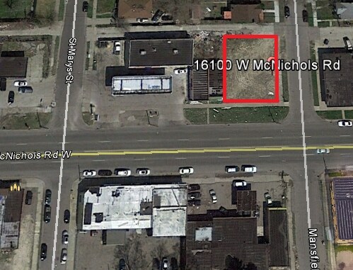
16100 W Mcnichols Rd
22-0139435
Manhattan City Park
Commercialacreage
N--W MC NICHOLS 7 THRU 9 RUGBY BLVD ADD SUB L54 P37 PLATS, W C R 22/299 69.5 X 90
X
Wayne
26163C0100E
Michigan
2025
0.14 AC
2025
Detroit W of Woodward
540400
Detroit
4,504 SF
Detroit-Warren-Dearborn, MI
DEMOGRAPHICS near 16100 W Mcnichols Rd
1 Mile
3 Mile
5 Mile
2024 Total Population
20,649
158,407
392,273
2029 Population
19,998
155,234
387,381
Pop Growth 2024-2029
(3.15%)
(2.00%)
(1.25%)
Average Age
40
39
39
2024 Total Households
8,172
61,689
157,554
HH Growth 2024-2029
(3.24%)
(2.09%)
(1.26%)
Median Household Inc
$36,659
$39,786
$42,578
Avg Household Size
2.50
2.50
2.40
2024 Avg HH Vehicles
1.00
1.00
1.00
Median Home Value
$84,304
$84,714
$103,514
Median Year Built
1951
1950
1951
Nearby Places
Map Layers
Map Styles
 Street
 Aerial
- Restaurants
- Banks
- Shops
- Fitness
- Groceries
PUBLIC TRANSPORTATION
COMMUTER RAIL
DRIVE
WALK
Distance
16 min
8.8 mi
DRIVE
WALK
Distance
15 min
9.1 mi
AIRPORT
Detroit Metro Wayne County
DRIVE
WALK
Distance
Detroit Metro Wayne County
35 min
21.8 mi
Windsor International
DRIVE
WALK
Distance
Windsor International
42 min
22.0 mi
SALE & LEASE HISTORY
LISTING DATE
SALE/LEASE

Nov 10, 2016
For Sale
Nearby Properties
Address
Land Use
TOTAL SIZE
Lot Size
Zoning
Address
Land Use
TOTAL SIZE
Lot Size
Zoning
925,367 SF
12.82 AC
R6
Address
Land Use
TOTAL SIZE
Lot Size
Zoning
1,211,148 SF
69.13 AC
M4
Address
Land Use
TOTAL SIZE
Lot Size
Zoning
300,830 SF
54 AC
LI
Address
Land Use
TOTAL SIZE
Lot Size
Zoning
97.05 AC
RS
Address
Land Use
TOTAL SIZE
Lot Size
Zoning
133,544 SF
19.65 AC
ERO
Address
Land Use
TOTAL SIZE
Lot Size
Zoning
273,000 SF
17.31 AC
LI
Address
Land Use
TOTAL SIZE
Lot Size
Zoning
202,736 SF
20 AC
PD
Address
Land Use
TOTAL SIZE
Lot Size
Zoning
200 SF
12.69 AC
RM
Address
Land Use
TOTAL SIZE
Lot Size
Zoning
11.11 AC
RS
Address
Land Use
TOTAL SIZE
Lot Size
Zoning
10.32 AC
LI
Address
Land Use
TOTAL SIZE
Lot Size
Zoning
143,700 SF
3.27 AC
PD
Address
Land Use
TOTAL SIZE
Lot Size
Zoning
163,661 SF
8.92 AC
PD
Address
Land Use
TOTAL SIZE
Lot Size
Zoning
165,829 SF
5.56 AC
R5
Address
Land Use
TOTAL SIZE
Lot Size
Zoning
93,329 SF
2.07 AC
ERO
Address
Land Use
TOTAL SIZE
Lot Size
Zoning
14.10 AC
RS
Address
Land Use
TOTAL SIZE
Lot Size
Zoning
54,672 SF
1.37 AC
R6
Address
Land Use
TOTAL SIZE
Lot Size
Zoning
104,567 SF
2.14 AC
PD
Address
Land Use
TOTAL SIZE
Lot Size
Zoning
116,790 SF
5.86 AC
R4
Address
Land Use
TOTAL SIZE
Lot Size
Zoning
90,958 SF
11.78 AC
R5
Address
Land Use
TOTAL SIZE
Lot Size
Zoning
Address
Land Use
TOTAL SIZE
Lot Size
Zoning
Address
Land Use
TOTAL SIZE
Lot Size
Zoning
63,216 SF
2.87 AC
R5
Address
Land Use
TOTAL SIZE
Lot Size
Zoning
66,870 SF
2.77 AC
Address
Land Use
TOTAL SIZE
Lot Size
Zoning
100,373 SF
5.65 AC
R4
Address
Land Use
TOTAL SIZE
Lot Size
Zoning
107,914 SF
6.41 AC
B-2
Address
Land Use
TOTAL SIZE
Lot Size
Zoning
315,973 SF
12.18 AC
M4
Address
Land Use
TOTAL SIZE
Lot Size
Zoning
81,031 SF
8.15 AC
PD
Address
Land Use
TOTAL SIZE
Lot Size
Zoning
127,680 SF
3.90 AC
ERO
Address
Land Use
TOTAL SIZE
Lot Size
Zoning
64,566 SF
3.64 AC
PD
Address
Land Use
TOTAL SIZE
Lot Size
Zoning
128,759 SF
8.85 AC
LI
The World's #1 Commercial Real Estate Marketplace
Connect with us
© 2026 CoStar Group
The information above has been obtained from sources believed reliable. While we do not doubt its accuracy we have not verified it and make no guarantee, warranty or representation about it. It is your responsibility to independently confirm its accuracy and completeness. Any projections, opinions, assumptions, or estimates used are for example only and do not represent the current or future performance of the property. The value of this transaction to you depends on tax and other factors which should be evaluated by your tax, financial, and legal advisors. You and your advisors should conduct a careful, independent investigation of the property to determine to your satisfaction the suitability of the property for your needs.