Property Record
16101 Weber Rd, Crest Hill, IL 60403


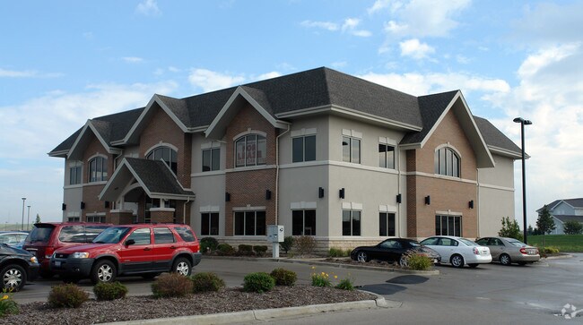
Property Detail
16101 Weber Rd
Chicago-Naperville-Elgin, IL-IN
LOT 1 IN CRESTLAKE COMMERCIAL SUB, BEING A SUB OF PRT OF THE NW1/4 OF SEC 20, T36N-R10E.
11-04-20-105-014
Will
Commercialnec
Illinois
B and X Area of moderate flood hazard, usually the area between the limits of the 100-year and 500-year floods.
1
2025
1.38 AC
2024
Joliet/Central Will
884103
Chicago
NEARBY LISTINGS FOR SALE OR LEASE
-
-
-
-
No Photo
-
View all Crest Hill listings for sale on LoopNet.com
DEMOGRAPHICS near 16101 Weber Rd
1 mile
3 mile
5 mile
2025 Total Population
6,686
55,445
181,066
2030 Population
6,785
55,860
183,025
Pop Growth 2025-2030
+ 1.48%
+ 0.75%
+ 1.08%
Average Age
51
41
40
2025 Total Households
3,107
18,962
65,304
HH Growth 2025-2030
+ 1.71%
+ 0.94%
+ 1.15%
Median Household Inc
$83,790
$93,296
$86,743
Avg Household Size
2.10
2.70
2.60
2025 Avg HH Vehicles
2.00
2.00
2.00
Median Home Value
$281,187
$268,473
$265,266
Median Year Built
2005
1998
1985
Nearby Places
Map Layers
Map Styles
 Street
 Aerial
Layers
 Traffic
 Biking
Places
Listings with unknown addresses are not visible on the map
- Restaurants
- Banks
- Shops
- Fitness
- Groceries
PUBLIC TRANSPORTATION
COMMUTER RAIL
Lockport Station (Heritage Corridor Line - Northeast Illinois Regional Commuter Railroad (Metra))
Drive
Walk
Distance
Lockport Station (Heritage Corridor Line - Northeast Illinois Regional Commuter Railroad (Metra))
10 min
4.1 mi
Joliet Station (Heritage Corridor Line - Northeast Illinois Regional Commuter Railroad (Metra), Rock Island District Line - Northeast Illinois Regional Commuter Railroad (Metra))
Drive
Walk
Distance
Joliet Station (Heritage Corridor Line - Northeast Illinois Regional Commuter Railroad (Metra), Rock Island District Line - Northeast Illinois Regional Commuter Railroad (Metra))
15 min
6.3 mi
AIRPORT
Chicago Midway International
Drive
Walk
Distance
Chicago Midway International
39 min
26.8 mi
Chicago O'Hare International
Drive
Walk
Distance
Chicago O'Hare International
56 min
38.2 mi
Nearby Properties
Address
Land Use
TOTAL SIZE
Lot Size
Zoning
Address
Land Use
TOTAL SIZE
Lot Size
Zoning
21.76 AC
Address
Land Use
TOTAL SIZE
Lot Size
Zoning
59.76 AC
Address
Land Use
TOTAL SIZE
Lot Size
Zoning
Address
Land Use
TOTAL SIZE
Lot Size
Zoning
48.28 AC
Address
Land Use
TOTAL SIZE
Lot Size
Zoning
32.49 AC
Address
Land Use
TOTAL SIZE
Lot Size
Zoning
62.35 AC
Address
Land Use
TOTAL SIZE
Lot Size
Zoning
37.47 AC
Address
Land Use
TOTAL SIZE
Lot Size
Zoning
46.85 AC
Address
Land Use
TOTAL SIZE
Lot Size
Zoning
39.75 AC
Address
Land Use
TOTAL SIZE
Lot Size
Zoning
50.08 AC
Address
Land Use
TOTAL SIZE
Lot Size
Zoning
54.90 AC
Address
Land Use
TOTAL SIZE
Lot Size
Zoning
Address
Land Use
TOTAL SIZE
Lot Size
Zoning
33.95 AC
Address
Land Use
TOTAL SIZE
Lot Size
Zoning
26.25 AC
Address
Land Use
TOTAL SIZE
Lot Size
Zoning
10.47 AC
Address
Land Use
TOTAL SIZE
Lot Size
Zoning
24.14 AC
Address
Land Use
TOTAL SIZE
Lot Size
Zoning
21.96 AC
Address
Land Use
TOTAL SIZE
Lot Size
Zoning
25.13 AC
Address
Land Use
TOTAL SIZE
Lot Size
Zoning
22.13 AC
Address
Land Use
TOTAL SIZE
Lot Size
Zoning
7.72 AC
Address
Land Use
TOTAL SIZE
Lot Size
Zoning
28.08 AC
Address
Land Use
TOTAL SIZE
Lot Size
Zoning
23.12 AC
Address
Land Use
TOTAL SIZE
Lot Size
Zoning
28.72 AC
Address
Land Use
TOTAL SIZE
Lot Size
Zoning
Address
Land Use
TOTAL SIZE
Lot Size
Zoning
20.50 AC
Address
Land Use
TOTAL SIZE
Lot Size
Zoning
26.02 AC
Address
Land Use
TOTAL SIZE
Lot Size
Zoning
22.44 AC
Address
Land Use
TOTAL SIZE
Lot Size
Zoning
26.31 AC
Address
Land Use
TOTAL SIZE
Lot Size
Zoning
18.76 AC
Address
Land Use
TOTAL SIZE
Lot Size
Zoning
The World's #1 Commercial Real Estate Marketplace
Connect with us
© 2026 CoStar Group
The information above has been obtained from sources believed reliable. While we do not doubt its accuracy we have not verified it and make no guarantee, warranty or representation about it. It is your responsibility to independently confirm its accuracy and completeness. Any projections, opinions, assumptions, or estimates used are for example only and do not represent the current or future performance of the property. The value of this transaction to you depends on tax and other factors which should be evaluated by your tax, financial, and legal advisors. You and your advisors should conduct a careful, independent investigation of the property to determine to your satisfaction the suitability of the property for your needs.