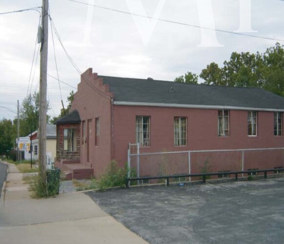
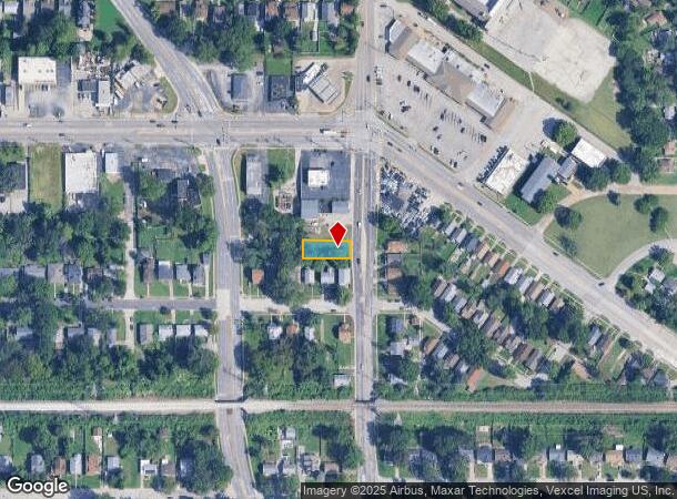
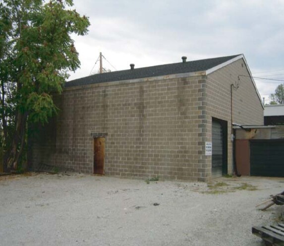
Property Record
1611 N Hanley Rd, Saint Louis, MO 63130
NEARBY LISTINGS FOR SALE OR LEASE
Property Detail
1611 N Hanley Rd
St. Louis, MO-IL
Meridian
16J-14-1552
MERIDIAN LOT PTS 11 & 12
Vacantlandnec
St. Louis
X
Missouri
29189C0212K
11,12
2024
0.15 AC
2025
Innerbelt E of 170
215901
St. Louis
DEMOGRAPHICS near 1611 N Hanley Rd
1 Mile
3 Mile
5 Mile
2024 Total Population
10,952
121,048
299,630
2029 Population
10,858
120,469
296,308
Pop Growth 2024-2029
(0.86%)
(0.48%)
(1.11%)
Average Age
41
39
39
2024 Total Households
4,741
50,837
132,317
HH Growth 2024-2029
(0.95%)
(0.46%)
(1.28%)
Median Household Inc
$45,831
$53,434
$51,890
Avg Household Size
2.20
2.20
2.10
2024 Avg HH Vehicles
1.00
1.00
1.00
Median Home Value
$94,999
$174,032
$168,771
Median Year Built
1951
1952
1952
Nearby Places
Map Layers
Map Styles
 Street
 Aerial
- Restaurants
- Banks
- Shops
- Fitness
- Groceries
PUBLIC TRANSPORTATION
COMMUTER RAIL
Wellston (Lambert Airport Shiloh-Scott - St. Louis MetroLink (MetroLink))
DRIVE
WALK
Distance
Wellston (Lambert Airport Shiloh-Scott - St. Louis MetroLink (MetroLink))
6 min
2.3 mi
University City-Big Bend (Shrewsbury-Lansdowne I-44 Emerson Park - St. Louis MetroLink (MetroLink))
DRIVE
WALK
Distance
University City-Big Bend (Shrewsbury-Lansdowne I-44 Emerson Park - St. Louis MetroLink (MetroLink))
5 min
2.6 mi
AIRPORT
St Louis Lambert International
DRIVE
WALK
Distance
St Louis Lambert International
11 min
6.2 mi
Scott AFB/Midamerica St Louis
DRIVE
WALK
Distance
Scott AFB/Midamerica St Louis
54 min
36.0 mi
Nearby Properties
Address
Land Use
TOTAL SIZE
Lot Size
Zoning
Address
Land Use
TOTAL SIZE
Lot Size
Zoning
684,846 SF
90.65 AC
R6
Address
Land Use
TOTAL SIZE
Lot Size
Zoning
558,158 SF
45.66 AC
14R-2
Address
Land Use
TOTAL SIZE
Lot Size
Zoning
1,053,686 SF
31.40 AC
43M-1
Address
Land Use
TOTAL SIZE
Lot Size
Zoning
5,898 SF
21.62 AC
R2
Address
Land Use
TOTAL SIZE
Lot Size
Zoning
72,612 SF
118.34 AC
3INSTU
Address
Land Use
TOTAL SIZE
Lot Size
Zoning
516,414 SF
2.61 AC
14C-2
Address
Land Use
TOTAL SIZE
Lot Size
Zoning
361,357 SF
2.99 AC
14HDC
Address
Land Use
TOTAL SIZE
Lot Size
Zoning
238,035 SF
3.23 AC
14HDC
Address
Land Use
TOTAL SIZE
Lot Size
Zoning
5,551 SF
0.72 AC
14HDC
Address
Land Use
TOTAL SIZE
Lot Size
Zoning
501,837 SF
21.52 AC
14PUD
Address
Land Use
TOTAL SIZE
Lot Size
Zoning
390,010 SF
13.25 AC
R6
Address
Land Use
TOTAL SIZE
Lot Size
Zoning
361,605 SF
1.75 AC
14HDC
Address
Land Use
TOTAL SIZE
Lot Size
Zoning
385,676 SF
3.04 AC
C4
Address
Land Use
TOTAL SIZE
Lot Size
Zoning
7,780 SF
15.61 AC
14R-2
Address
Land Use
TOTAL SIZE
Lot Size
Zoning
354,868 SF
2.04 AC
14HDC
Address
Land Use
TOTAL SIZE
Lot Size
Zoning
272,933 SF
0.82 AC
14PUD
Address
Land Use
TOTAL SIZE
Lot Size
Zoning
311,264 SF
1.40 AC
14HDC
Address
Land Use
TOTAL SIZE
Lot Size
Zoning
476,403 SF
1.40 AC
14HDC
Address
Land Use
TOTAL SIZE
Lot Size
Zoning
277,568 SF
0.68 AC
14HDC
Address
Land Use
TOTAL SIZE
Lot Size
Zoning
330,896 SF
2.68 AC
14HDC
Address
Land Use
TOTAL SIZE
Lot Size
Zoning
272,940 SF
0.87 AC
14PUD
Address
Land Use
TOTAL SIZE
Lot Size
Zoning
1.33 AC
C4
Address
Land Use
TOTAL SIZE
Lot Size
Zoning
33,004 SF
1.53 AC
14HDC
Address
Land Use
TOTAL SIZE
Lot Size
Zoning
183,908 SF
1.08 AC
14HDC
Address
Land Use
TOTAL SIZE
Lot Size
Zoning
262,446 SF
1.97 AC
14S-1
Address
Land Use
TOTAL SIZE
Lot Size
Zoning
17,239 SF
51.14 AC
R2
Address
Land Use
TOTAL SIZE
Lot Size
Zoning
281,259 SF
0.50 AC
14HDC
Address
Land Use
TOTAL SIZE
Lot Size
Zoning
235,785 SF
1.95 AC
C4
Address
Land Use
TOTAL SIZE
Lot Size
Zoning
233,748 SF
0.67 AC
14PUD
Address
Land Use
TOTAL SIZE
Lot Size
Zoning
15.27 AC
A
The World's #1 Commercial Real Estate Marketplace
Connect with us
© 2025 CoStar Group
The information above has been obtained from sources believed reliable. While we do not doubt its accuracy we have not verified it and make no guarantee, warranty or representation about it. It is your responsibility to independently confirm its accuracy and completeness. Any projections, opinions, assumptions, or estimates used are for example only and do not represent the current or future performance of the property. The value of this transaction to you depends on tax and other factors which should be evaluated by your tax, financial, and legal advisors. You and your advisors should conduct a careful, independent investigation of the property to determine to your satisfaction the suitability of the property for your needs.