Property Record
1611 W Ballard Rd, Spokane, WA 99208

NEARBY LISTINGS FOR SALE OR LEASE
-
-
View all Spokane listings for sale on LoopNet.com
Property Detail
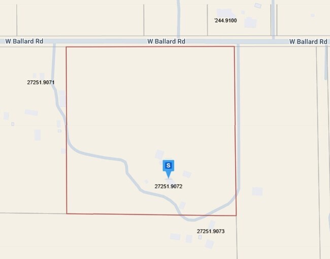
1611 W Ballard Rd
27251.9072
25-27-42, THE N 940.78 FT OF THE W 1/2 OF THE E 1/2 OF NE 1/4 TOGETHER W/ THE N 940.78 FT OF W 1/2 OF NE 1/4 LYG E OF LN DAF; BEG AT NW COR OF NE 1/4 OF SD SEC; TH S89*2206E, 1008.68 FT TO TRUE POB; TH S00*3017E, 940.78 FT & TERMINUS OF THIS LN DESC,
Agriculturalland
Spokane
X
Washington
53063C0360D
20.36 AC
2025
NW North Metro
2025
Spokane
010508
Spokane-Spokane Valley, WA
2,576 SF
DEMOGRAPHICS near 1611 W Ballard Rd
1 mile
3 mile
5 mile
2024 Total Population
306
12,911
44,614
2029 Population
323
13,569
46,921
Pop Growth 2024-2029
+ 5.56%
+ 5.10%
+ 5.17%
Average Age
44
40
41
2024 Total Households
108
4,554
15,787
HH Growth 2024-2029
+ 5.56%
+ 5.18%
+ 5.34%
Median Household Inc
$142,856
$97,256
$89,757
Avg Household Size
2.90
2.80
2.70
2024 Avg HH Vehicles
3.00
2.00
2.00
Median Home Value
$673,611
$449,108
$431,027
Median Year Built
2001
2001
1992
Nearby Places
Map Layers
Map Styles
 Street
 Aerial
Transit
 Traffic
 Biking
Places
Listings with unknown addresses are not visible on the map
- Restaurants
- Banks
- Shops
- Fitness
- Groceries
PUBLIC TRANSPORTATION
AIRPORT
Spokane International
Drive
Walk
Distance
Spokane International
39 min
19.1 mi
Freight Ports
Port of Everett
Drive
Walk
Distance
Port of Everett
366 min
314.7 mi
Nearby Properties
Address
Land Use
TOTAL SIZE
Lot Size
Zoning
Address
Land Use
TOTAL SIZE
Lot Size
Zoning
78,497 SF
9.19 AC
MU
Address
Land Use
TOTAL SIZE
Lot Size
Zoning
215,573 SF
11.30 AC
HDR
Address
Land Use
TOTAL SIZE
Lot Size
Zoning
172,525 SF
8.18 AC
HDR
Address
Land Use
TOTAL SIZE
Lot Size
Zoning
116,772 SF
8.56 AC
MU
Address
Land Use
TOTAL SIZE
Lot Size
Zoning
121,519 SF
6.26 AC
HDR
Address
Land Use
TOTAL SIZE
Lot Size
Zoning
67,763 SF
13.12 AC
LDR
Address
Land Use
TOTAL SIZE
Lot Size
Zoning
10,924 SF
61.48 AC
RT
Address
Land Use
TOTAL SIZE
Lot Size
Zoning
12,352 SF
10 AC
RT
Address
Land Use
TOTAL SIZE
Lot Size
Zoning
8,300 SF
18.35 AC
LDR
Address
Land Use
TOTAL SIZE
Lot Size
Zoning
10,746 SF
5.02 AC
RCV
Address
Land Use
TOTAL SIZE
Lot Size
Zoning
9,898 SF
5.04 AC
RT
Address
Land Use
TOTAL SIZE
Lot Size
Zoning
20,174 SF
20.48 AC
RCV
Address
Land Use
TOTAL SIZE
Lot Size
Zoning
23,714 SF
4.04 AC
LDR
Address
Land Use
TOTAL SIZE
Lot Size
Zoning
20,269 SF
112.58 AC
LDR
Address
Land Use
TOTAL SIZE
Lot Size
Zoning
28,383 SF
11.80 AC
RCV
Address
Land Use
TOTAL SIZE
Lot Size
Zoning
10,799 SF
9.34 AC
RT
Address
Land Use
TOTAL SIZE
Lot Size
Zoning
641,852 SF
24.47 AC
Address
Land Use
TOTAL SIZE
Lot Size
Zoning
10,410 SF
4.93 AC
RT
Address
Land Use
TOTAL SIZE
Lot Size
Zoning
14,825 SF
40 AC
RCV
Address
Land Use
TOTAL SIZE
Lot Size
Zoning
12,472 SF
7.78 AC
RCV
Address
Land Use
TOTAL SIZE
Lot Size
Zoning
8,122 SF
16.50 AC
RCV
Address
Land Use
TOTAL SIZE
Lot Size
Zoning
10,700 SF
2.82 AC
RCV
Address
Land Use
TOTAL SIZE
Lot Size
Zoning
8,445 SF
24.89 AC
RT
Address
Land Use
TOTAL SIZE
Lot Size
Zoning
9,201 SF
10 AC
RCV
Address
Land Use
TOTAL SIZE
Lot Size
Zoning
9,336 SF
5.42 AC
RCV
Address
Land Use
TOTAL SIZE
Lot Size
Zoning
9,729 SF
40 AC
RT
Address
Land Use
TOTAL SIZE
Lot Size
Zoning
9,798 SF
2.89 AC
UR
Address
Land Use
TOTAL SIZE
Lot Size
Zoning
5,057 SF
1.15 AC
RCV
Address
Land Use
TOTAL SIZE
Lot Size
Zoning
11,824 SF
3.68 AC
LDR
Address
Land Use
TOTAL SIZE
Lot Size
Zoning
12,830 SF
3.74 AC
RCV
The World's #1 Commercial Real Estate Marketplace
Connect with us
© 2026 CoStar Group
The information above has been obtained from sources believed reliable. While we do not doubt its accuracy we have not verified it and make no guarantee, warranty or representation about it. It is your responsibility to independently confirm its accuracy and completeness. Any projections, opinions, assumptions, or estimates used are for example only and do not represent the current or future performance of the property. The value of this transaction to you depends on tax and other factors which should be evaluated by your tax, financial, and legal advisors. You and your advisors should conduct a careful, independent investigation of the property to determine to your satisfaction the suitability of the property for your needs.