Property Record
16124 Rosecrans Ave, La Mirada, CA 90638
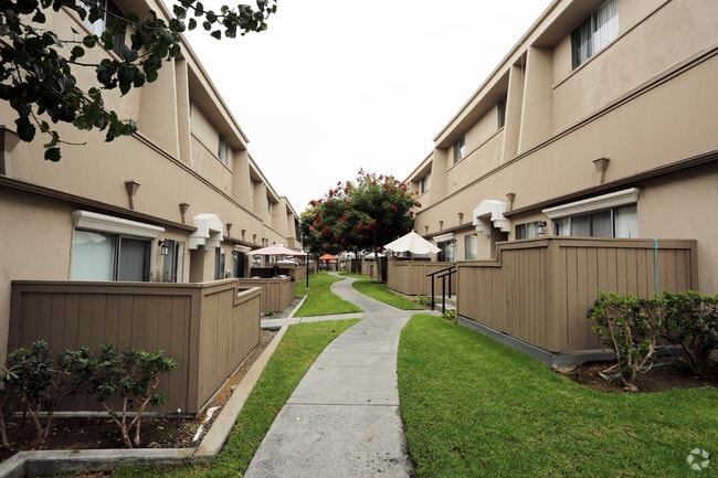


Property Detail
16124 Rosecrans Ave
8064-001-043
TRACT NO 29105 LOTS 1, 2, 3, 4, 5, 6, 7, 8, 9, 10, 11 AND LOT 12
Multifamilydwelling
Los Angeles
LCR3*
California
B and X Area of moderate flood hazard, usually the area between the limits of the 100-year and 500-year floods.
1
2025
5.05 AC
2025
La Mirada
503801
Los Angeles
162,110 SF
Los Angeles-Long Beach-Glendale, CA
NEARBY LISTINGS FOR SALE OR LEASE
DEMOGRAPHICS near 16124 Rosecrans Ave
1 mile
3 mile
5 mile
2025 Total Population
19,362
180,751
539,283
2030 Population
19,121
179,453
535,755
Pop Growth 2025-2030
(1.24%)
(0.72%)
(0.65%)
Average Age
44
41
40
2025 Total Households
6,564
56,785
165,588
HH Growth 2025-2030
(1.49%)
(0.96%)
(0.86%)
Median Household Inc
$105,361
$107,264
$102,419
Avg Household Size
2.90
3.10
3.10
2025 Avg HH Vehicles
2.00
2.00
2.00
Median Home Value
$811,431
$794,300
$787,243
Median Year Built
1971
1967
1965
Nearby Places
Map Layers
Map Styles
 Street
 Aerial
Layers
 Traffic
 Biking
Places
Listings with unknown addresses are not visible on the map
- Restaurants
- Banks
- Shops
- Fitness
- Groceries
PUBLIC TRANSPORTATION
COMMUTER RAIL
Buena Park (91 Line - Southern California Regional Rail Authority (Metrolink), Orange County Line - Southern California Regional Rail Authority (Metrolink))
Drive
Walk
Distance
Buena Park (91 Line - Southern California Regional Rail Authority (Metrolink), Orange County Line - Southern California Regional Rail Authority (Metrolink))
3 min
2.0 mi
Fullerton (91 Line - Southern California Regional Rail Authority (Metrolink), Orange County Line - Southern California Regional Rail Authority (Metrolink))
Drive
Walk
Distance
Fullerton (91 Line - Southern California Regional Rail Authority (Metrolink), Orange County Line - Southern California Regional Rail Authority (Metrolink))
11 min
5.6 mi
AIRPORT
Long Beach (Daugherty Field)
Drive
Walk
Distance
Long Beach (Daugherty Field)
26 min
16.3 mi
John Wayne/Orange County
Drive
Walk
Distance
John Wayne/Orange County
26 min
20.9 mi
Los Angeles International
Drive
Walk
Distance
Los Angeles International
36 min
26.6 mi
Freight Ports
Port of Long Beach
Drive
Walk
Distance
Port of Long Beach
32 min
21.9 mi
Nearby Properties
Address
Land Use
TOTAL SIZE
Lot Size
Zoning
Address
Land Use
TOTAL SIZE
Lot Size
Zoning
150,561 SF
65.24 AC
LMPUD
Address
Land Use
TOTAL SIZE
Lot Size
Zoning
476,442 SF
22.77 AC
Address
Land Use
TOTAL SIZE
Lot Size
Zoning
437,823 SF
19.27 AC
LMM2*
Address
Land Use
TOTAL SIZE
Lot Size
Zoning
564,705 SF
14.35 AC
LCA25*
Address
Land Use
TOTAL SIZE
Lot Size
Zoning
10.49 AC
Address
Land Use
TOTAL SIZE
Lot Size
Zoning
12.50 AC
Address
Land Use
TOTAL SIZE
Lot Size
Zoning
281,238 SF
14.83 AC
Address
Land Use
TOTAL SIZE
Lot Size
Zoning
225,016 SF
9.95 AC
LMM2*
Address
Land Use
TOTAL SIZE
Lot Size
Zoning
13.75 AC
Address
Land Use
TOTAL SIZE
Lot Size
Zoning
5.90 AC
Address
Land Use
TOTAL SIZE
Lot Size
Zoning
26.92 AC
Address
Land Use
TOTAL SIZE
Lot Size
Zoning
345,200 SF
8.51 AC
LMM2
Address
Land Use
TOTAL SIZE
Lot Size
Zoning
140,973 SF
10.03 AC
Address
Land Use
TOTAL SIZE
Lot Size
Zoning
128,481 SF
19.42 AC
LMR1*
Address
Land Use
TOTAL SIZE
Lot Size
Zoning
277,756 SF
10.47 AC
LMM2*
Address
Land Use
TOTAL SIZE
Lot Size
Zoning
24.80 AC
Address
Land Use
TOTAL SIZE
Lot Size
Zoning
249,572 SF
11.76 AC
LMM2*
Address
Land Use
TOTAL SIZE
Lot Size
Zoning
237,944 SF
12.09 AC
LMM2*
Address
Land Use
TOTAL SIZE
Lot Size
Zoning
444,784 SF
18.92 AC
SSM2*
Address
Land Use
TOTAL SIZE
Lot Size
Zoning
19.26 AC
Address
Land Use
TOTAL SIZE
Lot Size
Zoning
140,212 SF
6.65 AC
LMM2*
Address
Land Use
TOTAL SIZE
Lot Size
Zoning
10.49 AC
Address
Land Use
TOTAL SIZE
Lot Size
Zoning
178,140 SF
10.88 AC
Address
Land Use
TOTAL SIZE
Lot Size
Zoning
1,102,724 SF
25.93 AC
LMM2*
Address
Land Use
TOTAL SIZE
Lot Size
Zoning
118,906 SF
8.32 AC
CEM
Address
Land Use
TOTAL SIZE
Lot Size
Zoning
13.88 AC
Address
Land Use
TOTAL SIZE
Lot Size
Zoning
Address
Land Use
TOTAL SIZE
Lot Size
Zoning
15.11 AC
Address
Land Use
TOTAL SIZE
Lot Size
Zoning
Address
Land Use
TOTAL SIZE
Lot Size
Zoning
964 SF
8.83 AC
The World's #1 Commercial Real Estate Marketplace
Connect with us
© 2026 CoStar Group
The information above has been obtained from sources believed reliable. While we do not doubt its accuracy we have not verified it and make no guarantee, warranty or representation about it. It is your responsibility to independently confirm its accuracy and completeness. Any projections, opinions, assumptions, or estimates used are for example only and do not represent the current or future performance of the property. The value of this transaction to you depends on tax and other factors which should be evaluated by your tax, financial, and legal advisors. You and your advisors should conduct a careful, independent investigation of the property to determine to your satisfaction the suitability of the property for your needs.