Property Record
1613 132Nd Ave E, Sumner, WA 98390
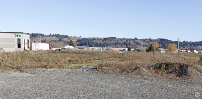
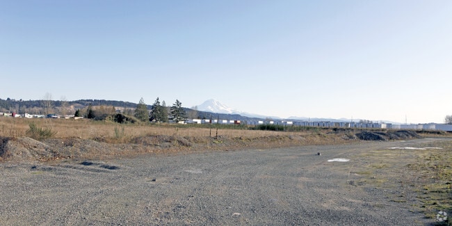
Property Detail
1613 132Nd Ave E
Seattle-Tacoma-Bellevue, WA
SECTION 11 TOWNSHIP 20 RANGE 04 QUARTER 11 HILLMANS C D PACIFIC CITY DIV # 4 L 15 B 68 EXC POR CYD TO CY OF SUMNER FOR R/W PER ETN 4327244 EASE OF RECORD DC00354477 6/10/14 BB
449540-1282
Pierce
Warehouse
Washington
M1
15
B and X Area of moderate flood hazard, usually the area between the limits of the 100-year and 500-year floods.
1.79 AC
2024
Tacoma Suburban
2025
Seattle/Puget Sound
073301
NEARBY LISTINGS FOR SALE OR LEASE
-
-
-
No Photo
-
-
-
-
-
View all Sumner listings for sale on LoopNet.com
DEMOGRAPHICS near 1613 132Nd Ave E
1 mile
3 mile
5 mile
2025 Total Population
1,296
61,186
165,786
2030 Population
1,327
62,855
169,890
Pop Growth 2025-2030
+ 2.39%
+ 2.73%
+ 2.48%
Average Age
43
39
39
2025 Total Households
485
22,071
60,767
HH Growth 2025-2030
+ 2.27%
+ 2.69%
+ 2.42%
Median Household Inc
$127,232
$109,191
$100,569
Avg Household Size
2.70
2.70
2.70
2025 Avg HH Vehicles
3.00
2.00
2.00
Median Home Value
$721,246
$627,399
$590,334
Median Year Built
1978
1993
1988
Nearby Places
Map Layers
Map Styles
 Street
 Aerial
Transit
 Traffic
 Biking
Places
Listings with unknown addresses are not visible on the map
- Restaurants
- Banks
- Shops
- Fitness
- Groceries
PUBLIC TRANSPORTATION
COMMUTER RAIL
Tacoma Dome Station (Sounder South Line - Central Puget Sound Regional Transit Authority Rail (Link Light Rail/Sounder), Tacoma Link - Central Puget Sound Regional Transit Authority Rail (Link Light Rail/Sounder))
Drive
Walk
Distance
Tacoma Dome Station (Sounder South Line - Central Puget Sound Regional Transit Authority Rail (Link Light Rail/Sounder), Tacoma Link - Central Puget Sound Regional Transit Authority Rail (Link Light Rail/Sounder))
19 min
9.9 mi
AIRPORT
Seattle-Tacoma International
Drive
Walk
Distance
Seattle-Tacoma International
31 min
17.8 mi
Freight Ports
Port of Tacoma
Drive
Walk
Distance
Port of Tacoma
19 min
10.1 mi
Nearby Properties
Address
Land Use
TOTAL SIZE
Lot Size
Zoning
Address
Land Use
TOTAL SIZE
Lot Size
Zoning
524,636 SF
102.29 AC
M2
Address
Land Use
TOTAL SIZE
Lot Size
Zoning
833,773 SF
94.01 AC
M1
Address
Land Use
TOTAL SIZE
Lot Size
Zoning
63,950 SF
127.86 AC
C3
Address
Land Use
TOTAL SIZE
Lot Size
Zoning
321,680 SF
31.59 AC
RM
Address
Land Use
TOTAL SIZE
Lot Size
Zoning
648,679 SF
27.43 AC
M1
Address
Land Use
TOTAL SIZE
Lot Size
Zoning
258,297 SF
16.13 AC
BP
Address
Land Use
TOTAL SIZE
Lot Size
Zoning
Address
Land Use
TOTAL SIZE
Lot Size
Zoning
501,104 SF
21.73 AC
Address
Land Use
TOTAL SIZE
Lot Size
Zoning
506,925 SF
24.22 AC
M1
Address
Land Use
TOTAL SIZE
Lot Size
Zoning
521,674 SF
24.55 AC
M1
Address
Land Use
TOTAL SIZE
Lot Size
Zoning
255,871 SF
11.17 AC
EDGWD
Address
Land Use
TOTAL SIZE
Lot Size
Zoning
208,900 SF
8.72 AC
EDGWD
Address
Land Use
TOTAL SIZE
Lot Size
Zoning
492,124 SF
21.54 AC
M1
Address
Land Use
TOTAL SIZE
Lot Size
Zoning
441,316 SF
20.26 AC
Address
Land Use
TOTAL SIZE
Lot Size
Zoning
251,498 SF
13.79 AC
LAKELAND H
Address
Land Use
TOTAL SIZE
Lot Size
Zoning
476,362 SF
26.61 AC
Address
Land Use
TOTAL SIZE
Lot Size
Zoning
503,526 SF
16.52 AC
M1
Address
Land Use
TOTAL SIZE
Lot Size
Zoning
215,619 SF
21.57 AC
TV
Address
Land Use
TOTAL SIZE
Lot Size
Zoning
430,880 SF
23.46 AC
M1
Address
Land Use
TOTAL SIZE
Lot Size
Zoning
428,056 SF
17.45 AC
M1
Address
Land Use
TOTAL SIZE
Lot Size
Zoning
204,727 SF
18.63 AC
TV
Address
Land Use
TOTAL SIZE
Lot Size
Zoning
401,076 SF
16.77 AC
M1
Address
Land Use
TOTAL SIZE
Lot Size
Zoning
385,468 SF
18.22 AC
M1
Address
Land Use
TOTAL SIZE
Lot Size
Zoning
427,253 SF
18.46 AC
M1
Address
Land Use
TOTAL SIZE
Lot Size
Zoning
278,038 SF
12.91 AC
M-1
Address
Land Use
TOTAL SIZE
Lot Size
Zoning
382,800 SF
19.15 AC
M1
Address
Land Use
TOTAL SIZE
Lot Size
Zoning
370,087 SF
15.61 AC
M1
Address
Land Use
TOTAL SIZE
Lot Size
Zoning
350,075 SF
16.66 AC
M1
The World's #1 Commercial Real Estate Marketplace
Connect with us
© 2026 CoStar Group
The information above has been obtained from sources believed reliable. While we do not doubt its accuracy we have not verified it and make no guarantee, warranty or representation about it. It is your responsibility to independently confirm its accuracy and completeness. Any projections, opinions, assumptions, or estimates used are for example only and do not represent the current or future performance of the property. The value of this transaction to you depends on tax and other factors which should be evaluated by your tax, financial, and legal advisors. You and your advisors should conduct a careful, independent investigation of the property to determine to your satisfaction the suitability of the property for your needs.