Property Record
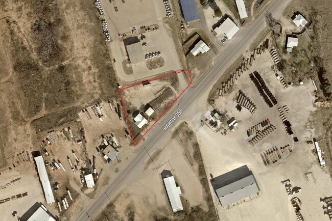
1613 E Highway 350, Big Spring, TX 79720


Property Detail
1613 E Highway 350
293501
NW/CORNER NE/4 OF SC 32 BK 32 1N 010 ACQ 081408 BLK/TRACT 32 1N 0.95 ACRES
Commercialnec
HOWARD
B and X Area of moderate flood hazard, usually the area between the limits of the 100-year and 500-year floods.
Texas
2025
0.95 AC
2025
Texas West Area
950100
Other Market Areas
2,308 SF
Big Spring, TX
NEARBY LISTINGS FOR SALE OR LEASE
DEMOGRAPHICS near 1613 E Highway 350
1 mile
3 mile
5 mile
2025 Total Population
444
8,388
21,142
2030 Population
437
8,225
20,654
Pop Growth 2025-2030
(1.58%)
(1.94%)
(2.31%)
Average Age
42
38
39
2025 Total Households
176
3,108
8,097
HH Growth 2025-2030
(0.57%)
(0.87%)
(1.70%)
Median Household Inc
$59,999
$68,123
$69,727
Avg Household Size
2.30
2.60
2.50
2025 Avg HH Vehicles
2.00
2.00
2.00
Median Home Value
$128,688
$116,818
$142,521
Median Year Built
1972
1962
1964
Nearby Places
Map Layers
Map Styles
 Street
 Aerial
Transit
 Traffic
 Biking
Places
Listings with unknown addresses are not visible on the map
- Restaurants
- Banks
- Shops
- Fitness
- Groceries
SALE & LEASE HISTORY
LISTING DATE
SALE/LEASE

Apr 17, 2024
For Sale
Nearby Properties
Address
Land Use
TOTAL SIZE
Lot Size
Zoning
Address
Land Use
TOTAL SIZE
Lot Size
Zoning
249,191 SF
13 AC
Address
Land Use
TOTAL SIZE
Lot Size
Zoning
99.22 AC
Address
Land Use
TOTAL SIZE
Lot Size
Zoning
225,060 SF
34 AC
Address
Land Use
TOTAL SIZE
Lot Size
Zoning
159,485 SF
7.80 AC
Address
Land Use
TOTAL SIZE
Lot Size
Zoning
393,167 SF
5 AC
Address
Land Use
TOTAL SIZE
Lot Size
Zoning
89,840 SF
2.11 AC
Address
Land Use
TOTAL SIZE
Lot Size
Zoning
95,564 SF
57.84 AC
Address
Land Use
TOTAL SIZE
Lot Size
Zoning
150,539 SF
3.21 AC
Address
Land Use
TOTAL SIZE
Lot Size
Zoning
27,449 SF
2 AC
Address
Land Use
TOTAL SIZE
Lot Size
Zoning
47,705 SF
1.86 AC
Address
Land Use
TOTAL SIZE
Lot Size
Zoning
182,409 SF
14.28 AC
Address
Land Use
TOTAL SIZE
Lot Size
Zoning
95,454 SF
0.32 AC
Address
Land Use
TOTAL SIZE
Lot Size
Zoning
75,540 SF
1.03 AC
Address
Land Use
TOTAL SIZE
Lot Size
Zoning
420,191 SF
11.11 AC
Address
Land Use
TOTAL SIZE
Lot Size
Zoning
84,709 SF
0.96 AC
Address
Land Use
TOTAL SIZE
Lot Size
Zoning
393,341 SF
19.26 AC
Address
Land Use
TOTAL SIZE
Lot Size
Zoning
126,990 SF
5.16 AC
Address
Land Use
TOTAL SIZE
Lot Size
Zoning
52,448 SF
1.92 AC
Address
Land Use
TOTAL SIZE
Lot Size
Zoning
11,687 SF
1.96 AC
Address
Land Use
TOTAL SIZE
Lot Size
Zoning
120,530 SF
5.41 AC
Address
Land Use
TOTAL SIZE
Lot Size
Zoning
102,592 SF
1.57 AC
Address
Land Use
TOTAL SIZE
Lot Size
Zoning
189,264 SF
1.57 AC
Address
Land Use
TOTAL SIZE
Lot Size
Zoning
52,000 SF
0.96 AC
Address
Land Use
TOTAL SIZE
Lot Size
Zoning
73,368 SF
1.31 AC
Address
Land Use
TOTAL SIZE
Lot Size
Zoning
56,000 SF
2.07 AC
Address
Land Use
TOTAL SIZE
Lot Size
Zoning
62,665 SF
3.30 AC
Address
Land Use
TOTAL SIZE
Lot Size
Zoning
64,985 SF
3.22 AC
Address
Land Use
TOTAL SIZE
Lot Size
Zoning
31,650 SF
0.96 AC
Address
Land Use
TOTAL SIZE
Lot Size
Zoning
24,980 SF
6.67 AC
Address
Land Use
TOTAL SIZE
Lot Size
Zoning
2,046 SF
34 AC
The World's #1 Commercial Real Estate Marketplace
Connect with us
© 2026 CoStar Group
The information above has been obtained from sources believed reliable. While we do not doubt its accuracy we have not verified it and make no guarantee, warranty or representation about it. It is your responsibility to independently confirm its accuracy and completeness. Any projections, opinions, assumptions, or estimates used are for example only and do not represent the current or future performance of the property. The value of this transaction to you depends on tax and other factors which should be evaluated by your tax, financial, and legal advisors. You and your advisors should conduct a careful, independent investigation of the property to determine to your satisfaction the suitability of the property for your needs.