Property Record
1614 E 63Rd St, Kansas City, MO 64110
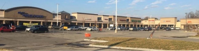


Property Detail
1614 E 63Rd St
Kansas City, MO-KS
BLUE HILLS CENTRE-TRACT 1 LOT A
47-120-20-02-00-0-00-000
JACKSON
Regionalshoppingcenterormallwithanchorstore
Missouri
B and X Area of moderate flood hazard, usually the area between the limits of the 100-year and 500-year floods.
a
2024
9.07 AC
2025
Kansas City MO
008000
Kansas City
100,375 SF
NEARBY LISTINGS FOR SALE OR LEASE
DEMOGRAPHICS near 1614 E 63Rd St
1 mile
3 mile
5 mile
2025 Total Population
14,274
104,288
246,109
2030 Population
14,580
106,673
252,848
Pop Growth 2025-2030
+ 2.14%
+ 2.29%
+ 2.74%
Average Age
39
39
39
2025 Total Households
6,081
47,291
112,993
HH Growth 2025-2030
+ 2.09%
+ 2.32%
+ 2.77%
Median Household Inc
$56,903
$70,104
$66,800
Avg Household Size
2.20
2.10
2.10
2025 Avg HH Vehicles
2.00
2.00
2.00
Median Home Value
$226,914
$283,934
$282,865
Median Year Built
1948
1949
1955
Nearby Places
Map Layers
Map Styles
 Street
 Aerial
Layers
 Traffic
 Biking
Places
Listings with unknown addresses are not visible on the map
- Restaurants
- Banks
- Shops
- Fitness
- Groceries
PUBLIC TRANSPORTATION
COMMUTER RAIL
Kansas City (Lincoln Service Missouri River Runner - Amtrak, Missouri River Runner - Amtrak, Southwest Chief - Amtrak)
Drive
Walk
Distance
Kansas City (Lincoln Service Missouri River Runner - Amtrak, Missouri River Runner - Amtrak, Southwest Chief - Amtrak)
13 min
6.1 mi
AIRPORT
Kansas City International
Drive
Walk
Distance
Kansas City International
39 min
27.6 mi
Freight Ports
Tulsa Port Of Catoosa
Drive
Walk
Distance
Tulsa Port Of Catoosa
265 min
232.7 mi
SALE & LEASE HISTORY
LISTING DATE
SALE/LEASE

Sep 25, 2016
For Lease
Dec 19, 2018
For Lease
Dec 14, 2017
For Lease
Nearby Properties
Address
Land Use
TOTAL SIZE
Lot Size
Zoning
Address
Land Use
TOTAL SIZE
Lot Size
Zoning
105,247 SF
0.72 AC
Address
Land Use
TOTAL SIZE
Lot Size
Zoning
543,241 SF
8.39 AC
Address
Land Use
TOTAL SIZE
Lot Size
Zoning
626,244 SF
16.41 AC
Address
Land Use
TOTAL SIZE
Lot Size
Zoning
129,265 SF
1.17 AC
Address
Land Use
TOTAL SIZE
Lot Size
Zoning
109,563 SF
0.98 AC
Address
Land Use
TOTAL SIZE
Lot Size
Zoning
149,157 SF
0.02 AC
URD
Address
Land Use
TOTAL SIZE
Lot Size
Zoning
251,409 SF
3.39 AC
Address
Land Use
TOTAL SIZE
Lot Size
Zoning
379,472 SF
Address
Land Use
TOTAL SIZE
Lot Size
Zoning
168,438 SF
3.13 AC
C-O
Address
Land Use
TOTAL SIZE
Lot Size
Zoning
369,624 SF
7.50 AC
Address
Land Use
TOTAL SIZE
Lot Size
Zoning
64,964 SF
0.85 AC
Address
Land Use
TOTAL SIZE
Lot Size
Zoning
193,643 SF
20.63 AC
Address
Land Use
TOTAL SIZE
Lot Size
Zoning
70,449 SF
0.66 AC
Address
Land Use
TOTAL SIZE
Lot Size
Zoning
174,983 SF
10.43 AC
Address
Land Use
TOTAL SIZE
Lot Size
Zoning
68,134 SF
5.24 AC
C-O
Address
Land Use
TOTAL SIZE
Lot Size
Zoning
153,946 SF
5.91 AC
Address
Land Use
TOTAL SIZE
Lot Size
Zoning
50,684 SF
0.07 AC
Address
Land Use
TOTAL SIZE
Lot Size
Zoning
785,016 SF
23.73 AC
Address
Land Use
TOTAL SIZE
Lot Size
Zoning
136,963 SF
2.05 AC
Address
Land Use
TOTAL SIZE
Lot Size
Zoning
213,914 SF
3.60 AC
Address
Land Use
TOTAL SIZE
Lot Size
Zoning
481,764 SF
26.50 AC
Address
Land Use
TOTAL SIZE
Lot Size
Zoning
205,182 SF
3.09 AC
Address
Land Use
TOTAL SIZE
Lot Size
Zoning
273,418 SF
1.97 AC
Address
Land Use
TOTAL SIZE
Lot Size
Zoning
82,299 SF
1.07 AC
Address
Land Use
TOTAL SIZE
Lot Size
Zoning
151,831 SF
12.93 AC
Address
Land Use
TOTAL SIZE
Lot Size
Zoning
283,616 SF
1.86 AC
Address
Land Use
TOTAL SIZE
Lot Size
Zoning
90,456 SF
0.81 AC
Address
Land Use
TOTAL SIZE
Lot Size
Zoning
59,590 SF
2.19 AC
Address
Land Use
TOTAL SIZE
Lot Size
Zoning
176,703 SF
1.43 AC
Address
Land Use
TOTAL SIZE
Lot Size
Zoning
57,972 SF
0.67 AC
The World's #1 Commercial Real Estate Marketplace
Connect with us
© 2026 CoStar Group
The information above has been obtained from sources believed reliable. While we do not doubt its accuracy we have not verified it and make no guarantee, warranty or representation about it. It is your responsibility to independently confirm its accuracy and completeness. Any projections, opinions, assumptions, or estimates used are for example only and do not represent the current or future performance of the property. The value of this transaction to you depends on tax and other factors which should be evaluated by your tax, financial, and legal advisors. You and your advisors should conduct a careful, independent investigation of the property to determine to your satisfaction the suitability of the property for your needs.