Property Record
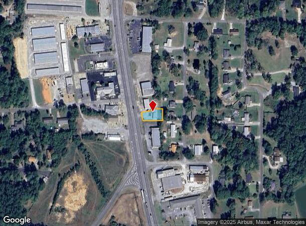
1615 Highway 77 Rd, Gadsden, AL 35907


NEARBY LISTINGS FOR SALE OR LEASE
Property Detail
1615 Highway 77 Rd
21-03-05-0-001-118.002
Has Been Add
Autorepair
H/S BASE YEAR - COM AT INT OF N ROW OF JORDAN DR & E ROW OF HWY 77 TH NW 226.58 ALONG E ROW OF HWY 77 TO POB TH NW 55S ALONG
X
Etowah
01055C0342E
Alabama
2025
0.21 AC
2025
Etowah County
010503
Birmingham
1,920 SF
Gadsden, AL
DEMOGRAPHICS near 1615 Highway 77 Rd
1 Mile
3 Mile
5 Mile
2024 Total Population
2,082
14,174
27,758
2029 Population
2,040
13,995
27,488
Pop Growth 2024-2029
(2.02%)
(1.26%)
(0.97%)
Average Age
43
42
42
2024 Total Households
834
5,839
11,357
HH Growth 2024-2029
(2.04%)
(1.30%)
(0.99%)
Median Household Inc
$68,749
$57,657
$56,422
Avg Household Size
2.50
2.40
2.40
2024 Avg HH Vehicles
2.00
2.00
2.00
Median Home Value
$177,777
$191,105
$183,926
Median Year Built
1984
1981
1979
Nearby Places
Map Layers
Map Styles
 Street
 Aerial
- Restaurants
- Banks
- Shops
- Fitness
- Groceries
Nearby Properties
Address
Land Use
TOTAL SIZE
Lot Size
Zoning
Address
Land Use
TOTAL SIZE
Lot Size
Zoning
117,758 SF
1.07 AC
Address
Land Use
TOTAL SIZE
Lot Size
Zoning
27,149 SF
2.33 AC
Address
Land Use
TOTAL SIZE
Lot Size
Zoning
40,805 SF
30.10 AC
Address
Land Use
TOTAL SIZE
Lot Size
Zoning
49,964 SF
10.36 AC
Address
Land Use
TOTAL SIZE
Lot Size
Zoning
8,288 SF
10 AC
Address
Land Use
TOTAL SIZE
Lot Size
Zoning
102,908 SF
15.90 AC
Address
Land Use
TOTAL SIZE
Lot Size
Zoning
71,320 SF
16 AC
Address
Land Use
TOTAL SIZE
Lot Size
Zoning
13,464 SF
11 AC
Address
Land Use
TOTAL SIZE
Lot Size
Zoning
43,550 SF
1.15 AC
Address
Land Use
TOTAL SIZE
Lot Size
Zoning
19,081 SF
0.60 AC
Address
Land Use
TOTAL SIZE
Lot Size
Zoning
38,983 SF
5.12 AC
Address
Land Use
TOTAL SIZE
Lot Size
Zoning
9,028 SF
8.30 AC
Address
Land Use
TOTAL SIZE
Lot Size
Zoning
8,672 SF
4.90 AC
Address
Land Use
TOTAL SIZE
Lot Size
Zoning
5,920 SF
8 AC
Address
Land Use
TOTAL SIZE
Lot Size
Zoning
82,699 SF
4.26 AC
Address
Land Use
TOTAL SIZE
Lot Size
Zoning
47,502 SF
9.60 AC
Address
Land Use
TOTAL SIZE
Lot Size
Zoning
26,956 SF
0.93 AC
Address
Land Use
TOTAL SIZE
Lot Size
Zoning
16,334 SF
8.50 AC
Address
Land Use
TOTAL SIZE
Lot Size
Zoning
Address
Land Use
TOTAL SIZE
Lot Size
Zoning
28,089 SF
8.90 AC
Address
Land Use
TOTAL SIZE
Lot Size
Zoning
55,564 SF
1.10 AC
Address
Land Use
TOTAL SIZE
Lot Size
Zoning
8,766 SF
2.90 AC
Address
Land Use
TOTAL SIZE
Lot Size
Zoning
24,096 SF
1.10 AC
Address
Land Use
TOTAL SIZE
Lot Size
Zoning
5,277 SF
2.83 AC
Address
Land Use
TOTAL SIZE
Lot Size
Zoning
57,252 SF
2.42 AC
Address
Land Use
TOTAL SIZE
Lot Size
Zoning
7,968 SF
4.88 AC
Address
Land Use
TOTAL SIZE
Lot Size
Zoning
25,002 SF
3.24 AC
Address
Land Use
TOTAL SIZE
Lot Size
Zoning
23,625 SF
8 AC
Address
Land Use
TOTAL SIZE
Lot Size
Zoning
1,920 SF
2.39 AC
Address
Land Use
TOTAL SIZE
Lot Size
Zoning
18,091 SF
3.68 AC
The World's #1 Commercial Real Estate Marketplace
Connect with us
© 2025 CoStar Group
The information above has been obtained from sources believed reliable. While we do not doubt its accuracy we have not verified it and make no guarantee, warranty or representation about it. It is your responsibility to independently confirm its accuracy and completeness. Any projections, opinions, assumptions, or estimates used are for example only and do not represent the current or future performance of the property. The value of this transaction to you depends on tax and other factors which should be evaluated by your tax, financial, and legal advisors. You and your advisors should conduct a careful, independent investigation of the property to determine to your satisfaction the suitability of the property for your needs.