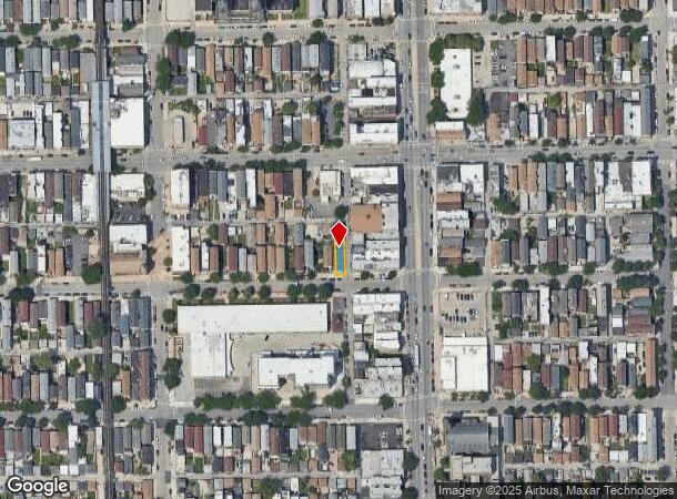
Property Record
1616 W 18Th Pl, Chicago, IL 60608
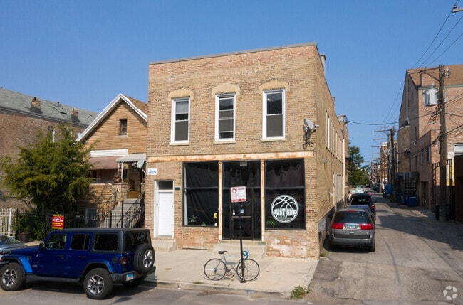
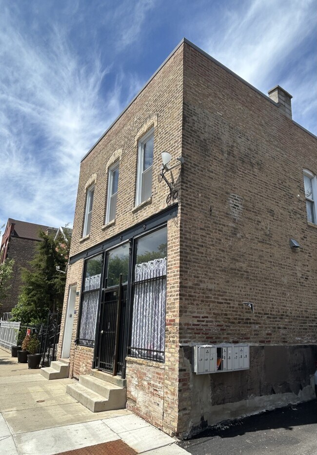
This Property Is For Sale
Current Lease Availabilities
NEARBY LISTINGS FOR SALE OR LEASE
Property Detail
1616 W 18Th Pl
Chicago-Naperville-Elgin, IL-IN-WI
Walkers Sub
17-19-411-036-0000
H H (WALKERS) SUB OF BLKS33-34,47 & PT BLK48 IN S F S MITHS SUB OF SEC 19-39-14
Multifamilydwelling
Cook
X
Illinois
17031C0506J
47
2023
0.72 AC
2024
Lower West Side
310800
Chicago
6,250 SF
DEMOGRAPHICS near 1616 W 18Th Pl
1 Mile
3 Mile
5 Mile
2024 Total Population
34,597
368,645
915,130
2029 Population
32,355
353,279
874,649
Pop Growth 2024-2029
(6.48%)
(4.17%)
(4.42%)
Average Age
36
36
37
2024 Total Households
14,445
164,287
404,080
HH Growth 2024-2029
(6.69%)
(3.79%)
(3.90%)
Median Household Inc
$59,911
$82,555
$79,567
Avg Household Size
2.30
2.10
2.20
2024 Avg HH Vehicles
1.00
1.00
1.00
Median Home Value
$328,853
$393,315
$398,478
Median Year Built
1948
1975
1965
Nearby Places
- Restaurants
- Banks
- Shops
- Fitness
- Groceries
PUBLIC TRANSPORTATION
TRANSIT/SUBWAY
18Th Street Station (Pink Line - Chicago Transit Authority "L" Trains (The "L"))
DRIVE
WALK
Distance
18Th Street Station (Pink Line - Chicago Transit Authority "L" Trains (The "L"))
0 min
4 min
0.2 mi
Damen Station (Pink Line) (Pink Line - Chicago Transit Authority "L" Trains (The "L"))
DRIVE
WALK
Distance
Damen Station (Pink Line) (Pink Line - Chicago Transit Authority "L" Trains (The "L"))
2 min
15 min
0.8 mi
COMMUTER RAIL
Western Avenue Station (Bnsf) (Burlington Northern-Santa Fe Railway Line - Northeast Illinois Regional Commuter Railroad (Metra))
DRIVE
WALK
Distance
Western Avenue Station (Bnsf) (Burlington Northern-Santa Fe Railway Line - Northeast Illinois Regional Commuter Railroad (Metra))
2 min
1.0 mi
Halsted Station (Burlington Northern-Santa Fe Railway Line - Northeast Illinois Regional Commuter Railroad (Metra))
DRIVE
WALK
Distance
Halsted Station (Burlington Northern-Santa Fe Railway Line - Northeast Illinois Regional Commuter Railroad (Metra))
3 min
1.3 mi
AIRPORT
Chicago Midway International
DRIVE
WALK
Distance
Chicago Midway International
14 min
7.8 mi
Chicago O'Hare International
DRIVE
WALK
Distance
Chicago O'Hare International
30 min
18.7 mi
Freight Ports
Port Milwaukee
DRIVE
WALK
Distance
Port Milwaukee
108 min
86.9 mi
Nearby Properties
Address
Land Use
TOTAL SIZE
Lot Size
Zoning
Address
Land Use
TOTAL SIZE
Lot Size
Zoning
4,667,723 SF
2.94 AC
DC-16
Address
Land Use
TOTAL SIZE
Lot Size
Zoning
1,546,909 SF
0.98 AC
PD 1369
Address
Land Use
TOTAL SIZE
Lot Size
Zoning
1,362,475 SF
1.97 AC
PD 1226
Address
Land Use
TOTAL SIZE
Lot Size
Zoning
1,396,750 SF
4.09 AC
PD 98
Address
Land Use
TOTAL SIZE
Lot Size
Zoning
1,810,145 SF
1.03 AC
PD 365
Address
Land Use
TOTAL SIZE
Lot Size
Zoning
3,090,691 SF
3.30 AC
PD 377,PD
Address
Land Use
TOTAL SIZE
Lot Size
Zoning
0.82 AC
PD 1115
Address
Land Use
TOTAL SIZE
Lot Size
Zoning
0.88 AC
DC-16,PD 9
Address
Land Use
TOTAL SIZE
Lot Size
Zoning
2,750,656 SF
6.29 AC
PD 1065
Address
Land Use
TOTAL SIZE
Lot Size
Zoning
1,888,207 SF
2.03 AC
PD 264
Address
Land Use
TOTAL SIZE
Lot Size
Zoning
1,496,448 SF
2 AC
PD 376
Address
Land Use
TOTAL SIZE
Lot Size
Zoning
2,429,909 SF
2.93 AC
PD 882
Address
Land Use
TOTAL SIZE
Lot Size
Zoning
2,456,900 SF
0.96 AC
PD 256
Address
Land Use
TOTAL SIZE
Lot Size
Zoning
2,612,517 SF
1.28 AC
PD 256
Address
Land Use
TOTAL SIZE
Lot Size
Zoning
4,296,046 SF
6.15 AC
DC-16
Address
Land Use
TOTAL SIZE
Lot Size
Zoning
1,215,367 SF
3.76 AC
PD 675
Address
Land Use
TOTAL SIZE
Lot Size
Zoning
3,914,400 SF
5.70 AC
DC-16
Address
Land Use
TOTAL SIZE
Lot Size
Zoning
1,559,966 SF
1.38 AC
DC-12
Address
Land Use
TOTAL SIZE
Lot Size
Zoning
1,316,385 SF
0.76 AC
PD 381
Address
Land Use
TOTAL SIZE
Lot Size
Zoning
1,231,710 SF
2.01 AC
PD 27
Address
Land Use
TOTAL SIZE
Lot Size
Zoning
1,051,000 SF
0.93 AC
PD 325
Address
Land Use
TOTAL SIZE
Lot Size
Zoning
0.61 AC
PD 824
Address
Land Use
TOTAL SIZE
Lot Size
Zoning
1,502,279 SF
3.79 AC
PD 98
Address
Land Use
TOTAL SIZE
Lot Size
Zoning
1,661,783 SF
0.56 AC
PD 500
Address
Land Use
TOTAL SIZE
Lot Size
Zoning
1,600,546 SF
1.04 AC
PD 191
Address
Land Use
TOTAL SIZE
Lot Size
Zoning
0.23 AC
PD 756
Address
Land Use
TOTAL SIZE
Lot Size
Zoning
1.54 AC
PD 743
Address
Land Use
TOTAL SIZE
Lot Size
Zoning
2.06 AC
DX-16
Address
Land Use
TOTAL SIZE
Lot Size
Zoning
1,250,000 SF
1.51 AC
PD 27
Address
Land Use
TOTAL SIZE
Lot Size
Zoning
1,376,978 SF
0.59 AC
PD 1060
The World's #1 Commercial Real Estate Marketplace
Connect with us
© 2025 CoStar Group
The information above has been obtained from sources believed reliable. While we do not doubt its accuracy we have not verified it and make no guarantee, warranty or representation about it. It is your responsibility to independently confirm its accuracy and completeness. Any projections, opinions, assumptions, or estimates used are for example only and do not represent the current or future performance of the property. The value of this transaction to you depends on tax and other factors which should be evaluated by your tax, financial, and legal advisors. You and your advisors should conduct a careful, independent investigation of the property to determine to your satisfaction the suitability of the property for your needs.