Property Record
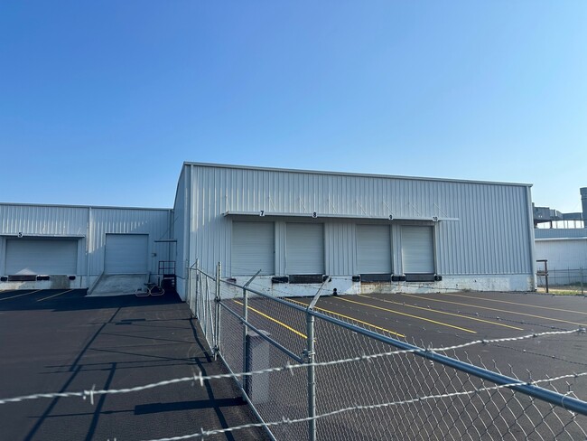
1617 James P Rodgers Dr, Valdosta, GA 31601


NEARBY LISTINGS FOR SALE OR LEASE
Property Detail
1617 James P Rodgers Dr
0126B-002
East Industrial
Warehouse
AZALEA CITY INDUSTRIAL PK
X
Lowndes
13185C0220E
Georgia
2024
2 AC
2024
Valdosta/Lake Park
011402
Other Market Areas
49,800 SF
Valdosta, GA
DEMOGRAPHICS near 1617 James P Rodgers Dr
1 Mile
3 Mile
5 Mile
2024 Total Population
1,221
14,474
47,934
2029 Population
1,276
15,204
49,982
Pop Growth 2024-2029
+ 4.50%
+ 5.04%
+ 4.27%
Average Age
38
37
35
2024 Total Households
366
5,603
18,413
HH Growth 2024-2029
+ 5.46%
+ 5.34%
+ 4.50%
Median Household Inc
$21,357
$23,239
$28,563
Avg Household Size
2.50
2.40
2.40
2024 Avg HH Vehicles
2.00
1.00
2.00
Median Home Value
$77,930
$104,926
$131,937
Median Year Built
1984
1980
1982
Nearby Places
Map Layers
Map Styles
 Street
 Aerial
- Restaurants
- Banks
- Shops
- Fitness
- Groceries
PUBLIC TRANSPORTATION
AIRPORT
Valdosta Regional
DRIVE
WALK
Distance
Valdosta Regional
3 min
1.3 mi
SALE & LEASE HISTORY
LISTING DATE
SALE/LEASE

Sep 28, 2023
For Lease
Mar 17, 2021
For Lease
Jan 27, 2021
For Lease
Jan 27, 2021
For Sale
Feb 06, 2017
For Lease
Dec 01, 2016
For Lease
Nearby Properties
Address
Land Use
TOTAL SIZE
Lot Size
Zoning
Address
Land Use
TOTAL SIZE
Lot Size
Zoning
1,200 SF
73.36 AC
M-2
Address
Land Use
TOTAL SIZE
Lot Size
Zoning
210,020 SF
4.22 AC
C-C
Address
Land Use
TOTAL SIZE
Lot Size
Zoning
414,158 SF
40 AC
M-1
Address
Land Use
TOTAL SIZE
Lot Size
Zoning
150,802 SF
11.97 AC
M-1
Address
Land Use
TOTAL SIZE
Lot Size
Zoning
210,000 SF
81.43 AC
M-2
Address
Land Use
TOTAL SIZE
Lot Size
Zoning
2,496 SF
63.73 AC
M-2
Address
Land Use
TOTAL SIZE
Lot Size
Zoning
97,568 SF
3.63 AC
C-H
Address
Land Use
TOTAL SIZE
Lot Size
Zoning
101,774 SF
3.55 AC
C-H
Address
Land Use
TOTAL SIZE
Lot Size
Zoning
120,400 SF
9.12 AC
M-1
Address
Land Use
TOTAL SIZE
Lot Size
Zoning
76,250 SF
3.05 AC
C-H
Address
Land Use
TOTAL SIZE
Lot Size
Zoning
143,560 SF
M-1
Address
Land Use
TOTAL SIZE
Lot Size
Zoning
114,460 SF
M-1
Address
Land Use
TOTAL SIZE
Lot Size
Zoning
72,832 SF
114.10 AC
M-1
Address
Land Use
TOTAL SIZE
Lot Size
Zoning
55,180 SF
2.46 AC
M-2
Address
Land Use
TOTAL SIZE
Lot Size
Zoning
3,284 SF
17.45 AC
R-M
Address
Land Use
TOTAL SIZE
Lot Size
Zoning
100,000 SF
25.27 AC
M-1
Address
Land Use
TOTAL SIZE
Lot Size
Zoning
108,800 SF
15 AC
M-2
Address
Land Use
TOTAL SIZE
Lot Size
Zoning
56,879 SF
63 AC
CON
Address
Land Use
TOTAL SIZE
Lot Size
Zoning
2,610 SF
10 AC
R-M
Address
Land Use
TOTAL SIZE
Lot Size
Zoning
52,220 SF
181.31 AC
M-2
Address
Land Use
TOTAL SIZE
Lot Size
Zoning
480 SF
10 AC
R-M
Address
Land Use
TOTAL SIZE
Lot Size
Zoning
8,320 SF
61 AC
E-A
Address
Land Use
TOTAL SIZE
Lot Size
Zoning
21,558 SF
30.25 AC
M-2
Address
Land Use
TOTAL SIZE
Lot Size
Zoning
576 SF
6,986.68 AC
E-A
Address
Land Use
TOTAL SIZE
Lot Size
Zoning
54,000 SF
9.15 AC
M-2
Address
Land Use
TOTAL SIZE
Lot Size
Zoning
150,862 SF
30 AC
M-1
Address
Land Use
TOTAL SIZE
Lot Size
Zoning
74,638 SF
4.72 AC
M-1
Address
Land Use
TOTAL SIZE
Lot Size
Zoning
12,268 SF
2.88 AC
R-M
Address
Land Use
TOTAL SIZE
Lot Size
Zoning
35,520 SF
16.58 AC
M-2
The World's #1 Commercial Real Estate Marketplace
Connect with us
© 2026 CoStar Group
The information above has been obtained from sources believed reliable. While we do not doubt its accuracy we have not verified it and make no guarantee, warranty or representation about it. It is your responsibility to independently confirm its accuracy and completeness. Any projections, opinions, assumptions, or estimates used are for example only and do not represent the current or future performance of the property. The value of this transaction to you depends on tax and other factors which should be evaluated by your tax, financial, and legal advisors. You and your advisors should conduct a careful, independent investigation of the property to determine to your satisfaction the suitability of the property for your needs.