Property Record
16173 Perkins Rd, Baton Rouge, LA 70810
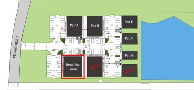

Property Detail
16173 Perkins Rd
Baton Rouge, LA
WARD: 3-3, SUBDIVISION: PERKINS 8 CONDOMINIUM, LOT: UNIT D. UNIT D, CONT 0.110 ACRES, RESUB OF LOT E OF THE LEE & MARY JOHNSO
30844721
E BATON ROUGE
Commercialcondominium
Louisiana
AE The base floodplain where base flood elevations are provided. AE Zones are now used on new format FIRMs instead of A1-A30 Zones.
e
2025
0.11 AC
2025
Essen/Bluebonnet
004021
Baton Rouge
NEARBY LISTINGS FOR SALE OR LEASE
DEMOGRAPHICS near 16173 Perkins Rd
1 mile
3 mile
5 mile
2025 Total Population
2,441
34,015
116,566
2030 Population
2,389
33,662
116,264
Pop Growth 2025-2030
(2.13%)
(1.04%)
(0.26%)
Average Age
41
41
40
2025 Total Households
954
13,976
48,330
HH Growth 2025-2030
(2.31%)
(1.12%)
(0.37%)
Median Household Inc
$119,425
$97,697
$90,307
Avg Household Size
2.50
2.40
2.30
2025 Avg HH Vehicles
2.00
2.00
2.00
Median Home Value
$531,570
$360,984
$324,523
Median Year Built
2000
1993
1992
Nearby Places
Map Layers
Map Styles
 Street
 Aerial
Layers
 Traffic
 Biking
Places
Listings with unknown addresses are not visible on the map
- Restaurants
- Banks
- Shops
- Fitness
- Groceries
PUBLIC TRANSPORTATION
AIRPORT
Baton Rouge Metro Ryan Field
Drive
Walk
Distance
Baton Rouge Metro Ryan Field
25 min
15.3 mi
Freight Ports
Port of Greater Baton Rouge
Drive
Walk
Distance
Port of Greater Baton Rouge
23 min
14.9 mi
Nearby Properties
Address
Land Use
TOTAL SIZE
Lot Size
Zoning
Address
Land Use
TOTAL SIZE
Lot Size
Zoning
502,888 SF
28.87 AC
Address
Land Use
TOTAL SIZE
Lot Size
Zoning
12.21 AC
Address
Land Use
TOTAL SIZE
Lot Size
Zoning
Address
Land Use
TOTAL SIZE
Lot Size
Zoning
490,875 SF
12 AC
Address
Land Use
TOTAL SIZE
Lot Size
Zoning
362,253 SF
34.85 AC
Address
Land Use
TOTAL SIZE
Lot Size
Zoning
281,736 SF
13.13 AC
Address
Land Use
TOTAL SIZE
Lot Size
Zoning
126,124 SF
19.66 AC
Address
Land Use
TOTAL SIZE
Lot Size
Zoning
Address
Land Use
TOTAL SIZE
Lot Size
Zoning
Address
Land Use
TOTAL SIZE
Lot Size
Zoning
291,736 SF
21.28 AC
Address
Land Use
TOTAL SIZE
Lot Size
Zoning
Address
Land Use
TOTAL SIZE
Lot Size
Zoning
175,662 SF
17.66 AC
Address
Land Use
TOTAL SIZE
Lot Size
Zoning
186,400 SF
9.13 AC
Address
Land Use
TOTAL SIZE
Lot Size
Zoning
134,175 SF
23.88 AC
Address
Land Use
TOTAL SIZE
Lot Size
Zoning
166,670 SF
24.70 AC
Address
Land Use
TOTAL SIZE
Lot Size
Zoning
198,812 SF
16.17 AC
Address
Land Use
TOTAL SIZE
Lot Size
Zoning
Address
Land Use
TOTAL SIZE
Lot Size
Zoning
23.68 AC
Address
Land Use
TOTAL SIZE
Lot Size
Zoning
12.24 AC
Address
Land Use
TOTAL SIZE
Lot Size
Zoning
7.20 AC
Address
Land Use
TOTAL SIZE
Lot Size
Zoning
17,578 SF
10 AC
Address
Land Use
TOTAL SIZE
Lot Size
Zoning
83,950 SF
11.45 AC
Address
Land Use
TOTAL SIZE
Lot Size
Zoning
Address
Land Use
TOTAL SIZE
Lot Size
Zoning
113,271 SF
13.59 AC
Address
Land Use
TOTAL SIZE
Lot Size
Zoning
197,151 SF
17.81 AC
Address
Land Use
TOTAL SIZE
Lot Size
Zoning
13.13 AC
Address
Land Use
TOTAL SIZE
Lot Size
Zoning
Address
Land Use
TOTAL SIZE
Lot Size
Zoning
188,617 SF
10.36 AC
Address
Land Use
TOTAL SIZE
Lot Size
Zoning
125,942 SF
15.89 AC
Address
Land Use
TOTAL SIZE
Lot Size
Zoning
82,685 SF
15.13 AC
The World's #1 Commercial Real Estate Marketplace
Connect with us
© 2026 CoStar Group
The information above has been obtained from sources believed reliable. While we do not doubt its accuracy we have not verified it and make no guarantee, warranty or representation about it. It is your responsibility to independently confirm its accuracy and completeness. Any projections, opinions, assumptions, or estimates used are for example only and do not represent the current or future performance of the property. The value of this transaction to you depends on tax and other factors which should be evaluated by your tax, financial, and legal advisors. You and your advisors should conduct a careful, independent investigation of the property to determine to your satisfaction the suitability of the property for your needs.