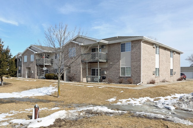
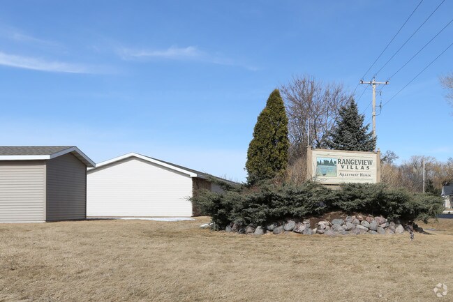
Property Record
1618 W Evergreen Dr, Appleton, WI 54913

Property Detail
1618 W Evergreen Dr
Appleton, WI
CSM 3526 LOT 2 (PLATTED OUT OF PRT NW NW SEC15-21-17)
10-1-0631-05
Outagamie
Commercialnec
Wisconsin
C and X Area of minimal flood hazard, usually depicted on FIRMs as above the 500-year flood level.
2
2024
0.29 AC
2024
Outer Outagamie County
012505
Green Bay
13,252 SF
NEARBY LISTINGS FOR SALE OR LEASE
-
-
View all Appleton listings for sale on LoopNet.com
DEMOGRAPHICS near 1618 W Evergreen Dr
1 mile
3 mile
5 mile
2025 Total Population
6,853
51,508
112,090
2030 Population
7,010
52,200
114,342
Pop Growth 2025-2030
+ 2.29%
+ 1.34%
+ 2.01%
Average Age
41
40
40
2025 Total Households
2,910
21,463
46,721
HH Growth 2025-2030
+ 2.30%
+ 1.40%
+ 2.13%
Median Household Inc
$106,572
$82,535
$80,956
Avg Household Size
2.30
2.30
2.30
2025 Avg HH Vehicles
2.00
2.00
2.00
Median Home Value
$318,311
$254,186
$261,687
Median Year Built
1996
1974
1977
Nearby Places
Map Layers
Map Styles
 Street
 Aerial
Transit
 Traffic
 Biking
Places
Listings with unknown addresses are not visible on the map
- Restaurants
- Banks
- Shops
- Fitness
- Groceries
PUBLIC TRANSPORTATION
AIRPORT
Appleton International
Drive
Walk
Distance
Appleton International
18 min
10.4 mi
Green Bay/Austin Straubel International
Drive
Walk
Distance
Green Bay/Austin Straubel International
36 min
26.5 mi
Nearby Properties
Address
Land Use
TOTAL SIZE
Lot Size
Zoning
Address
Land Use
TOTAL SIZE
Lot Size
Zoning
645,392 SF
25.87 AC
Address
Land Use
TOTAL SIZE
Lot Size
Zoning
500,700 SF
47.17 AC
Address
Land Use
TOTAL SIZE
Lot Size
Zoning
189,107 SF
13.37 AC
Address
Land Use
TOTAL SIZE
Lot Size
Zoning
70,136 SF
6.34 AC
C2
Address
Land Use
TOTAL SIZE
Lot Size
Zoning
2,032 SF
18.48 AC
R3
Address
Land Use
TOTAL SIZE
Lot Size
Zoning
65,818 SF
8.01 AC
C2
Address
Land Use
TOTAL SIZE
Lot Size
Zoning
278,801 SF
20.94 AC
Address
Land Use
TOTAL SIZE
Lot Size
Zoning
194,573 SF
19.99 AC
Address
Land Use
TOTAL SIZE
Lot Size
Zoning
53,321 SF
2.51 AC
CBD
Address
Land Use
TOTAL SIZE
Lot Size
Zoning
44,164 SF
0.62 AC
CBD
Address
Land Use
TOTAL SIZE
Lot Size
Zoning
17.43 AC
M2
Address
Land Use
TOTAL SIZE
Lot Size
Zoning
40,560 SF
6.67 AC
R3
Address
Land Use
TOTAL SIZE
Lot Size
Zoning
107,202 SF
39.98 AC
C2
Address
Land Use
TOTAL SIZE
Lot Size
Zoning
15,560 SF
15.24 AC
Address
Land Use
TOTAL SIZE
Lot Size
Zoning
6.66 AC
Address
Land Use
TOTAL SIZE
Lot Size
Zoning
249,444 SF
18.81 AC
Address
Land Use
TOTAL SIZE
Lot Size
Zoning
25,705 SF
2.03 AC
PDR3
Address
Land Use
TOTAL SIZE
Lot Size
Zoning
83,926 SF
7.35 AC
C2
Address
Land Use
TOTAL SIZE
Lot Size
Zoning
45,646 SF
44 SF
PDC2
Address
Land Use
TOTAL SIZE
Lot Size
Zoning
22.26 AC
Address
Land Use
TOTAL SIZE
Lot Size
Zoning
25.59 AC
Address
Land Use
TOTAL SIZE
Lot Size
Zoning
248,212 SF
7.87 AC
M2
Address
Land Use
TOTAL SIZE
Lot Size
Zoning
6,000 SF
1.70 AC
CBD
Address
Land Use
TOTAL SIZE
Lot Size
Zoning
39,510 SF
7.73 AC
Address
Land Use
TOTAL SIZE
Lot Size
Zoning
7,979 SF
6.64 AC
C2
Address
Land Use
TOTAL SIZE
Lot Size
Zoning
12.02 AC
M2
Address
Land Use
TOTAL SIZE
Lot Size
Zoning
97,355 SF
7.99 AC
Address
Land Use
TOTAL SIZE
Lot Size
Zoning
65,174 SF
9.13 AC
C2
Address
Land Use
TOTAL SIZE
Lot Size
Zoning
40,560 SF
3.69 AC
R3
Address
Land Use
TOTAL SIZE
Lot Size
Zoning
13,644 SF
0.39 AC
CBD
The World's #1 Commercial Real Estate Marketplace
Connect with us
© 2026 CoStar Group
The information above has been obtained from sources believed reliable. While we do not doubt its accuracy we have not verified it and make no guarantee, warranty or representation about it. It is your responsibility to independently confirm its accuracy and completeness. Any projections, opinions, assumptions, or estimates used are for example only and do not represent the current or future performance of the property. The value of this transaction to you depends on tax and other factors which should be evaluated by your tax, financial, and legal advisors. You and your advisors should conduct a careful, independent investigation of the property to determine to your satisfaction the suitability of the property for your needs.