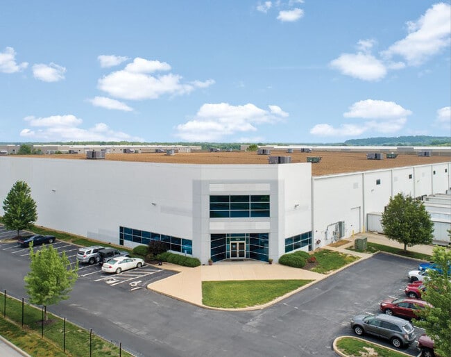
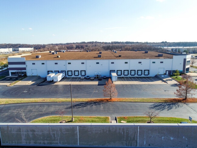
Property Record
1619 Park 370 Pl, Hazelwood, MO 63042

Current Lease Availabilities
NEARBY LISTINGS FOR SALE OR LEASE
Property Detail
1619 Park 370 Pl
St. Louis, MO-IL
Park 370 Plat Two Lots 19 & 20 Bdy Adj
08M-42-0116
PARK 370 PLAT TWO LOTS 19 & 20 BDY ADJ LOTS 19 & 20 BDY ADJ LOTS 19A & 20A BDY ADJ LOT 20AA
Warehouse
St. Louis
AE
Missouri
29183C0295G
20aa
2024
11.28 AC
2025
North County
211401
St. Louis
213,100 SF
DEMOGRAPHICS near 1619 Park 370 Pl
1 Mile
3 Mile
5 Mile
2024 Total Population
1,167
25,027
110,739
2029 Population
1,142
24,517
110,192
Pop Growth 2024-2029
(2.14%)
(2.04%)
(0.49%)
Average Age
42
40
40
2024 Total Households
535
10,777
45,749
HH Growth 2024-2029
(2.06%)
(2.11%)
(0.52%)
Median Household Inc
$46,316
$60,197
$59,855
Avg Household Size
2.10
2.20
2.30
2024 Avg HH Vehicles
2.00
2.00
2.00
Median Home Value
$159,011
$162,616
$163,049
Median Year Built
1970
1969
1966
Nearby Places
Map Layers
Map Styles
 Street
 Aerial
- Restaurants
- Banks
- Shops
- Fitness
- Groceries
PUBLIC TRANSPORTATION
AIRPORT
St Louis Lambert International
DRIVE
WALK
Distance
St Louis Lambert International
15 min
7.3 mi
Freight Ports
Port Milwaukee
DRIVE
WALK
Distance
Port Milwaukee
435 min
380.4 mi
Nearby Properties
Address
Land Use
TOTAL SIZE
Lot Size
Zoning
Address
Land Use
TOTAL SIZE
Lot Size
Zoning
4,416 SF
54.81 AC
80B
Address
Land Use
TOTAL SIZE
Lot Size
Zoning
833,525 SF
25.53 AC
R1
Address
Land Use
TOTAL SIZE
Lot Size
Zoning
893,188 SF
71.88 AC
G
Address
Land Use
TOTAL SIZE
Lot Size
Zoning
528,000 SF
21.10 AC
80I
Address
Land Use
TOTAL SIZE
Lot Size
Zoning
542,500 SF
39.91 AC
FPNU
Address
Land Use
TOTAL SIZE
Lot Size
Zoning
662,199 SF
26.58 AC
10M-1
Address
Land Use
TOTAL SIZE
Lot Size
Zoning
491,800 SF
18.69 AC
80AG
Address
Land Use
TOTAL SIZE
Lot Size
Zoning
406,000 SF
18.82 AC
80CA
Address
Land Use
TOTAL SIZE
Lot Size
Zoning
317,145 SF
21.71 AC
10M-1
Address
Land Use
TOTAL SIZE
Lot Size
Zoning
403,200 SF
21.99 AC
10M-1
Address
Land Use
TOTAL SIZE
Lot Size
Zoning
445,715 SF
28.16 AC
80I
Address
Land Use
TOTAL SIZE
Lot Size
Zoning
343,900 SF
19.62 AC
80AG
Address
Land Use
TOTAL SIZE
Lot Size
Zoning
119,925 SF
72.26 AC
10M-1
Address
Land Use
TOTAL SIZE
Lot Size
Zoning
335,294 SF
33.83 AC
24MFD
Address
Land Use
TOTAL SIZE
Lot Size
Zoning
293,622 SF
28.06 AC
H
Address
Land Use
TOTAL SIZE
Lot Size
Zoning
269,258 SF
89.80 AC
80F
Address
Land Use
TOTAL SIZE
Lot Size
Zoning
534,068 SF
39.76 AC
M1
Address
Land Use
TOTAL SIZE
Lot Size
Zoning
216,000 SF
16.42 AC
80AG
Address
Land Use
TOTAL SIZE
Lot Size
Zoning
135,721 SF
5.40 AC
80F
Address
Land Use
TOTAL SIZE
Lot Size
Zoning
278,550 SF
18 AC
10M-1
Address
Land Use
TOTAL SIZE
Lot Size
Zoning
387,158 SF
34.19 AC
R6
Address
Land Use
TOTAL SIZE
Lot Size
Zoning
780,115 SF
17.91 AC
PD
Address
Land Use
TOTAL SIZE
Lot Size
Zoning
36.40 AC
80I
Address
Land Use
TOTAL SIZE
Lot Size
Zoning
203,240 SF
8.50 AC
80H
Address
Land Use
TOTAL SIZE
Lot Size
Zoning
382,000 SF
28.06 AC
80I
Address
Land Use
TOTAL SIZE
Lot Size
Zoning
235,200 SF
13.96 AC
10M-1
Address
Land Use
TOTAL SIZE
Lot Size
Zoning
1,599,101 SF
69.43 AC
M1
Address
Land Use
TOTAL SIZE
Lot Size
Zoning
192,180 SF
24.89 AC
10M-1
Address
Land Use
TOTAL SIZE
Lot Size
Zoning
189,800 SF
10.74 AC
10M-1
The World's #1 Commercial Real Estate Marketplace
Connect with us
© 2025 CoStar Group
The information above has been obtained from sources believed reliable. While we do not doubt its accuracy we have not verified it and make no guarantee, warranty or representation about it. It is your responsibility to independently confirm its accuracy and completeness. Any projections, opinions, assumptions, or estimates used are for example only and do not represent the current or future performance of the property. The value of this transaction to you depends on tax and other factors which should be evaluated by your tax, financial, and legal advisors. You and your advisors should conduct a careful, independent investigation of the property to determine to your satisfaction the suitability of the property for your needs.