Property Record
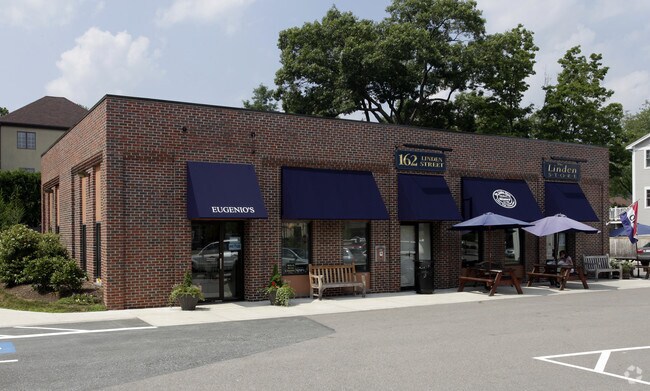
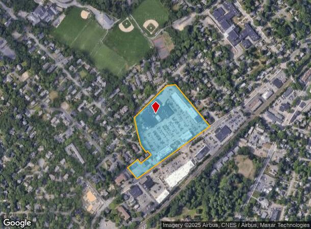
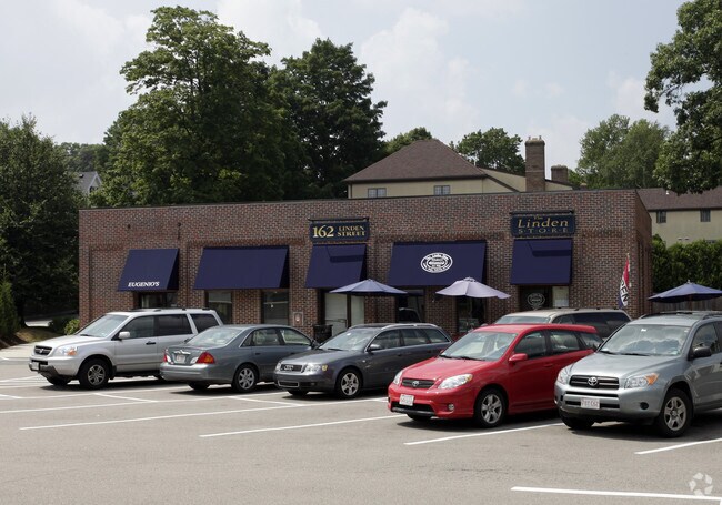
162 Linden St, Wellesley, MA 02482
NEARBY LISTINGS FOR SALE OR LEASE
Property Detail
162 Linden St
WELL-000123-000040
Norfolk
Regionalshoppingcenterormallwithanchorstore
Massachusetts
X
10.87 AC
25021C0016F
Wellesley/Needham
2025
Boston
2025
Boston-Cambridge-Newton, MA-NH
404302
DEMOGRAPHICS near 162 Linden St
1 Mile
3 Mile
5 Mile
2024 Total Population
12,021
57,325
149,117
2029 Population
12,029
57,255
148,263
Pop Growth 2024-2029
+ 0.07%
(0.12%)
(0.57%)
Average Age
39
41
41
2024 Total Households
3,688
19,210
53,232
HH Growth 2024-2029
+ 0.03%
(0.19%)
(0.66%)
Median Household Inc
$211,984
$210,393
$183,015
Avg Household Size
2.70
2.80
2.70
2024 Avg HH Vehicles
2.00
2.00
2.00
Median Home Value
$1,091,295
$1,045,171
$995,482
Median Year Built
1956
1959
1958
Nearby Places
Map Layers
Map Styles
 Street
 Aerial
- Restaurants
- Banks
- Shops
- Fitness
- Groceries
PUBLIC TRANSPORTATION
TRANSIT/SUBWAY
Wellesley Square (Framingham/Worcester Line - Massachusetts Bay Transportation Authority Commuter Rail (Purple Line))
DRIVE
WALK
Distance
Wellesley Square (Framingham/Worcester Line - Massachusetts Bay Transportation Authority Commuter Rail (Purple Line))
2 min
10 min
0.5 mi
COMMUTER RAIL
Wellesley Square (Framingham/Worcester Line - Massachusetts Bay Transportation Authority Commuter Rail (Purple Line))
DRIVE
WALK
Distance
Wellesley Square (Framingham/Worcester Line - Massachusetts Bay Transportation Authority Commuter Rail (Purple Line))
2 min
9 min
0.5 mi
Wellesley Hills (Framingham/Worcester Line - Massachusetts Bay Transportation Authority Commuter Rail (Purple Line))
DRIVE
WALK
Distance
Wellesley Hills (Framingham/Worcester Line - Massachusetts Bay Transportation Authority Commuter Rail (Purple Line))
4 min
1.3 mi
AIRPORT
General Edward Lawrence Logan International
DRIVE
WALK
Distance
General Edward Lawrence Logan International
31 min
17.7 mi
Worcester Regional
DRIVE
WALK
Distance
Worcester Regional
56 min
32.2 mi
Freight Ports
Port of Boston
DRIVE
WALK
Distance
Port of Boston
29 min
16.1 mi
Nearby Properties
Address
Land Use
TOTAL SIZE
Lot Size
Zoning
Address
Land Use
TOTAL SIZE
Lot Size
Zoning
522,600 SF
59.54 AC
A2
Address
Land Use
TOTAL SIZE
Lot Size
Zoning
15,974 SF
2.45 AC
ED
Address
Land Use
TOTAL SIZE
Lot Size
Zoning
6.33 AC
SR10
Address
Land Use
TOTAL SIZE
Lot Size
Zoning
189,858 SF
61.45 AC
A
Address
Land Use
TOTAL SIZE
Lot Size
Zoning
179,963 SF
41.28 AC
A
Address
Land Use
TOTAL SIZE
Lot Size
Zoning
15.08 AC
SR10
Address
Land Use
TOTAL SIZE
Lot Size
Zoning
1,683 SF
46.10 AC
SR15
Address
Land Use
TOTAL SIZE
Lot Size
Zoning
122,748 SF
16.90 AC
HPU
Address
Land Use
TOTAL SIZE
Lot Size
Zoning
49.88 AC
T
Address
Land Use
TOTAL SIZE
Lot Size
Zoning
3.80 AC
Address
Land Use
TOTAL SIZE
Lot Size
Zoning
25.70 AC
SR10
Address
Land Use
TOTAL SIZE
Lot Size
Zoning
80.85 AC
SR40
Address
Land Use
TOTAL SIZE
Lot Size
Zoning
13,244 SF
12.72 AC
SR10
Address
Land Use
TOTAL SIZE
Lot Size
Zoning
75,625 SF
23.23 AC
B
Address
Land Use
TOTAL SIZE
Lot Size
Zoning
7.15 AC
Address
Land Use
TOTAL SIZE
Lot Size
Zoning
1,592 SF
10.65 AC
ED
Address
Land Use
TOTAL SIZE
Lot Size
Zoning
139,710 SF
60.70 AC
SRA
Address
Land Use
TOTAL SIZE
Lot Size
Zoning
7.85 AC
SR10
Address
Land Use
TOTAL SIZE
Lot Size
Zoning
1.43 AC
Address
Land Use
TOTAL SIZE
Lot Size
Zoning
105 AC
SRD 30
Address
Land Use
TOTAL SIZE
Lot Size
Zoning
45.04 AC
ED
Address
Land Use
TOTAL SIZE
Lot Size
Zoning
455 SF
18.97 AC
SR10
Address
Land Use
TOTAL SIZE
Lot Size
Zoning
182.10 AC
O
Address
Land Use
TOTAL SIZE
Lot Size
Zoning
28.45 AC
Address
Land Use
TOTAL SIZE
Lot Size
Zoning
90,646 SF
10.63 AC
SRB
Address
Land Use
TOTAL SIZE
Lot Size
Zoning
2.19 AC
SRD 15
Address
Land Use
TOTAL SIZE
Lot Size
Zoning
14.06 AC
ED
Address
Land Use
TOTAL SIZE
Lot Size
Zoning
1,128 SF
6.05 AC
APD
Address
Land Use
TOTAL SIZE
Lot Size
Zoning
39 AC
ED
The World's #1 Commercial Real Estate Marketplace
Connect with us
© 2026 CoStar Group
The information above has been obtained from sources believed reliable. While we do not doubt its accuracy we have not verified it and make no guarantee, warranty or representation about it. It is your responsibility to independently confirm its accuracy and completeness. Any projections, opinions, assumptions, or estimates used are for example only and do not represent the current or future performance of the property. The value of this transaction to you depends on tax and other factors which should be evaluated by your tax, financial, and legal advisors. You and your advisors should conduct a careful, independent investigation of the property to determine to your satisfaction the suitability of the property for your needs.