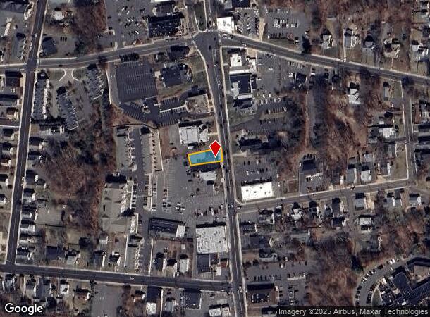
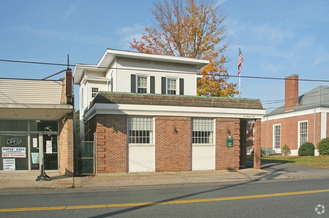
Property Record
162 Main St, Southington, CT 06489

NEARBY LISTINGS FOR SALE OR LEASE
Property Detail
162 Main St
SOUT-000100-000000-000034
Hartford
Officebuilding
Connecticut
X
34
09003C0582G
0.15 AC
2025
Southington
2025
Hartford
430100
Hartford-West Hartford-East Hartford, CT
2,285 SF
DEMOGRAPHICS near 162 Main St
1 Mile
3 Mile
5 Mile
2024 Total Population
10,409
40,765
78,625
2029 Population
10,367
40,615
78,260
Pop Growth 2024-2029
(0.40%)
(0.37%)
(0.46%)
Average Age
45
43
43
2024 Total Households
4,566
15,964
31,344
HH Growth 2024-2029
(0.46%)
(0.43%)
(0.52%)
Median Household Inc
$79,448
$107,641
$97,818
Avg Household Size
2.20
2.50
2.40
2024 Avg HH Vehicles
2.00
2.00
2.00
Median Home Value
$265,215
$321,360
$296,860
Median Year Built
1967
1972
1972
Nearby Places
Map Layers
Map Styles
 Street
 Aerial
- Restaurants
- Banks
- Shops
- Fitness
- Groceries
PUBLIC TRANSPORTATION
COMMUTER RAIL
DRIVE
WALK
Distance
12 min
8.9 mi
DRIVE
WALK
Distance
12 min
9.0 mi
AIRPORT
Tweed/New Haven
DRIVE
WALK
Distance
Tweed/New Haven
38 min
26.3 mi
Bradley International
DRIVE
WALK
Distance
Bradley International
56 min
32.5 mi
Nearby Properties
Address
Land Use
TOTAL SIZE
Lot Size
Zoning
Address
Land Use
TOTAL SIZE
Lot Size
Zoning
395,492 SF
54.09 AC
R-20/2
Address
Land Use
TOTAL SIZE
Lot Size
Zoning
106,970 SF
7.92 AC
R-12
Address
Land Use
TOTAL SIZE
Lot Size
Zoning
86,019 SF
7.51 AC
B
Address
Land Use
TOTAL SIZE
Lot Size
Zoning
128,599 SF
14.75 AC
R-20/2
Address
Land Use
TOTAL SIZE
Lot Size
Zoning
130,912 SF
11 AC
R-12
Address
Land Use
TOTAL SIZE
Lot Size
Zoning
14,307 SF
13.39 AC
R-20/2
Address
Land Use
TOTAL SIZE
Lot Size
Zoning
17.62 AC
B
Address
Land Use
TOTAL SIZE
Lot Size
Zoning
149,912 SF
13.66 AC
B
Address
Land Use
TOTAL SIZE
Lot Size
Zoning
130,252 SF
14.82 AC
B
Address
Land Use
TOTAL SIZE
Lot Size
Zoning
137,510 SF
12.95 AC
B
Address
Land Use
TOTAL SIZE
Lot Size
Zoning
16.04 AC
B
Address
Land Use
TOTAL SIZE
Lot Size
Zoning
150,972 SF
9.99 AC
I-1
Address
Land Use
TOTAL SIZE
Lot Size
Zoning
98,463 SF
5.01 AC
I-1
Address
Land Use
TOTAL SIZE
Lot Size
Zoning
109,212 SF
20.15 AC
B
Address
Land Use
TOTAL SIZE
Lot Size
Zoning
121,648 SF
6.96 AC
I-1
Address
Land Use
TOTAL SIZE
Lot Size
Zoning
134,876 SF
19.44 AC
R-12
Address
Land Use
TOTAL SIZE
Lot Size
Zoning
95,940 SF
12 AC
B
Address
Land Use
TOTAL SIZE
Lot Size
Zoning
12.28 AC
R-20/2
Address
Land Use
TOTAL SIZE
Lot Size
Zoning
9.07 AC
B
Address
Land Use
TOTAL SIZE
Lot Size
Zoning
101,250 SF
16.91 AC
B
Address
Land Use
TOTAL SIZE
Lot Size
Zoning
40 AC
I-2
Address
Land Use
TOTAL SIZE
Lot Size
Zoning
101,495 SF
9.74 AC
B
Address
Land Use
TOTAL SIZE
Lot Size
Zoning
67,503 SF
2.53 AC
B
Address
Land Use
TOTAL SIZE
Lot Size
Zoning
46,395 SF
11.80 AC
I-2
Address
Land Use
TOTAL SIZE
Lot Size
Zoning
68,669 SF
5.35 AC
B
Address
Land Use
TOTAL SIZE
Lot Size
Zoning
76,113 SF
18.68 AC
R-20/2
Address
Land Use
TOTAL SIZE
Lot Size
Zoning
22,512 SF
3.31 AC
CB
Address
Land Use
TOTAL SIZE
Lot Size
Zoning
32,076 SF
16.33 AC
R-20/2
Address
Land Use
TOTAL SIZE
Lot Size
Zoning
85,232 SF
5.71 AC
R-HD
Address
Land Use
TOTAL SIZE
Lot Size
Zoning
20,591 SF
4.01 AC
R-20/2
The World's #1 Commercial Real Estate Marketplace
Connect with us
© 2026 CoStar Group
The information above has been obtained from sources believed reliable. While we do not doubt its accuracy we have not verified it and make no guarantee, warranty or representation about it. It is your responsibility to independently confirm its accuracy and completeness. Any projections, opinions, assumptions, or estimates used are for example only and do not represent the current or future performance of the property. The value of this transaction to you depends on tax and other factors which should be evaluated by your tax, financial, and legal advisors. You and your advisors should conduct a careful, independent investigation of the property to determine to your satisfaction the suitability of the property for your needs.