Property Record
162 N Main St, Sharon, MA 02067

Current Lease Availabilities
NEARBY LISTINGS FOR SALE OR LEASE
-
-
View all Sharon listings for lease on LoopNet.com
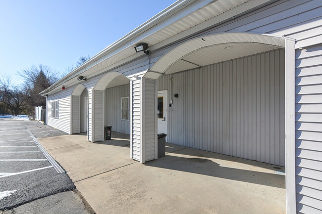
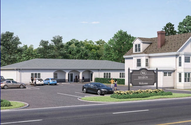
Property Detail
162 N Main St
Taxexempt
Norfolk
X
Massachusetts
25021C0193F
1.09 AC
0
I-95 Corridor South
2025
Boston
414300
Boston-Cambridge-Newton, MA-NH
4,399 SF
SHAR-000112-000007
DEMOGRAPHICS near 162 N Main St
1 Mile
3 Mile
5 Mile
2024 Total Population
4,342
41,338
118,902
2029 Population
4,326
41,224
118,261
Pop Growth 2024-2029
(0.37%)
(0.28%)
(0.54%)
Average Age
42
42
42
2024 Total Households
1,642
15,979
45,394
HH Growth 2024-2029
(0.49%)
(0.23%)
(0.58%)
Median Household Inc
$161,188
$131,942
$118,253
Avg Household Size
2.60
2.50
2.50
2024 Avg HH Vehicles
2.00
2.00
2.00
Median Home Value
$682,669
$582,289
$598,785
Median Year Built
1962
1971
1968
Nearby Places
Map Layers
Map Styles
 Street
 Aerial
- Restaurants
- Banks
- Shops
- Fitness
- Groceries
PUBLIC TRANSPORTATION
COMMUTER RAIL
Sharon (Providence/Stoughton Line - Massachusetts Bay Transportation Authority Commuter Rail (Purple Line))
DRIVE
WALK
Distance
Sharon (Providence/Stoughton Line - Massachusetts Bay Transportation Authority Commuter Rail (Purple Line))
3 min
18 min
0.9 mi
Canton Center (Providence/Stoughton Line - Massachusetts Bay Transportation Authority Commuter Rail (Purple Line))
DRIVE
WALK
Distance
Canton Center (Providence/Stoughton Line - Massachusetts Bay Transportation Authority Commuter Rail (Purple Line))
5 min
2.9 mi
AIRPORT
General Edward Lawrence Logan International
DRIVE
WALK
Distance
General Edward Lawrence Logan International
39 min
21.4 mi
Freight Ports
Port of Boston
DRIVE
WALK
Distance
Port of Boston
36 min
19.2 mi
Nearby Properties
Address
Land Use
TOTAL SIZE
Lot Size
Zoning
Address
Land Use
TOTAL SIZE
Lot Size
Zoning
544,990 SF
63.29 AC
Address
Land Use
TOTAL SIZE
Lot Size
Zoning
417,014 SF
10 AC
6
Address
Land Use
TOTAL SIZE
Lot Size
Zoning
56,088 SF
23.94 AC
I
Address
Land Use
TOTAL SIZE
Lot Size
Zoning
30.94 AC
Address
Land Use
TOTAL SIZE
Lot Size
Zoning
198,120 SF
51 AC
3
Address
Land Use
TOTAL SIZE
Lot Size
Zoning
28,561 SF
26.30 AC
Address
Land Use
TOTAL SIZE
Lot Size
Zoning
81,009 SF
22.16 AC
Address
Land Use
TOTAL SIZE
Lot Size
Zoning
14.33 AC
Address
Land Use
TOTAL SIZE
Lot Size
Zoning
263,007 SF
8.11 AC
Address
Land Use
TOTAL SIZE
Lot Size
Zoning
196,398 SF
28.50 AC
Address
Land Use
TOTAL SIZE
Lot Size
Zoning
12.24 AC
I
Address
Land Use
TOTAL SIZE
Lot Size
Zoning
103,901 SF
22.21 AC
Address
Land Use
TOTAL SIZE
Lot Size
Zoning
77,791 SF
2.24 AC
3
Address
Land Use
TOTAL SIZE
Lot Size
Zoning
93,218 SF
9.68 AC
LI
Address
Land Use
TOTAL SIZE
Lot Size
Zoning
100,012 SF
7.11 AC
Address
Land Use
TOTAL SIZE
Lot Size
Zoning
54,948 SF
11.43 AC
Address
Land Use
TOTAL SIZE
Lot Size
Zoning
107,467 SF
19.59 AC
Address
Land Use
TOTAL SIZE
Lot Size
Zoning
158,279 SF
8.60 AC
Address
Land Use
TOTAL SIZE
Lot Size
Zoning
55,182 SF
4.04 AC
Address
Land Use
TOTAL SIZE
Lot Size
Zoning
77,212 SF
2.40 AC
5
Address
Land Use
TOTAL SIZE
Lot Size
Zoning
87,655 SF
3.39 AC
GB
Address
Land Use
TOTAL SIZE
Lot Size
Zoning
56,414 SF
7.63 AC
Address
Land Use
TOTAL SIZE
Lot Size
Zoning
147,984 SF
20.57 AC
Address
Land Use
TOTAL SIZE
Lot Size
Zoning
67,338 SF
11.50 AC
9
Address
Land Use
TOTAL SIZE
Lot Size
Zoning
1,060 SF
103.22 AC
Address
Land Use
TOTAL SIZE
Lot Size
Zoning
73,461 SF
18.29 AC
Address
Land Use
TOTAL SIZE
Lot Size
Zoning
64,689 SF
24.60 AC
5
Address
Land Use
TOTAL SIZE
Lot Size
Zoning
185,106 SF
27.89 AC
Address
Land Use
TOTAL SIZE
Lot Size
Zoning
97,269 SF
2.92 AC
Address
Land Use
TOTAL SIZE
Lot Size
Zoning
17,052 SF
33.53 AC
7
The World's #1 Commercial Real Estate Marketplace
Connect with us
© 2025 CoStar Group
The information above has been obtained from sources believed reliable. While we do not doubt its accuracy we have not verified it and make no guarantee, warranty or representation about it. It is your responsibility to independently confirm its accuracy and completeness. Any projections, opinions, assumptions, or estimates used are for example only and do not represent the current or future performance of the property. The value of this transaction to you depends on tax and other factors which should be evaluated by your tax, financial, and legal advisors. You and your advisors should conduct a careful, independent investigation of the property to determine to your satisfaction the suitability of the property for your needs.