Property Record
162 N Mccall Ave, Sanger, CA 93657
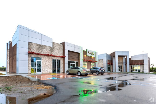


Property Detail
162 N Mccall Ave
314-120-66
3.97 AC PAR 2 & 3 OF P/M 8126 BK 73 PGS 29-31
Commercialnec
FRESNO
C2
California
B and X Area of moderate flood hazard, usually the area between the limits of the 100-year and 500-year floods.
3.97 AC
2025
E Outlying Fresno Cnty
2025
Fresno
005916
Fresno, CA
12,527 SF
NEARBY LISTINGS FOR SALE OR LEASE
-
-
View all Sanger listings for sale on LoopNet.com
DEMOGRAPHICS near 162 N Mccall Ave
1 mile
3 mile
5 mile
2025 Total Population
296
10,987
92,810
2030 Population
297
11,101
95,390
Pop Growth 2025-2030
+ 0.34%
+ 1.04%
+ 2.78%
Average Age
39
37
36
2025 Total Households
91
3,308
27,127
HH Growth 2025-2030
0.00%
+ 1.06%
+ 2.76%
Median Household Inc
$102,941
$99,802
$101,623
Avg Household Size
3.10
3.30
3.40
2025 Avg HH Vehicles
3.00
2.00
2.00
Median Home Value
$633,333
$461,436
$464,321
Median Year Built
1969
1995
2002
Nearby Places
Map Layers
Map Styles
 Street
 Aerial
Layers
 Traffic
 Biking
Places
Listings with unknown addresses are not visible on the map
- Restaurants
- Banks
- Shops
- Fitness
- Groceries
PUBLIC TRANSPORTATION
AIRPORT
Fresno Yosemite International
Drive
Walk
Distance
Fresno Yosemite International
11 min
8.1 mi
Freight Ports
Port of Stockton
Drive
Walk
Distance
Port of Stockton
163 min
138.1 mi
Nearby Properties
Address
Land Use
TOTAL SIZE
Lot Size
Zoning
Address
Land Use
TOTAL SIZE
Lot Size
Zoning
109,374 SF
8.61 AC
RM25
Address
Land Use
TOTAL SIZE
Lot Size
Zoning
165,948 SF
16.88 AC
C2
Address
Land Use
TOTAL SIZE
Lot Size
Zoning
87,150 SF
7.26 AC
RM25
Address
Land Use
TOTAL SIZE
Lot Size
Zoning
158.81 AC
AE20
Address
Land Use
TOTAL SIZE
Lot Size
Zoning
54,050 SF
6.27 AC
CP
Address
Land Use
TOTAL SIZE
Lot Size
Zoning
924 SF
154 AC
AE20
Address
Land Use
TOTAL SIZE
Lot Size
Zoning
13,717 SF
1.03 AC
C2
Address
Land Use
TOTAL SIZE
Lot Size
Zoning
156.04 AC
AE20
Address
Land Use
TOTAL SIZE
Lot Size
Zoning
14,888 SF
1.25 AC
CP
Address
Land Use
TOTAL SIZE
Lot Size
Zoning
32,070 SF
109.34 AC
RR
Address
Land Use
TOTAL SIZE
Lot Size
Zoning
73,577 SF
25.18 AC
AE20
Address
Land Use
TOTAL SIZE
Lot Size
Zoning
5,088 SF
31.46 AC
AE20
Address
Land Use
TOTAL SIZE
Lot Size
Zoning
6,500 SF
0.65 AC
CP
Address
Land Use
TOTAL SIZE
Lot Size
Zoning
1,058 SF
77.22 AC
AE20
Address
Land Use
TOTAL SIZE
Lot Size
Zoning
890 SF
39.26 AC
AE20
Address
Land Use
TOTAL SIZE
Lot Size
Zoning
18,900 SF
1.64 AC
CN
Address
Land Use
TOTAL SIZE
Lot Size
Zoning
4,828 SF
29.30 AC
AE20
Address
Land Use
TOTAL SIZE
Lot Size
Zoning
94,589 SF
20.81 AC
AE20
Address
Land Use
TOTAL SIZE
Lot Size
Zoning
40 AC
AE20
Address
Land Use
TOTAL SIZE
Lot Size
Zoning
41,972 SF
3.41 AC
C2
Address
Land Use
TOTAL SIZE
Lot Size
Zoning
39.55 AC
AE20
Address
Land Use
TOTAL SIZE
Lot Size
Zoning
2,032 SF
0.83 AC
Address
Land Use
TOTAL SIZE
Lot Size
Zoning
5,964 SF
0.64 AC
C2
Address
Land Use
TOTAL SIZE
Lot Size
Zoning
2,516 SF
49.97 AC
AE20
Address
Land Use
TOTAL SIZE
Lot Size
Zoning
816 SF
76.51 AC
AE20
Address
Land Use
TOTAL SIZE
Lot Size
Zoning
1,070 SF
221.11 AC
AE20
Address
Land Use
TOTAL SIZE
Lot Size
Zoning
1,886 SF
56.46 AC
AE20
The World's #1 Commercial Real Estate Marketplace
Connect with us
© 2026 CoStar Group
The information above has been obtained from sources believed reliable. While we do not doubt its accuracy we have not verified it and make no guarantee, warranty or representation about it. It is your responsibility to independently confirm its accuracy and completeness. Any projections, opinions, assumptions, or estimates used are for example only and do not represent the current or future performance of the property. The value of this transaction to you depends on tax and other factors which should be evaluated by your tax, financial, and legal advisors. You and your advisors should conduct a careful, independent investigation of the property to determine to your satisfaction the suitability of the property for your needs.