Property Record
162 Twp Rd, South Point, OH 45680
NEARBY LISTINGS FOR SALE OR LEASE
Property Detail
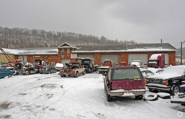
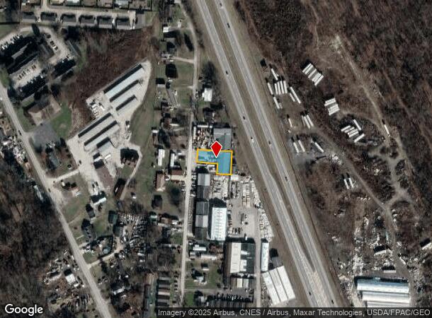
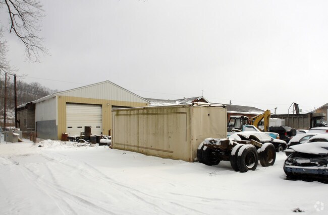
162 Twp Rd
15-113-1200-000
South Point Delta
Autorepair
17-2-19 19/20 PT S1/2 SEC LESS 0.09A BAL= 0.25A
X
Lawrence
54099C0025C
Ohio
0
0.25 AC
2024
Lawrence County
051101
Huntington/Ashland
5,358 SF
Huntington-Ashland, WV-KY-OH
DEMOGRAPHICS near 162 Twp Rd
1 Mile
3 Mile
5 Mile
2024 Total Population
2,186
20,094
46,998
2029 Population
2,141
19,789
46,141
Pop Growth 2024-2029
(2.06%)
(1.52%)
(1.82%)
Average Age
38
41
42
2024 Total Households
897
8,347
19,644
HH Growth 2024-2029
(2.01%)
(1.43%)
(1.74%)
Median Household Inc
$27,629
$48,237
$46,934
Avg Household Size
2.40
2.30
2.30
2024 Avg HH Vehicles
1.00
2.00
2.00
Median Home Value
$83,533
$120,953
$116,719
Median Year Built
1986
1966
1967
Nearby Places
Map Layers
Map Styles
 Street
 Aerial
- Restaurants
- Banks
- Shops
- Fitness
- Groceries
PUBLIC TRANSPORTATION
COMMUTER RAIL
Ashland Amtrak Station (Cardinal - Amtrak)
DRIVE
WALK
Distance
Ashland Amtrak Station (Cardinal - Amtrak)
7 min
4.9 mi
AIRPORT
Tri-State/Milton J Ferguson Field
DRIVE
WALK
Distance
Tri-State/Milton J Ferguson Field
25 min
18.2 mi
Freight Ports
Port of Toledo
DRIVE
WALK
Distance
Port of Toledo
337 min
260.8 mi
Nearby Properties
Address
Land Use
TOTAL SIZE
Lot Size
Zoning
Address
Land Use
TOTAL SIZE
Lot Size
Zoning
6.96 AC
Z02
Address
Land Use
TOTAL SIZE
Lot Size
Zoning
116,640 SF
0.97 AC
COMMERCIAL
Address
Land Use
TOTAL SIZE
Lot Size
Zoning
0.73 AC
Z02
Address
Land Use
TOTAL SIZE
Lot Size
Zoning
123,920 SF
6.81 AC
Address
Land Use
TOTAL SIZE
Lot Size
Zoning
141 AC
COMMERCIAL
Address
Land Use
TOTAL SIZE
Lot Size
Zoning
47,107 SF
4.67 AC
Address
Land Use
TOTAL SIZE
Lot Size
Zoning
8,364 SF
3 AC
Z02
Address
Land Use
TOTAL SIZE
Lot Size
Zoning
1.46 AC
COMMERCIAL
Address
Land Use
TOTAL SIZE
Lot Size
Zoning
3.50 AC
Z02
Address
Land Use
TOTAL SIZE
Lot Size
Zoning
1,920 SF
33.30 AC
Z03
Address
Land Use
TOTAL SIZE
Lot Size
Zoning
126,716 SF
10.60 AC
Address
Land Use
TOTAL SIZE
Lot Size
Zoning
54.65 AC
Address
Land Use
TOTAL SIZE
Lot Size
Zoning
66,600 SF
1.35 AC
OTHER
Address
Land Use
TOTAL SIZE
Lot Size
Zoning
4 AC
Z01
Address
Land Use
TOTAL SIZE
Lot Size
Zoning
96,405 SF
1.40 AC
COMMERCIAL
Address
Land Use
TOTAL SIZE
Lot Size
Zoning
1.60 AC
COMMERCIAL
Address
Land Use
TOTAL SIZE
Lot Size
Zoning
27,084 SF
3.73 AC
Address
Land Use
TOTAL SIZE
Lot Size
Zoning
4,824 SF
2.83 AC
OTHER
Address
Land Use
TOTAL SIZE
Lot Size
Zoning
20,018 SF
0.36 AC
OTHER
Address
Land Use
TOTAL SIZE
Lot Size
Zoning
68,160 SF
0.87 AC
Z01
Address
Land Use
TOTAL SIZE
Lot Size
Zoning
0.57 AC
RESIDENTIA
Address
Land Use
TOTAL SIZE
Lot Size
Zoning
2.99 AC
RESIDENTIA
Address
Land Use
TOTAL SIZE
Lot Size
Zoning
30,000 SF
0.39 AC
OTHER
Address
Land Use
TOTAL SIZE
Lot Size
Zoning
2.92 AC
COMMERCIAL
Address
Land Use
TOTAL SIZE
Lot Size
Zoning
43.18 AC
COMMERCIAL
Address
Land Use
TOTAL SIZE
Lot Size
Zoning
11.96 AC
Address
Land Use
TOTAL SIZE
Lot Size
Zoning
0.69 AC
COMMERCIAL
Address
Land Use
TOTAL SIZE
Lot Size
Zoning
0.10 AC
COMMERCIAL
Address
Land Use
TOTAL SIZE
Lot Size
Zoning
0.87 AC
RESIDENTIA
Address
Land Use
TOTAL SIZE
Lot Size
Zoning
3,273 SF
0.41 AC
COMMERCIAL
The World's #1 Commercial Real Estate Marketplace
Connect with us
© 2025 CoStar Group
The information above has been obtained from sources believed reliable. While we do not doubt its accuracy we have not verified it and make no guarantee, warranty or representation about it. It is your responsibility to independently confirm its accuracy and completeness. Any projections, opinions, assumptions, or estimates used are for example only and do not represent the current or future performance of the property. The value of this transaction to you depends on tax and other factors which should be evaluated by your tax, financial, and legal advisors. You and your advisors should conduct a careful, independent investigation of the property to determine to your satisfaction the suitability of the property for your needs.