Property Record
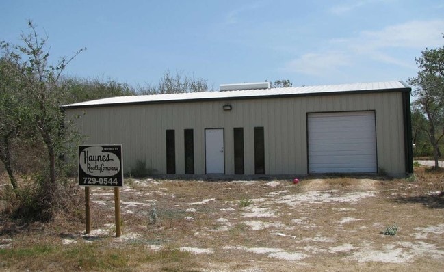
1620 Highway 35 S, Rockport, TX 78382

Property Detail
1620 Highway 35 S
Corpus Christi, TX
MANNING BLK 109 LOT 13 THRU 16 UNDIVIDED INTEREST 50.0000000000%
R70202
ARANSAS
Commercialnec
Texas
B and X Area of moderate flood hazard, usually the area between the limits of the 100-year and 500-year floods.
13-16
2023
0.60 AC
2025
Rockport/N Aransas
950302
Corpus Christi
NEARBY LISTINGS FOR SALE OR LEASE
DEMOGRAPHICS near 1620 Highway 35 S
1 mile
3 mile
5 mile
2024 Total Population
3,430
12,000
20,218
2029 Population
3,644
12,628
21,275
Pop Growth 2024-2029
+ 6.24%
+ 5.23%
+ 5.23%
Average Age
42
46
48
2024 Total Households
1,388
4,890
8,713
HH Growth 2024-2029
+ 6.70%
+ 5.66%
+ 5.76%
Median Household Inc
$41,976
$49,404
$61,188
Avg Household Size
2.30
2.30
2.20
2024 Avg HH Vehicles
2.00
2.00
2.00
Median Home Value
$196,666
$234,450
$270,197
Median Year Built
1987
1990
1993
Nearby Places
Map Layers
Map Styles
 Street
 Aerial
Transit
 Traffic
 Biking
Places
Listings with unknown addresses are not visible on the map
- Restaurants
- Banks
- Shops
- Fitness
- Groceries
PUBLIC TRANSPORTATION
AIRPORT
Corpus Christi International
Drive
Walk
Distance
Corpus Christi International
48 min
37.5 mi
Freight Ports
Port of Corpus Christi
Drive
Walk
Distance
Port of Corpus Christi
36 min
29.5 mi
SALE & LEASE HISTORY
LISTING DATE
SALE/LEASE

Jan 03, 2018
For Sale
Nearby Properties
Address
Land Use
TOTAL SIZE
Lot Size
Zoning
Address
Land Use
TOTAL SIZE
Lot Size
Zoning
395,335 SF
57.39 AC
Address
Land Use
TOTAL SIZE
Lot Size
Zoning
7,385 SF
44.08 AC
Address
Land Use
TOTAL SIZE
Lot Size
Zoning
163,293 SF
13.66 AC
Address
Land Use
TOTAL SIZE
Lot Size
Zoning
126,886 AC
Address
Land Use
TOTAL SIZE
Lot Size
Zoning
65,191 SF
Address
Land Use
TOTAL SIZE
Lot Size
Zoning
18,998 SF
20 AC
Address
Land Use
TOTAL SIZE
Lot Size
Zoning
59,220 AC
Address
Land Use
TOTAL SIZE
Lot Size
Zoning
43,584 SF
0.48 AC
Address
Land Use
TOTAL SIZE
Lot Size
Zoning
59,600 SF
6.15 AC
Address
Land Use
TOTAL SIZE
Lot Size
Zoning
43,816 SF
3.46 AC
Address
Land Use
TOTAL SIZE
Lot Size
Zoning
41,075 SF
11.93 AC
Address
Land Use
TOTAL SIZE
Lot Size
Zoning
30,880 SF
16.53 AC
Address
Land Use
TOTAL SIZE
Lot Size
Zoning
3,524 SF
14.03 AC
Address
Land Use
TOTAL SIZE
Lot Size
Zoning
30,927 SF
9.08 AC
Address
Land Use
TOTAL SIZE
Lot Size
Zoning
31,795 SF
1.50 AC
Address
Land Use
TOTAL SIZE
Lot Size
Zoning
31,494 SF
1.84 AC
Address
Land Use
TOTAL SIZE
Lot Size
Zoning
24,890 SF
16.22 AC
Address
Land Use
TOTAL SIZE
Lot Size
Zoning
68,265 SF
8.15 AC
Address
Land Use
TOTAL SIZE
Lot Size
Zoning
5.02 AC
Address
Land Use
TOTAL SIZE
Lot Size
Zoning
15,147 SF
21.52 AC
Address
Land Use
TOTAL SIZE
Lot Size
Zoning
23,065 SF
1.50 AC
Address
Land Use
TOTAL SIZE
Lot Size
Zoning
14,770 SF
1.92 AC
Address
Land Use
TOTAL SIZE
Lot Size
Zoning
3,917 SF
6.60 AC
Address
Land Use
TOTAL SIZE
Lot Size
Zoning
15,600 SF
3.11 AC
Address
Land Use
TOTAL SIZE
Lot Size
Zoning
25,655 SF
Address
Land Use
TOTAL SIZE
Lot Size
Zoning
13,553 SF
0.45 AC
Address
Land Use
TOTAL SIZE
Lot Size
Zoning
1,669 SF
7.02 AC
Address
Land Use
TOTAL SIZE
Lot Size
Zoning
21,676 SF
6.87 AC
Address
Land Use
TOTAL SIZE
Lot Size
Zoning
14,812 SF
10.35 AC
Address
Land Use
TOTAL SIZE
Lot Size
Zoning
37,601 SF
2.46 AC
The World's #1 Commercial Real Estate Marketplace
Connect with us
© 2026 CoStar Group
The information above has been obtained from sources believed reliable. While we do not doubt its accuracy we have not verified it and make no guarantee, warranty or representation about it. It is your responsibility to independently confirm its accuracy and completeness. Any projections, opinions, assumptions, or estimates used are for example only and do not represent the current or future performance of the property. The value of this transaction to you depends on tax and other factors which should be evaluated by your tax, financial, and legal advisors. You and your advisors should conduct a careful, independent investigation of the property to determine to your satisfaction the suitability of the property for your needs.