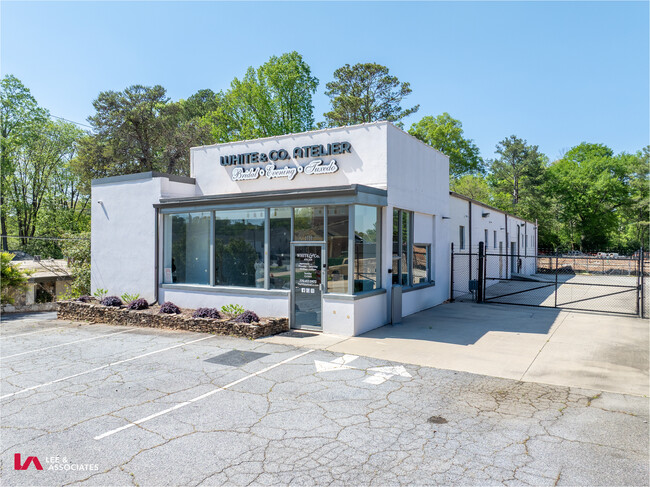
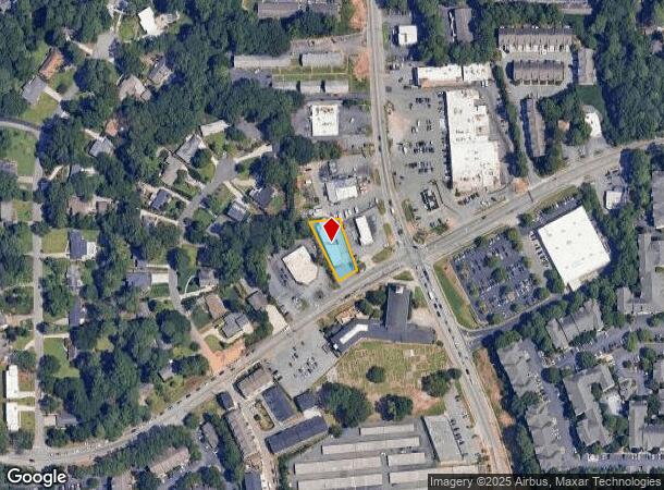
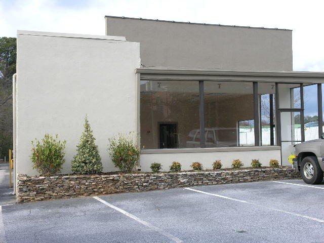
Property Record
1620 Lavista Rd Ne, Atlanta, GA 30329
Current Lease Availabilities
NEARBY LISTINGS FOR SALE OR LEASE
Property Detail
1620 Lavista Rd Ne
Atlanta-Sandy Springs-Roswell, GA
Deshong E
18-109-02-065
LOUDERMILK PROPERTYTOGETHER WITH PROPERTY BEG AT NW SIDE OF LAVISTA & BRIARCLIFF RDALSO ADDL PROPERTY AT LAVISTA
Storebuilding
DeKalb
X
Georgia
13089C0054K
65
2025
0.31 AC
2025
Northlake/I-85
021502
Atlanta
4,374 SF
DEMOGRAPHICS near 1620 Lavista Rd Ne
1 Mile
3 Mile
5 Mile
2024 Total Population
14,669
145,591
413,367
2029 Population
14,554
147,267
420,646
Pop Growth 2024-2029
(0.78%)
+ 1.15%
+ 1.76%
Average Age
36
38
37
2024 Total Households
7,021
69,760
199,154
HH Growth 2024-2029
(1.00%)
+ 1.34%
+ 2.14%
Median Household Inc
$83,348
$99,338
$102,325
Avg Household Size
2.00
2.00
1.90
2024 Avg HH Vehicles
2.00
1.00
1.00
Median Home Value
$499,037
$602,948
$581,803
Median Year Built
1985
1987
1991
Nearby Places
- Restaurants
- Banks
- Shops
- Fitness
- Groceries
PUBLIC TRANSPORTATION
COMMUTER RAIL
DRIVE
WALK
Distance
9 min
4.8 mi
AIRPORT
Hartsfield - Jackson Atlanta International
DRIVE
WALK
Distance
Hartsfield - Jackson Atlanta International
28 min
17.6 mi
Nearby Properties
Address
Land Use
TOTAL SIZE
Lot Size
Zoning
Address
Land Use
TOTAL SIZE
Lot Size
Zoning
11,126,925 SF
43.33 AC
C3
Address
Land Use
TOTAL SIZE
Lot Size
Zoning
179.40 AC
R4
Address
Land Use
TOTAL SIZE
Lot Size
Zoning
3,356,268 SF
14.72 AC
C3
Address
Land Use
TOTAL SIZE
Lot Size
Zoning
2,612 SF
137.60 AC
X
Address
Land Use
TOTAL SIZE
Lot Size
Zoning
345,125 SF
7.73 AC
C1
Address
Land Use
TOTAL SIZE
Lot Size
Zoning
702,901 SF
3.72 AC
PDOC
Address
Land Use
TOTAL SIZE
Lot Size
Zoning
169,435 SF
76.18 AC
M
Address
Land Use
TOTAL SIZE
Lot Size
Zoning
1,233,815 SF
2.18 AC
PDMU
Address
Land Use
TOTAL SIZE
Lot Size
Zoning
687,016 SF
4.21 AC
R4
Address
Land Use
TOTAL SIZE
Lot Size
Zoning
1,021,058 SF
2.89 AC
C3
Address
Land Use
TOTAL SIZE
Lot Size
Zoning
598,962 SF
4.50 AC
PDOC
Address
Land Use
TOTAL SIZE
Lot Size
Zoning
835,636 SF
5.63 AC
PDOC
Address
Land Use
TOTAL SIZE
Lot Size
Zoning
188,648 SF
4.39 AC
X
Address
Land Use
TOTAL SIZE
Lot Size
Zoning
589,761 SF
22.67 AC
RM-HD
Address
Land Use
TOTAL SIZE
Lot Size
Zoning
2,820,296 SF
9.58 AC
RG5
Address
Land Use
TOTAL SIZE
Lot Size
Zoning
458,822 SF
2.86 AC
RG2
Address
Land Use
TOTAL SIZE
Lot Size
Zoning
863,826 SF
3.79 AC
C4
Address
Land Use
TOTAL SIZE
Lot Size
Zoning
664,442 SF
4.76 AC
RG3
Address
Land Use
TOTAL SIZE
Lot Size
Zoning
188,469 SF
4.06 AC
C-1
Address
Land Use
TOTAL SIZE
Lot Size
Zoning
645,419 SF
1.11 AC
C3
Address
Land Use
TOTAL SIZE
Lot Size
Zoning
389,560 SF
4.01 AC
C1
Address
Land Use
TOTAL SIZE
Lot Size
Zoning
431,259 SF
48.90 AC
RM100
Address
Land Use
TOTAL SIZE
Lot Size
Zoning
1,060,239 SF
0.06 AC
C3
Address
Land Use
TOTAL SIZE
Lot Size
Zoning
230,911 SF
6.29 AC
X
Address
Land Use
TOTAL SIZE
Lot Size
Zoning
187,172 SF
7.22 AC
OI
Address
Land Use
TOTAL SIZE
Lot Size
Zoning
257,989 SF
12.41 AC
OI
Address
Land Use
TOTAL SIZE
Lot Size
Zoning
713,717 SF
2.82 AC
R3
Address
Land Use
TOTAL SIZE
Lot Size
Zoning
634,223 SF
4 AC
RG3
Address
Land Use
TOTAL SIZE
Lot Size
Zoning
790,055 SF
2.95 AC
C3
Address
Land Use
TOTAL SIZE
Lot Size
Zoning
574,125 SF
1.96 AC
C3
The World's #1 Commercial Real Estate Marketplace
Connect with us
© 2025 CoStar Group
The information above has been obtained from sources believed reliable. While we do not doubt its accuracy we have not verified it and make no guarantee, warranty or representation about it. It is your responsibility to independently confirm its accuracy and completeness. Any projections, opinions, assumptions, or estimates used are for example only and do not represent the current or future performance of the property. The value of this transaction to you depends on tax and other factors which should be evaluated by your tax, financial, and legal advisors. You and your advisors should conduct a careful, independent investigation of the property to determine to your satisfaction the suitability of the property for your needs.