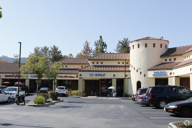
Property Record
1620 Newbury Rd, Newbury Park, CA 91320

NEARBY LISTINGS FOR SALE OR LEASE
Property Detail
1620 Newbury Rd
660-0-030-555
Rancho El Conejo
Storebuilding
PR APN 6600030345
X
Ventura
06111C0966E
California
2024
9.25 AC
2025
Thousand Oaks/SE County
005909
Los Angeles
34,585 SF
Oxnard-Thousand Oaks-Ventura, CA
DEMOGRAPHICS near 1620 Newbury Rd
1 Mile
3 Mile
5 Mile
2024 Total Population
13,677
59,065
117,840
2029 Population
13,443
58,127
116,107
Pop Growth 2024-2029
(1.71%)
(1.59%)
(1.47%)
Average Age
41
43
43
2024 Total Households
4,867
21,255
42,989
HH Growth 2024-2029
(1.89%)
(1.71%)
(1.54%)
Median Household Inc
$113,862
$113,314
$115,045
Avg Household Size
2.80
2.70
2.60
2024 Avg HH Vehicles
2.00
2.00
2.00
Median Home Value
$737,980
$782,829
$809,613
Median Year Built
1978
1975
1976
Nearby Places
Map Layers
Map Styles
 Street
 Aerial
- Restaurants
- Banks
- Shops
- Fitness
- Groceries
PUBLIC TRANSPORTATION
COMMUTER RAIL
Camarillo (Ventura County Line - Southern California Regional Rail Authority (Metrolink))
DRIVE
WALK
Distance
Camarillo (Ventura County Line - Southern California Regional Rail Authority (Metrolink))
12 min
8.1 mi
Freight Ports
The Port of Hueneme
DRIVE
WALK
Distance
The Port of Hueneme
31 min
18.8 mi
SALE & LEASE HISTORY
LISTING DATE
SALE/LEASE

Sep 25, 2016
For Lease
Nearby Properties
Address
Land Use
TOTAL SIZE
Lot Size
Zoning
Address
Land Use
TOTAL SIZE
Lot Size
Zoning
2.08 AC
Address
Land Use
TOTAL SIZE
Lot Size
Zoning
13.12 AC
PL
Address
Land Use
TOTAL SIZE
Lot Size
Zoning
Address
Land Use
TOTAL SIZE
Lot Size
Zoning
Address
Land Use
TOTAL SIZE
Lot Size
Zoning
3.87 AC
Address
Land Use
TOTAL SIZE
Lot Size
Zoning
5.25 AC
Address
Land Use
TOTAL SIZE
Lot Size
Zoning
239,224 SF
11.65 AC
Address
Land Use
TOTAL SIZE
Lot Size
Zoning
Address
Land Use
TOTAL SIZE
Lot Size
Zoning
Address
Land Use
TOTAL SIZE
Lot Size
Zoning
199,586 SF
8.95 AC
RPD25
Address
Land Use
TOTAL SIZE
Lot Size
Zoning
15,596 SF
3.17 AC
C2
Address
Land Use
TOTAL SIZE
Lot Size
Zoning
182,756 SF
8.88 AC
RPD1
Address
Land Use
TOTAL SIZE
Lot Size
Zoning
98,667 SF
17.87 AC
Address
Land Use
TOTAL SIZE
Lot Size
Zoning
162,078 SF
9.05 AC
R3
Address
Land Use
TOTAL SIZE
Lot Size
Zoning
Address
Land Use
TOTAL SIZE
Lot Size
Zoning
49,559 SF
2.87 AC
M1
Address
Land Use
TOTAL SIZE
Lot Size
Zoning
1.94 AC
Address
Land Use
TOTAL SIZE
Lot Size
Zoning
26,654 SF
17.84 AC
C3
Address
Land Use
TOTAL SIZE
Lot Size
Zoning
2.07 AC
Address
Land Use
TOTAL SIZE
Lot Size
Zoning
127,196 SF
10.18 AC
MULT
Address
Land Use
TOTAL SIZE
Lot Size
Zoning
164,951 SF
10.20 AC
RPD.
Address
Land Use
TOTAL SIZE
Lot Size
Zoning
90,194 SF
4.12 AC
Address
Land Use
TOTAL SIZE
Lot Size
Zoning
3.15 AC
Address
Land Use
TOTAL SIZE
Lot Size
Zoning
74,757 SF
9.01 AC
Address
Land Use
TOTAL SIZE
Lot Size
Zoning
Address
Land Use
TOTAL SIZE
Lot Size
Zoning
Address
Land Use
TOTAL SIZE
Lot Size
Zoning
68,015 SF
1.22 AC
Address
Land Use
TOTAL SIZE
Lot Size
Zoning
Address
Land Use
TOTAL SIZE
Lot Size
Zoning
73,565 SF
5.27 AC
MULT
Address
Land Use
TOTAL SIZE
Lot Size
Zoning
The World's #1 Commercial Real Estate Marketplace
Connect with us
© 2026 CoStar Group
The information above has been obtained from sources believed reliable. While we do not doubt its accuracy we have not verified it and make no guarantee, warranty or representation about it. It is your responsibility to independently confirm its accuracy and completeness. Any projections, opinions, assumptions, or estimates used are for example only and do not represent the current or future performance of the property. The value of this transaction to you depends on tax and other factors which should be evaluated by your tax, financial, and legal advisors. You and your advisors should conduct a careful, independent investigation of the property to determine to your satisfaction the suitability of the property for your needs.