Property Record
1620 State Route 57, Hackettstown, NJ 07840
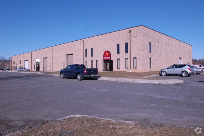


Property Detail
1620 State Route 57
16-01202-0000-00004
Warren
Industrialgeneral
New Jersey
B and X Area of moderate flood hazard, usually the area between the limits of the 100-year and 500-year floods.
4
2024
3.33 AC
2025
Warren
031500
Northern New Jersey
24,000 SF
Allentown-Bethlehem-Easton, PA-NJ
NEARBY LISTINGS FOR SALE OR LEASE
-
-
View all Hackettstown listings for lease on LoopNet.com
DEMOGRAPHICS near 1620 State Route 57
1 mile
3 mile
5 mile
2025 Total Population
1,523
13,725
39,636
2030 Population
1,563
13,876
40,149
Pop Growth 2025-2030
+ 2.63%
+ 1.10%
+ 1.29%
Average Age
44
43
43
2025 Total Households
558
5,204
14,887
HH Growth 2025-2030
+ 2.51%
+ 1.04%
+ 1.34%
Median Household Inc
$137,500
$120,981
$118,213
Avg Household Size
2.70
2.50
2.60
2025 Avg HH Vehicles
3.00
2.00
2.00
Median Home Value
$385,365
$468,950
$449,324
Median Year Built
1980
1979
1977
Nearby Places
Map Layers
Map Styles
 Street
 Aerial
Layers
 Traffic
 Biking
Places
Listings with unknown addresses are not visible on the map
- Restaurants
- Banks
- Shops
- Fitness
- Groceries
PUBLIC TRANSPORTATION
COMMUTER RAIL
Hackettstown (Montclair-Boonton Line - NJ Transit Commuter Rail (NJ Transit), Morris & Essex Morristown Line - NJ Transit Commuter Rail (NJ Transit))
Drive
Walk
Distance
Hackettstown (Montclair-Boonton Line - NJ Transit Commuter Rail (NJ Transit), Morris & Essex Morristown Line - NJ Transit Commuter Rail (NJ Transit))
9 min
4.6 mi
Freight Ports
New York Container Terminal
Drive
Walk
Distance
New York Container Terminal
77 min
48.4 mi
SALE & LEASE HISTORY
LISTING DATE
SALE/LEASE

Sep 25, 2016
For Lease
Sep 24, 2016
For Sale
Nov 04, 2020
For Lease
Aug 07, 2017
For Lease
Nearby Properties
Address
Land Use
TOTAL SIZE
Lot Size
Zoning
Address
Land Use
TOTAL SIZE
Lot Size
Zoning
Address
Land Use
TOTAL SIZE
Lot Size
Zoning
1,798 SF
46.98 AC
R-1
Address
Land Use
TOTAL SIZE
Lot Size
Zoning
122,877 SF
36.64 AC
B-2
Address
Land Use
TOTAL SIZE
Lot Size
Zoning
255,000 SF
39.57 AC
Address
Land Use
TOTAL SIZE
Lot Size
Zoning
133,042 SF
23.25 AC
HC
Address
Land Use
TOTAL SIZE
Lot Size
Zoning
5.02 AC
R-1
Address
Land Use
TOTAL SIZE
Lot Size
Zoning
Address
Land Use
TOTAL SIZE
Lot Size
Zoning
29.81 AC
OR/I
Address
Land Use
TOTAL SIZE
Lot Size
Zoning
12.60 AC
R1R2
Address
Land Use
TOTAL SIZE
Lot Size
Zoning
156,298 SF
16.96 AC
Address
Land Use
TOTAL SIZE
Lot Size
Zoning
1,352 SF
166.25 AC
C
Address
Land Use
TOTAL SIZE
Lot Size
Zoning
116,386 SF
33.90 AC
R125
Address
Land Use
TOTAL SIZE
Lot Size
Zoning
1,908 SF
6.35 AC
HC
Address
Land Use
TOTAL SIZE
Lot Size
Zoning
14.40 AC
R-1
Address
Land Use
TOTAL SIZE
Lot Size
Zoning
10 AC
OR/I
Address
Land Use
TOTAL SIZE
Lot Size
Zoning
30.55 AC
OR/I
Address
Land Use
TOTAL SIZE
Lot Size
Zoning
150,942 SF
33.80 AC
Address
Land Use
TOTAL SIZE
Lot Size
Zoning
90.90 AC
R125
Address
Land Use
TOTAL SIZE
Lot Size
Zoning
69,042 SF
7.20 AC
L-I
Address
Land Use
TOTAL SIZE
Lot Size
Zoning
38,211 SF
14.60 AC
R30
Address
Land Use
TOTAL SIZE
Lot Size
Zoning
5,585 SF
1.81 AC
Address
Land Use
TOTAL SIZE
Lot Size
Zoning
Address
Land Use
TOTAL SIZE
Lot Size
Zoning
13.90 AC
HC
Address
Land Use
TOTAL SIZE
Lot Size
Zoning
2,848 SF
1.70 AC
Address
Land Use
TOTAL SIZE
Lot Size
Zoning
47,502 SF
4.55 AC
HC
Address
Land Use
TOTAL SIZE
Lot Size
Zoning
64.75 AC
R-5
Address
Land Use
TOTAL SIZE
Lot Size
Zoning
7.09 AC
B2
Address
Land Use
TOTAL SIZE
Lot Size
Zoning
32,160 SF
5.19 AC
HC
Address
Land Use
TOTAL SIZE
Lot Size
Zoning
7,152 SF
86.06 AC
Address
Land Use
TOTAL SIZE
Lot Size
Zoning
7,200 SF
0.24 AC
APT
The World's #1 Commercial Real Estate Marketplace
Connect with us
© 2026 CoStar Group
The information above has been obtained from sources believed reliable. While we do not doubt its accuracy we have not verified it and make no guarantee, warranty or representation about it. It is your responsibility to independently confirm its accuracy and completeness. Any projections, opinions, assumptions, or estimates used are for example only and do not represent the current or future performance of the property. The value of this transaction to you depends on tax and other factors which should be evaluated by your tax, financial, and legal advisors. You and your advisors should conduct a careful, independent investigation of the property to determine to your satisfaction the suitability of the property for your needs.