Property Record
16200 Queens Ct, Upper Marlboro, MD 20774

NEARBY LISTINGS FOR SALE OR LEASE
-
-
View all Upper Marlboro listings for lease on LoopNet.com
Property Detail
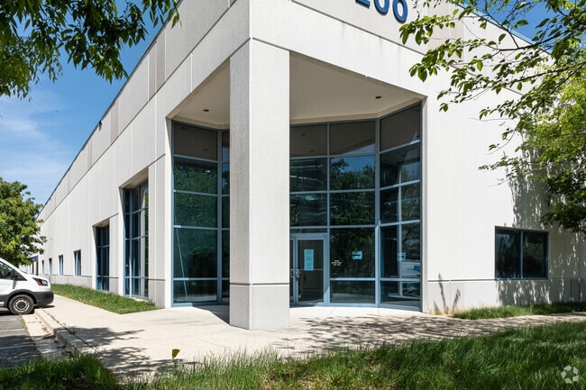
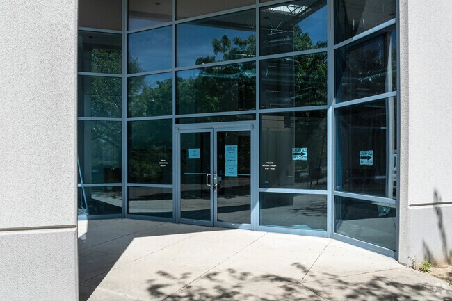
16200 Queens Ct
Washington-Arlington-Alexandria, DC-VA-MD-WV
Collington Center
07-3526910
.
Warehouse
Prince George's
X
Maryland
24033C0280E
21
2024
6.84 AC
2025
Bowie
800507
Washington, DC
96,292 SF
DEMOGRAPHICS near 16200 Queens Ct
1 Mile
3 Mile
5 Mile
2024 Total Population
164
26,757
74,182
2029 Population
159
26,046
72,471
Pop Growth 2024-2029
(3.05%)
(2.66%)
(2.31%)
Average Age
45
42
42
2024 Total Households
54
9,141
27,019
HH Growth 2024-2029
(1.85%)
(2.77%)
(2.41%)
Median Household Inc
$170,833
$152,847
$123,496
Avg Household Size
2.90
2.90
2.70
2024 Avg HH Vehicles
3.00
2.00
2.00
Median Home Value
$698,718
$475,254
$424,054
Median Year Built
1993
1996
1992
Nearby Places
Map Layers
Map Styles
 Street
 Aerial
- Restaurants
- Banks
- Shops
- Fitness
- Groceries
PUBLIC TRANSPORTATION
AIRPORT
Ronald Reagan Washington Ntl
DRIVE
WALK
Distance
Ronald Reagan Washington Ntl
40 min
25.1 mi
Baltimore/Washington International Thurgood Marshall
DRIVE
WALK
Distance
Baltimore/Washington International Thurgood Marshall
43 min
28.2 mi
Freight Ports
Port of Baltimore
DRIVE
WALK
Distance
Port of Baltimore
50 min
33.7 mi
SALE & LEASE HISTORY
LISTING DATE
SALE/LEASE

Feb 27, 2023
For Lease
Nearby Properties
Address
Land Use
TOTAL SIZE
Lot Size
Zoning
Address
Land Use
TOTAL SIZE
Lot Size
Zoning
1,251,903 SF
157.53 AC
IH
Address
Land Use
TOTAL SIZE
Lot Size
Zoning
15.87 AC
LCD
Address
Land Use
TOTAL SIZE
Lot Size
Zoning
306,916 SF
26.65 AC
IH
Address
Land Use
TOTAL SIZE
Lot Size
Zoning
123,000 SF
36.77 AC
AR
Address
Land Use
TOTAL SIZE
Lot Size
Zoning
290,919 SF
28.01 AC
IH
Address
Land Use
TOTAL SIZE
Lot Size
Zoning
170,850 SF
28.43 AC
IH
Address
Land Use
TOTAL SIZE
Lot Size
Zoning
133,694 SF
9.46 AC
CS
Address
Land Use
TOTAL SIZE
Lot Size
Zoning
378,068 SF
24.35 AC
IH
Address
Land Use
TOTAL SIZE
Lot Size
Zoning
392,581 SF
27.85 AC
IH
Address
Land Use
TOTAL SIZE
Lot Size
Zoning
222,152 SF
11.89 AC
IH
Address
Land Use
TOTAL SIZE
Lot Size
Zoning
242,331 SF
19.71 AC
IH
Address
Land Use
TOTAL SIZE
Lot Size
Zoning
188,751 SF
9.81 AC
IH
Address
Land Use
TOTAL SIZE
Lot Size
Zoning
169,840 SF
9.81 AC
IH
Address
Land Use
TOTAL SIZE
Lot Size
Zoning
103,679 SF
7.44 AC
IH
Address
Land Use
TOTAL SIZE
Lot Size
Zoning
85,255 SF
7.15 AC
IH
Address
Land Use
TOTAL SIZE
Lot Size
Zoning
5.01 AC
LCD
Address
Land Use
TOTAL SIZE
Lot Size
Zoning
110,000 SF
6.88 AC
IH
Address
Land Use
TOTAL SIZE
Lot Size
Zoning
107.45 AC
ROS
Address
Land Use
TOTAL SIZE
Lot Size
Zoning
138,790 SF
13.16 AC
IH
Address
Land Use
TOTAL SIZE
Lot Size
Zoning
73,509 SF
7.26 AC
CGO
Address
Land Use
TOTAL SIZE
Lot Size
Zoning
41,081 SF
3.83 AC
RR
Address
Land Use
TOTAL SIZE
Lot Size
Zoning
149,336 SF
29.82 AC
IH
Address
Land Use
TOTAL SIZE
Lot Size
Zoning
38,631 SF
1.41 AC
CGO
Address
Land Use
TOTAL SIZE
Lot Size
Zoning
96,000 SF
5.68 AC
IH
Address
Land Use
TOTAL SIZE
Lot Size
Zoning
80,486 SF
7.92 AC
IH
Address
Land Use
TOTAL SIZE
Lot Size
Zoning
103,260 SF
5.72 AC
IH
Address
Land Use
TOTAL SIZE
Lot Size
Zoning
97,900 SF
7.16 AC
IH
Address
Land Use
TOTAL SIZE
Lot Size
Zoning
79,662 SF
8.65 AC
IH
Address
Land Use
TOTAL SIZE
Lot Size
Zoning
71,456 SF
20.08 AC
IH
Address
Land Use
TOTAL SIZE
Lot Size
Zoning
94,556 SF
6.73 AC
IH
The World's #1 Commercial Real Estate Marketplace
Connect with us
© 2025 CoStar Group
The information above has been obtained from sources believed reliable. While we do not doubt its accuracy we have not verified it and make no guarantee, warranty or representation about it. It is your responsibility to independently confirm its accuracy and completeness. Any projections, opinions, assumptions, or estimates used are for example only and do not represent the current or future performance of the property. The value of this transaction to you depends on tax and other factors which should be evaluated by your tax, financial, and legal advisors. You and your advisors should conduct a careful, independent investigation of the property to determine to your satisfaction the suitability of the property for your needs.