Property Record
16301 N May Ave, Edmond, OK 73013


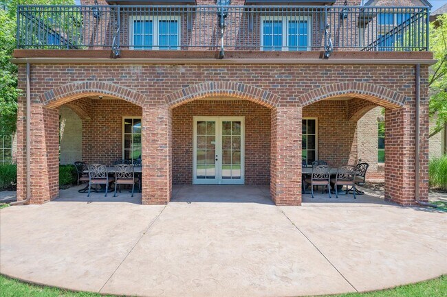
Property Detail
16301 N May Ave
204941010
MUIRFIELD VILLAGE 001 002
Commercialnec
OKLAHOMA
PUD
Oklahoma
B and X Area of moderate flood hazard, usually the area between the limits of the 100-year and 500-year floods.
2
2024
1.80 AC
2025
North Outlying
108535
Oklahoma City
18,398 SF
Oklahoma City, OK
NEARBY LISTINGS FOR SALE OR LEASE
DEMOGRAPHICS near 16301 N May Ave
1 mile
3 mile
5 mile
2025 Total Population
9,713
75,013
162,749
2030 Population
9,882
76,988
166,231
Pop Growth 2025-2030
+ 1.74%
+ 2.63%
+ 2.14%
Average Age
37
37
38
2025 Total Households
3,697
30,393
68,170
HH Growth 2025-2030
+ 2.03%
+ 2.95%
+ 2.32%
Median Household Inc
$109,211
$93,426
$84,946
Avg Household Size
2.60
2.40
2.30
2025 Avg HH Vehicles
2.00
2.00
2.00
Median Home Value
$322,721
$336,178
$293,315
Median Year Built
2005
2002
1994
Nearby Places
Map Layers
Map Styles
 Street
 Aerial
Layers
 Traffic
 Biking
Places
Listings with unknown addresses are not visible on the map
- Restaurants
- Banks
- Shops
- Fitness
- Groceries
PUBLIC TRANSPORTATION
AIRPORT
Will Rogers World
Drive
Walk
Distance
Will Rogers World
31 min
20.1 mi
Freight Ports
Tulsa Port Of Catoosa
Drive
Walk
Distance
Tulsa Port Of Catoosa
132 min
121.5 mi
SALE & LEASE HISTORY
LISTING DATE
SALE/LEASE

Jun 05, 2023
For Sale
Dec 05, 2024
For Sale
Nearby Properties
Address
Land Use
TOTAL SIZE
Lot Size
Zoning
Address
Land Use
TOTAL SIZE
Lot Size
Zoning
294,327 SF
14.04 AC
PUD
Address
Land Use
TOTAL SIZE
Lot Size
Zoning
140,312 SF
7.91 AC
C-3
Address
Land Use
TOTAL SIZE
Lot Size
Zoning
3,056 SF
23.33 AC
PUD
Address
Land Use
TOTAL SIZE
Lot Size
Zoning
3,444 SF
27.22 AC
PUD
Address
Land Use
TOTAL SIZE
Lot Size
Zoning
594,334 SF
71.64 AC
C-3
Address
Land Use
TOTAL SIZE
Lot Size
Zoning
460,954 SF
24.83 AC
PUD
Address
Land Use
TOTAL SIZE
Lot Size
Zoning
41,733 SF
2.63 AC
O-1
Address
Land Use
TOTAL SIZE
Lot Size
Zoning
41,733 SF
2.47 AC
C-3
Address
Land Use
TOTAL SIZE
Lot Size
Zoning
366,844 SF
18.47 AC
PUD
Address
Land Use
TOTAL SIZE
Lot Size
Zoning
376,079 SF
29.77 AC
PUD
Address
Land Use
TOTAL SIZE
Lot Size
Zoning
8,354 SF
16.65 AC
PUD
Address
Land Use
TOTAL SIZE
Lot Size
Zoning
253,426 SF
23.80 AC
Address
Land Use
TOTAL SIZE
Lot Size
Zoning
304,423 SF
31.20 AC
PUD
Address
Land Use
TOTAL SIZE
Lot Size
Zoning
7.42 AC
PUD
Address
Land Use
TOTAL SIZE
Lot Size
Zoning
391,776 SF
10.12 AC
PUD
Address
Land Use
TOTAL SIZE
Lot Size
Zoning
184,238 SF
7.35 AC
C-3
Address
Land Use
TOTAL SIZE
Lot Size
Zoning
10,811 SF
1.46 AC
PUD
Address
Land Use
TOTAL SIZE
Lot Size
Zoning
297,836 SF
15 AC
PUD
Address
Land Use
TOTAL SIZE
Lot Size
Zoning
302,058 SF
23.78 AC
PUD
Address
Land Use
TOTAL SIZE
Lot Size
Zoning
358,436 SF
18.03 AC
PUD
Address
Land Use
TOTAL SIZE
Lot Size
Zoning
227,714 SF
14.15 AC
PUD
Address
Land Use
TOTAL SIZE
Lot Size
Zoning
291,228 SF
14.15 AC
PUD
Address
Land Use
TOTAL SIZE
Lot Size
Zoning
255,921 SF
9.93 AC
PUD
Address
Land Use
TOTAL SIZE
Lot Size
Zoning
247,230 SF
22.75 AC
PUD
Address
Land Use
TOTAL SIZE
Lot Size
Zoning
294,250 SF
17.85 AC
PUD
Address
Land Use
TOTAL SIZE
Lot Size
Zoning
191,504 SF
20.03 AC
PUD
Address
Land Use
TOTAL SIZE
Lot Size
Zoning
235,612 SF
28.09 AC
PUD
Address
Land Use
TOTAL SIZE
Lot Size
Zoning
316,212 SF
16.36 AC
PUD
Address
Land Use
TOTAL SIZE
Lot Size
Zoning
279,215 SF
11.58 AC
PUD
Address
Land Use
TOTAL SIZE
Lot Size
Zoning
2,086 SF
11.67 AC
PUD
The World's #1 Commercial Real Estate Marketplace
Connect with us
© 2026 CoStar Group
The information above has been obtained from sources believed reliable. While we do not doubt its accuracy we have not verified it and make no guarantee, warranty or representation about it. It is your responsibility to independently confirm its accuracy and completeness. Any projections, opinions, assumptions, or estimates used are for example only and do not represent the current or future performance of the property. The value of this transaction to you depends on tax and other factors which should be evaluated by your tax, financial, and legal advisors. You and your advisors should conduct a careful, independent investigation of the property to determine to your satisfaction the suitability of the property for your needs.